
Eagle Pass, Texas
Eagle Pass, Texas | |
|---|---|
| • FIPS code | 48-21892[3] |
| GNIS feature ID | 1356538[2] |
| Website | www |
Eagle Pass is a city in and the
Eagle Pass
History
Eagle Pass was the first American settlement on the Rio Grande. Originally known as Camp Eagle Pass, it served as a temporary outpost for the Texas militia, which had been ordered to stop illegal trade with Mexico during the Mexican–American War.[5] Eagle Pass is so named because the contour of the hills through which the Rio Grande flows bore a fancied resemblance to the outstretched wings of an eagle.[6]
On April 24, 2007, at 7:00 pm CDT, a tornado tore through outside of Eagle Pass and caused loss of life and property damage. The community was paralyzed for more than a week. This tornado tore through the southern part of the town, and major damage was done. At the Rosita Valley Elementary School, one child was waiting with his teacher to be picked up and as the dangerous storm approached, the child was picked up and his teacher left the campus too. Minutes later, the school was flattened with nothing to spare. Since then, the school has been rebuilt, and the community lives life normally.[8]
The City of Eagle Pass was sued by the
On August 8, 2012, a federal grand jury in the U.S. District Court in Del Rio indicted five Eagle Pass residents, including a former Public Works Department employee, in connection with an estimated $70,000 credit-card fraud scheme. According to the indictment, during 2011, City of Eagle Pass employee Edgar Aguilar obtained five City of Eagle Pass-owned Fuelman credit cards designated for fuel purchases for Public Works department vehicles and distributed them to his accomplices to purchase fuel for their own vehicles and to purchase fuel for others at the city's expense. In some instances, defendants charged individuals a reduced rate for fuel purchased using the city's credit card and then pocketed the cash.[13] On November 29, 2012, Aguilar entered a guilty plea for the charges of theft and fraud, and on May 15, 2013, was sentenced to 42 months in federal prison and ordered to pay $68,373.87 in restitution for his role in the fraudulent scheme.[14]
On March 30, 2017, Hector Chavez Sr., the former Eagle Pass city manager, pleaded guilty to lying to the FBI regarding a bribery scheme involving public contracts in Maverick County. Chavez, with the company Chace Management, was charged with receiving $20,000 from the owner of the engineering firm Hejl, Lee, and Associates to bribe a county commissioner to procure a $270,000 contract for the engineering firm. Chavez admitted to having given false information in 2015. Chavez was sentenced to 42 months in federal prison and three years' supervised release on August 21, 2017.[15][16]
On January 11, 2024, following
Geography
Eagle Pass is located at 28°42′38″N 100°29′22″W / 28.71056°N 100.48944°W (28.710622, −100.489331).[19]
According to the United States Census Bureau, the city has a total area of 7.4 mi2 (19.2 km2), of which 0.04 mi2 (0.1 km2) (0.40%) is covered by water.
The area is served by
Climate
Eagle Pass has a
| Climate data for Eagle Pass, Texas, 1991–2020 normals, extremes 1897–2018 | |||||||||||||
|---|---|---|---|---|---|---|---|---|---|---|---|---|---|
| Month | Jan | Feb | Mar | Apr | May | Jun | Jul | Aug | Sep | Oct | Nov | Dec | Year |
| Record high °F (°C) | 96 (36) |
101 (38) |
106 (41) |
108 (42) |
114 (46) |
115 (46) |
115 (46) |
112 (44) |
111 (44) |
106 (41) |
100 (38) |
94 (34) |
115 (46) |
| Mean maximum °F (°C) | 81.7 (27.6) |
86.7 (30.4) |
92.5 (33.6) |
99.1 (37.3) |
101.3 (38.5) |
104.2 (40.1) |
104.2 (40.1) |
105.0 (40.6) |
101.0 (38.3) |
95.7 (35.4) |
88.4 (31.3) |
80.8 (27.1) |
107.4 (41.9) |
| Mean daily maximum °F (°C) | 64.5 (18.1) |
70.0 (21.1) |
77.6 (25.3) |
84.4 (29.1) |
90.3 (32.4) |
96.0 (35.6) |
97.5 (36.4) |
98.6 (37.0) |
91.8 (33.2) |
83.4 (28.6) |
72.4 (22.4) |
64.8 (18.2) |
82.6 (28.1) |
| Daily mean °F (°C) | 52.1 (11.2) |
56.7 (13.7) |
64.5 (18.1) |
71.0 (21.7) |
78.1 (25.6) |
83.9 (28.8) |
85.6 (29.8) |
86.5 (30.3) |
80.4 (26.9) |
71.4 (21.9) |
60.3 (15.7) |
52.3 (11.3) |
70.2 (21.3) |
| Mean daily minimum °F (°C) | 39.7 (4.3) |
43.4 (6.3) |
51.4 (10.8) |
57.7 (14.3) |
65.9 (18.8) |
71.8 (22.1) |
73.8 (23.2) |
74.3 (23.5) |
69.1 (20.6) |
59.3 (15.2) |
48.3 (9.1) |
39.8 (4.3) |
57.9 (14.4) |
| Mean minimum °F (°C) | 28.2 (−2.1) |
30.6 (−0.8) |
36.4 (2.4) |
45.6 (7.6) |
56.8 (13.8) |
65.9 (18.8) |
70.0 (21.1) |
69.6 (20.9) |
57.8 (14.3) |
45.1 (7.3) |
34.9 (1.6) |
27.5 (−2.5) |
24.0 (−4.4) |
| Record low °F (°C) | 10 (−12) |
10 (−12) |
20 (−7) |
32 (0) |
42 (6) |
47 (8) |
62 (17) |
60 (16) |
42 (6) |
27 (−3) |
19 (−7) |
12 (−11) |
10 (−12) |
| Average precipitation inches (mm) | 0.74 (19) |
0.74 (19) |
1.18 (30) |
2.02 (51) |
2.80 (71) |
2.20 (56) |
2.10 (53) |
1.68 (43) |
3.29 (84) |
2.14 (54) |
1.13 (29) |
0.81 (21) |
20.83 (530) |
| Average precipitation days (≥ 0.01 in) | 3.8 | 3.6 | 3.7 | 3.5 | 4.5 | 3.8 | 3.4 | 3.0 | 5.3 | 3.5 | 3.7 | 3.5 | 45.3 |
| Source 1: NOAA[20] | |||||||||||||
| Source 2: National Weather Service (mean maxima/minima 1981–2010)[21] | |||||||||||||
Demographics
| Census | Pop. | Note | %± |
|---|---|---|---|
| 1850 | 383 | — | |
| 1860 | 522 | 36.3% | |
| 1870 | 1,240 | 137.5% | |
| 1880 | 1,627 | 31.2% | |
| 1910 | 3,536 | — | |
| 1920 | 5,765 | 63.0% | |
| 1930 | 5,059 | −12.2% | |
| 1940 | 13,343 | 163.7% | |
| 1950 | 14,211 | 6.5% | |
| 1960 | 12,094 | −14.9% | |
| 1970 | 15,364 | 27.0% | |
| 1980 | 21,407 | 39.3% | |
| 1990 | 20,651 | −3.5% | |
| 2000 | 22,413 | 8.5% | |
| 2010 | 26,248 | 17.1% | |
| 2020 | 28,130 | 7.2% | |
| U.S. Decennial Census 2018 Estimate[22] | |||
2020 census
| Race | Number | Percentage |
|---|---|---|
White (NH)
|
1,006 | 3.58% |
Black or African American (NH)
|
117 | 0.42% |
Alaska Native (NH)
|
61 | 0.22% |
| Asian (NH) | 159 | 0.57% |
| Pacific Islander (NH) | 1 | 0.0% |
| Some Other Race (NH) | 67 | 0.24% |
| Mixed/Multi-Racial (NH) | 55 | 0.2% |
| Hispanic or Latino | 26,664 | 94.79% |
| Total | 28,130 |
As of the 2020 United States census, there were 28,130 people, 8,850 households, and 7,053 families residing in the city.
2006
As of the
Of the 6,925 households, 43.5% had children under the age of 18 living with them, 59.0% were married couples living together, 18.3% had a female householder with no husband present, and 19.3% were not families. About 17.7% of all households were made up of individuals, and 9.5% had someone living alone who was 65 or older. The average household size was 3.22, and the average family size was 3.69.
In the city, the population was distributed as 32.7% under 18, 8.6% from 18 to 24, 25.6% from 25 to 44, 19.9% from 45 to 64, and 13.1% who were 65 or older. The median age was 32 years. For every 100 females, there were 88.5 males. For every 100 females age 18 and over, there were 81.8 males.
The median income for a household in the city was $23,623, and for a family was $27,140. Males had a median income of $26,350 versus $17,346 for females. The
Economy
The City of Eagle Pass is home to small and large businesses alike, but its primary sectors are retail, import/export, and manufacturing. Two of its largest manufacturers are Mossberg and MicroStar. It was in 2014 when Maverick Arms decided to expand to Eagle Pass[25] after it received assistance from the State of Texas using the Texas Enterprise Fund.
The City of Eagle Pass and Maverick County recently adopted matching incentives policies (2020) making it easier for outside businesses to expand operations in the region. Incentives are handled through the city's Economic Development Department.
Because of its location along the U.S./Mexico border, the retail sector is healthy due to the large number of visitors Eagle Pass gets from Mexico. It is estimated that on a regular weekday, Eagle Pass gets 6,000 people across into the U.S. vs. 10,000 on the weekend. Many of these visitors stay within the city limits to shop and eat at local restaurants.
Government
The United States Postal Service operates a post office located at 410 S Bibb Ave.
The United States Border Patrol has two stations in Eagle Pass. The Eagle Pass North Station is at 2285 Del Rio Blvd and the Eagle Pass South Station at 4156 El Indio Hwy.
Eagle Pass is the headquarters of the
Transportation
Highways in the area are:
Utilities
In 2000, as part of the power exchange between Texas and Mexico, a
Media
- Eagle Pass News Leader
- The News Gram
Notable people
- Tres Barrera (born 1994), backup catcher for the Washington Nationals
- Rian James (1899–1953), author and screenwriter
- Louis Lane (1923–2016) conductor of Cleveland and Atlanta symphonies
- Biz Mackey (1897–1965), catcher and manager in Negro League baseball
- Robert C. Mathis (1927–2016), retired Air Force four-star general, served as Vice Chief of Staff, U.S. Air Force
- Guadalupe Garcia McCall, author and educator
- Connie Douglas Reeves (1901–2003), rancher, National Cowgirl Museum and Hall of Fame
- Gus Sorola (born 1978), co-founder of Rooster Teeth
Gallery
-
 Downtown Eagle Pass
 -
 Eagle Pass City Hall at the foot of International Bridge
 -
 The Rio Grande at Eagle Pass, Texas, with Piedras Negras in the background
 -
 Historic FirstUnited MethodistChurch on Quarry Street
 -
 Map of the city 1887
 -
 The restored Fort Duncan in Eagle Pass is located near the International Bridge.
 -
 The International Bridge across the Rio Grande in Eagle Pass
 -
 The Eagle Pass public library is located on Main Street east of the Maverick County Courthouse.
 -
 Fort Duncan Medical Center in Eagle Pass is named after the formerUS Armyoutpost.
 -
 Historic Maverick County Courthouse
 -
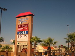 Mall de las Aguilas on Bibb Street in Eagle Pass


See also
- Camino Real International Bridge
- Eagle Pass – Piedras Negras International Bridge
- Fort Duncan
- Union Pacific International Railroad Bridge
Notes
References
- ^ "2019 U.S. Gazetteer Files". United States Census Bureau. Retrieved August 7, 2020.
- ^ a b U.S. Geological Survey Geographic Names Information System: Eagle Pass, Texas
- ^ a b "U.S. Census website". United States Census Bureau. Retrieved 2008-01-31.
- ^ "Explore Census Data".
- ^ Texas Transportation Commission, Texas State Travel Guide, 2008, p. 232
- ^ Gannett, Henry (1905). The Origin of Certain Place Names in the United States. Govt. Print. Off. pp. 112.
- ^ Handbook of Texas Online
- ^ "Tornado Kills 7 Near Eagle Pass On Mexican Border". CBS 11 TV. 2007-04-25. Retrieved 2009-03-21.
- ^ Texas City Ordered to Turn Over Land to Feds for Border Fence Construction, January 16, 2008
- ^ Buch, Jason (Dec 9, 2012). "Corruption costly for Maverick residents". San Antonio Express-News. Retrieved Aug 15, 2019.
- ^ Buch, Jason (Feb 20, 2015). "More Maverick County officials arrested by FBI in bribery investigation". San Antonio Express-News. Retrieved Aug 15, 2019.
- ^ "Former Maverick County Commissioner, Former County Employee, and Three Contractors Sentenced to Federal Prison in Connection with a Bribery, Kickback, and Bid-Rigging Scheme — FBI". www.fbi.gov. Retrieved Aug 15, 2019.
- ^ "Federal Grand Jury Indicts Five in Connection with Credit Card Fraud Scheme Involving the City of Eagle Pass". FBI. Retrieved Aug 15, 2019.
- ^ "Former Eagle Pass Department of Public Works Employee Sentenced for Role in City Credit Card Fraud Scheme". FBI. Retrieved Aug 15, 2019.
- ^ Guillermo Contreras, "Ex-Eagle Pass manager faces up to 5 years for lying to FBI," San Antonio Express-News, April 1, 2017, p. 6.
- ^ "Former Eagle Pass City Manager Hector Chavez, Sr. Sentenced to Federal Prison for Lying to FBI in Connection with Investigation into "Pay-To-Play" Bribery Scheme Involving Maverick County Contracts - Eagle Pass Business Journal". www.epbusinessjournal.com. Retrieved Aug 15, 2019.
- ^ "Border standoff between Texas, feds intensifies as governor defies Supreme Court ruling". PBS NewsHour. 2024-01-25. Retrieved 2024-01-26.
- ^ García, Texas Tribune, Uriel J. (2024-01-22). "In Eagle Pass, a tense border standoff between Texas and the federal government is reaching a crescendo". KSAT. Retrieved 2024-01-26.
{{cite web}}: CS1 maint: multiple names: authors list (link) - ^ "US Gazetteer files: 2010, 2000, and 1990". United States Census Bureau. 2011-02-12. Retrieved 2011-04-23.
- ^ "U.S. Climate Normals Quick Access – Station: Eagle Pass 3N, TX". National Oceanic and Atmospheric Administration. Retrieved April 13, 2023.
- ^ "NOAA Online Weather Data – NWS Austin". National Weather Service. Retrieved April 13, 2023.
- ^ "Population Estimates". United States Census Bureau. Retrieved June 8, 2018.
- ^ "Explore Census Data". data.census.gov. Retrieved 2022-05-20.
- ^ "About the Hispanic Population and its Origin". www.census.gov. Retrieved 18 May 2022.
- ^ Keys, Lili (8 July 2014). "Maverick Arms expanding in Eagle Pass, Texas". LSONews. Archived from the original on 2014-11-14. Retrieved 22 December 2021.
- ^ "Tribal Directory." National Congress of American Indians. Retrieved 12 Sept 2013.
- ^ "References | ABB". new.abb.com. Retrieved Aug 15, 2019.
External links
Municipalities and communities of Maverick County, Texas, United States | ||
|---|---|---|
| City |  | |
| CDPs | ||
| Indian reservation | ||
| ||
| International | |
|---|---|
| National | |
| Geographic | |
| Other | |