
East Dunbartonshire
East Dunbartonshire
Aest Dunbartanshire Siorrachd Dhùn Bhreatann an Ear | |
|---|---|
 | |
|
East Dunbartonshire Council | |
| • Control | Scottish National Party minority (council NOC) |
| • MPs |
|
| • MSPs |
|
| Area | |
| • Total | 67.4 sq mi (174.5 km2) |
| • Rank | Ranked 21st |
| • Density | 1,600/sq mi (620/km2) |
| ONS code | S12000045 |
| ISO 3166 code | GB-EDU |
East Dunbartonshire (
.The
History
East Dunbartonshire was created in 1996 under the Local Government etc. (Scotland) Act 1994, which abolished the regions and districts which had been created in 1975, replacing them with unitary council areas. East Dunbartonshire covered the area of the abolished Bearsden and Milngavie and Strathkelvin districts (except the Chryston and Auchinloch area from the latter, which went to North Lanarkshire). Both former districts had been in the Strathclyde region.[1]
Both of East Dunbartonshire's predecessor districts had been created in 1975 under the
Demographics
East Dunbartonshire council area has low levels of deprivation, with relatively low unemployment and low levels of crime. The population is both declining and ageing.[3]
In a 2007
Communities
The area is divided into thirteen community council areas, twelve of which have community councils as at 2023 (being those with asterisks in the list below):[7]
- Baldernock*
- Bearsden East*
- Bearsden North*
- Bearsden West*
- Bishopbriggs*
- Campsie*
- Kirkintilloch*
- Lenzie*
- Milngavie*
- Milton of Campsie*
- Torrance*
- Twechar
- Waterside*
Governance
East Dunbartonshire | ||
|---|---|---|
Chief Executive | Gerry Cornes since January 2009 | |
| Structure | ||
| Seats | 22 councillors | |
8 / 22 | ||
5 / 22 | ||
4 / 22 | ||
2 / 22 | ||
3 / 22 | ||
| Elections | ||
| Single transferable vote | ||
Last election | 5 May 2022 | |
Next election | 6 May 2027 | |
| Meeting place | ||
 | ||
| 12 Strathkelvin Place, Kirkintilloch, G66 1XT | ||
| Website | ||
| www | ||
Political control
The first election to East Dunbartonshire Council was held in 1995, initially operating as a shadow authority alongside the outgoing authorities until the new system came into force on 1 April 1996. Political control of the council since 1996 has been as follows:[8]
| Party in control | Years | |
|---|---|---|
| Labour | 1996–1999 | |
| No overall control | 1999– | |
Leadership
The first
| Councillor | Party | From | To | Notes | |
|---|---|---|---|---|---|
| Charles Kennedy | Labour | 1 Apr 1996 | Oct 1999 | ||
| Keith Moody | Liberal Democrats | Oct 1999 | May 2003 | ||
| John Morrison | Liberal Democrats | 8 May 2003 | 3 May 2007 | ||
| Rhondda Geekie[10] | Labour | 17 May 2007 | 4 May 2017 | ||
| Gordan Low | SNP | 23 May 2017 | 21 Dec 2017 | ||
| Vaughan Moody | Liberal Democrats | 20 Mar 2018 | May 2022 | Co-leaders | |
| Andrew Polson | Conservative | ||||
| Gordan Low | SNP | 19 May 2022 | |||
Composition
Following the 2022 election and subsequent changes of allegiance up to July 2023, the composition of the council was:[11]
| Party | Councillors | |
|---|---|---|
| SNP | 8 | |
| Liberal Democrats | 5 | |
| Labour | 4 | |
| Conservative | 2 | |
| Independent | 3 | |
| Total | 22 | |
The next election is due in 2027.
Premises
Since 2012 the council has been based at 12 Strathkelvin Place in
Elections
Since 2007 elections have been held every five years under the single transferable vote system, introduced by the Local Governance (Scotland) Act 2004. Election results since 1995 have been as follows:[8]
| Year | Seats | SNP | Liberal Democrats | Labour | Conservative | Independent / Other | Notes |
|---|---|---|---|---|---|---|---|
| 1995 | 26 | 0 | 9 | 15 | 2 | 0 | |
| 1999 | 24 | 1 | 10 | 10 | 3 | 0 | New ward boundaries.[15] |
| 2003 | 24 | 0 | 12 | 9 | 3 | 0 | |
| 2007 | 24 | 8 | 3 | 6 | 5 | 2[a] | New ward boundaries.[16] |
| 2012 | 24 | 8 | 3 | 8 | 2 | 3[b] | |
| 2017 | 22 | 7 | 6 | 2 | 6 | 1 | New ward boundaries.[17] |
| 2022 | 22 | 8 | 6 | 4 | 3 | 1 | |
- ^ Both East Dunbartonshire Independent Alliance
- ^ Two being East Dunbartonshire Independent Alliance
Wards
Since 2007, the council (as with all others in Scotland) has been elected using multi-member
| # | Ward Name | Location | Seats | Population
(2020) |
|---|---|---|---|---|
| 1 | Milngavie | 
|
3 | 13,572 |
| 2 | Bearsden North | 
|
3 | 14,943 |
| 3 | Bearsden South | 
|
3 | 13,318 |
| 4 | Bishopbriggs North and Campsie | 
|
4 | 19,323 |
| 5 | Bishopbriggs South | 
|
3 | 15,868 |
| 6 | Kirkintilloch East and North and Twechar | 
|
3 | 18,251 |
| 7 | Lenzie and Kirkintilloch South | 
|
3 | 13,475 |
Settlements
Largest settlements by population:
| Settlement | Population (mid-2020 est.)[19] |
|---|---|
| Bearsden |
28,470 |
| Bishopbriggs |
23,680 |
| Kirkintilloch |
21,870 |
| Milngavie |
12,840 |
| Lenzie |
8,090 |
| Lennoxtown |
4,260 |
| Milton of Campsie |
3,910 |
Torrance
|
2,320 |
| Twechar |
1,340 |
Places of interest
- Campsie Fells
- West Highland Way
- Forth and Clyde Canal
- Antonine Wall
- Mugdock Country Park
- Milngavie water treatment works
- River Kelvin
- Lillie Art Gallery
- Auld Kirk Museum
- Huntershill Village
- The Fort Theatre
- The Turret Theatre
- The Gadloch
-

-
 Thomas Muir
 -
 Thomas Muir Cairn - Erected by John SL Watson and unveiled by East Dunbartonshire's Provost John Dempsey (1997)
 -
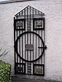 Scottish Political Martyrs Gate - Erected by John SL Watson and unveiled by East Dunbartonshire's Provost John Dempsey (1997)
 -
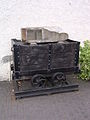 Miners of the world memorial hutch - created by John SL Watson and unveiled by leader of East Dunbartsonshire Council John Morrison (2003)
 -
 Finger Post marking the Old Glasgow-Stirling postal road
 -
 Huntershill Village Mile Stone
 -
 Southwest view across Gadloch Towards the distant Red Road Flats.


Education
There are 8 secondary schools and 33 primary schools in the area.[20][21] The secondary schools are:
- Bearsden Academy, Bearsden
- Bishopbriggs Academy, Bishopbriggs
- Boclair Academy, Bearsden
- Douglas Academy, Milngavie
- Kirkintilloch High School, Kirkintilloch
- Lenzie Academy, Lenzie
- St Ninian's High School, Kirkintilloch
- Turnbull High School, Bishopbriggs
References
- ^ "Local Government etc. (Scotland) Act 1994", legislation.gov.uk, The National Archives, 1994 c. 39, retrieved 15 February 2023
- ^ "Local Government (Scotland) Act 1973", legislation.gov.uk, The National Archives, 1973 c. 65, retrieved 15 February 2023
- ^ Controller of Audit to the Accounts Commission (May 2009). "The Audit of Best Value and Community Planning - East Dunbartonshire Council". Scottish Government. Retrieved 3 May 2012.
- ^ "Scots areas top happy family poll". BBC News. 18 April 2007. Retrieved 1 March 2014.
- ^ "BBC News - Aberdeenshire tops 'quality of life' list". BBC News. 27 December 2010. Retrieved 1 March 2014.
- ^ "East Dunbartonshire is only Scottish area in UK top 20 for 'quality of life'". The Scotsman. Edinburgh. 28 March 2008. Retrieved 1 March 2014.
- ^ "Community Councils". East Dunbartonshire Council. Retrieved 15 February 2023.
- ^ a b "Compositions calculator". The Elections Centre. Retrieved 15 February 2023.
- ^ "Council minutes". East Dunbartonshire Council. Retrieved 15 February 2023.
- ^ "New coalition moves to bring back weekly bin collections". The Herald. Archived from the original on 29 September 2007. Retrieved 22 May 2007.
- ^ Morrison, Hamish (1 November 2022). "Scottish Lib Dems 'suspend councillor Aileen Polson over electoral fraud charge'". The National. Retrieved 16 July 2023.
- ^ "Strathkelvin District Council: Public Notice - Closure of Council Chambers, Kirkintilloch, and removal to new Civic Headquarters, Lenzie Road, Kirkintilloch". Airdrie and Coatbridge Advertiser. 19 July 1985. Retrieved 16 February 2023.
- ^ "Bulldozers move in to demolish landmark". Glasgow World. 3 November 2015. Retrieved 16 February 2023.
- ^ "Council agenda, 15 December 2022" (PDF). East Dunbartonshire Council. Retrieved 16 February 2023.
- ^ "The East Dunbartonshire (Electoral Arrangements) Order 1998", legislation.gov.uk, The National Archives, SI 1998/3245, retrieved 15 February 2023
- ^ Scottish Parliament. The East Dunbartonshire (Electoral Arrangements) Order 2006 as made, from legislation.gov.uk.
- ^ Scottish Parliament. The East Dunbartonshire (Electoral Arrangements) Order 2016 as made, from legislation.gov.uk.
- ^ a b Council Area | East Dunbartonshire, Scottish Government Statistics. Retrieved 21 April 2022
- ^ "Mid-2020 Population Estimates for Settlements and Localities in Scotland". National Records of Scotland. 31 March 2022. Retrieved 31 March 2022.
- ^ "Secondary Schools". East Dunbartonshire Council. Retrieved 16 February 2023.
- ^ "Primary Schools". East Dunbartonshire Council. Retrieved 16 February 2023.
External links
- East Dunbartonshire at Curlie
- East Dunbartonshire Council report prepared for the Scottish Government Accounts Commission
- Huntershill Village website
| Authority control databases: Geographic |
|---|