Jammu and Kashmir (union territory)
Jammu and Kashmir | |
|---|---|
Region administered by | |
| Time zone | UTC+05:30 (IST) |
| ISO 3166 code | IN-JK |
| Vehicle registration | JK |
| HDI (2018) | |
| Website | www |
Jammu and Kashmir[b] is a region administered by India as a union territory[1] and consists of the southern portion of the larger Kashmir region, which has been the subject of a dispute between India and Pakistan since 1947 and between India and China since 1959.[3] The Line of Control separates Jammu and Kashmir from the Pakistani-administered territories of Azad Kashmir and Gilgit-Baltistan in the west and north. It lies to the north of the Indian states of Himachal Pradesh and Punjab and to the west of Ladakh which is administered by India as a union territory.[2]
Provisions for the formation of the union territory of Jammu and Kashmir were contained within the Jammu and Kashmir Reorganisation Act, 2019, which was passed by both houses of the Parliament of India in August 2019. The act re-constituted the former state of Jammu and Kashmir into two union territories, one being Jammu and Kashmir and the other being Ladakh, with effect from 31 October 2019.[18]
Terminology
Jammu and Kashmir is named after the two regions it encompasses – the
History
The state of
Jammu and Kashmir had three distinct areas: Hindu-majority
The Bharatiya Janata Party (BJP) came to power in the 2014 Indian general election and five years later included in their 2019 election manifesto the revocation of Article 370 of the Constitution of India, in order to bring Jammu and Kashmir to equal status with other states.[26]
A resolution to repeal Article 370 was passed by both the houses of the Parliament of India in August 2019. At the same time, a reorganisation act was also passed, which would reconstitute the state into two union territories, Jammu and Kashmir and Ladakh.[28] The reorganisation took effect from 31 October 2019.[18]
In September 2019, nearly 4,000 people, including two former Chief Ministers and hundreds of other politicians, were arrested by the Indian authorities in Kashmir;[29] the state was put under a lockdown and communication and internet services were suspended.[30][31]
Geography
Topography
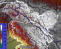
Jammu and Kashmir is home to several valleys such as the Kashmir Valley, Tawi Valley,
Climate
The climate of Jammu and Kashmir varies with altitude and across regions. Southern and southwestern areas have a sub tropical climate, with hot summers and cool winters. This region receives most of its rainfall during the
Administrative divisions

The union territory of Jammu and Kashmir consists of two
| Division | Name | Headquarters | Area (km2) |
Area (sq miles) |
Rural Area (km2) |
Urban Area (km2) |
|
|---|---|---|---|---|---|---|---|
Jammu
|
Kathua district | Kathua | 2,502 | 966 | 2,458.84 | 43.16 | [40] |
| Jammu district | Jammu
|
2,342 | 904 | 2,089.87 | 252.13 | [41] | |
| Samba district | Samba
|
904 | 349 | 865.24 | 38.76 | [42] | |
| Udhampur district | Udhampur | 2,637 | 1,018 | 2,593.28 | 43.72 | [43] | |
| Reasi district | Reasi | 1,719 | 664 | 1,679.99 | 39.01 | [44] | |
| Rajouri district | Rajouri | 2,630 | 1,015 | 2,608.11 | 21.89 | [45] | |
Poonch district
|
Poonch | 1,674 | 646 | 1,649.92 | 24.08 | [46] | |
| Doda district | Doda | 8,912 | 3,441 | 8,892.25 | 19.75 | [47] | |
| Ramban district | Ramban
|
1,329 | 513 | 1,313.92 | 15.08 | [48] | |
| Kishtwar district | Kishtwar | 1,644 | 635 | 1,643.37 | 0.63 | [49] | |
| Total for division | 26,293 | 10,151 | 25,794.95 | 498.05 | |||
Kashmir
|
Anantnag district | Anantnag | 3,574 | 1,380 | 3,475.76 | 98.24 | [50] |
| Kulgam district | Kulgam | 410 | 158 | 360.20 | 49.80 | [51] | |
| Pulwama district | Pulwama | 1,086 | 419 | 1,047.45 | 38.55 | [52] | |
| Shopian district | Shopian | 312 | 120 | 306.56 | 5.44 | [53] | |
| Budgam district | Budgam | 1,361 | 525 | 1,311.95 | 49.05 | [54] | |
| Srinagar district | Srinagar | 1,979 | 764 | 1,684.42 | 294.53 | [55] | |
| Ganderbal district | Ganderbal | 259 | 100 | 233.60 | 25.40 | [56] | |
Bandipora district
|
Bandipora | 345 | 133 | 295.37 | 49.63 | [57] | |
| Baramulla district | Baramulla | 4,243 | 1,638 | 4,179.44 | 63.56 | [58] | |
| Kupwara district | Kupwara | 2,379 | 919 | 2,331.66 | 47.34 | [59] | |
| Total for division | 15,948 | 6,156 | 15,226.41 | 721.54 | |||
Transport
Air
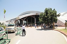
Jammu and Kashmir has two major airports at the two capitals of the territory: Jammu Airport at Jammu and Srinagar Airport at Srinagar, which is also the only international airport in the territory. These airports have regular flights to Delhi, Mumbai, Bangalore, Chandigarh and other major cities of the country.
Railway
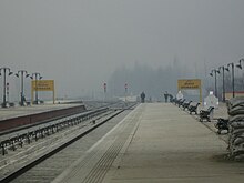
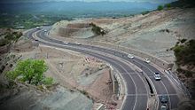
The under-construction
Road
The Jammu–Srinagar National Highway, a segment of the NH44, is the main highway in the territory connecting the two capitals by road. National Highways 1, 144, 144A, 444, 501, 701 and 701A are the other NHs in the territory.
Demographics
As per the 2011 census, Jammu and Kashmir has a total population of 12,267,013. The sex ratio is 889 females per 1000 males. Around 924,485 (7.54%) of the population is
Religion
Muslims constitute the majority of the population of Jammu and Kashmir with a large Hindu minority.
The
Language
Kashmiri is the most-spoken language, is mainly spoken in the Kashmir Valley and in the upper reaches of the Chenab Valley, with a sizeable number of speakers in Jammu City. Dogri, related to Punjabi and Pahari, is spoken throughout the plains areas of Jammu division, as well as in parts of the hills. The hill people speak several languages. In the Pir Panjal Range, bordering Pakistan-administered Kashmir, the main language is Pahari-Pothwari, a western variety of Punjabi, as well as Gojri, the language of the Gujjar tribe. In the eastern hills of Jammu division are spoken various Western Pahari languages such as Siraji and Bhaderwahi, which merge with the dialects of western Himachal Pradesh.[68] Urdu is also widely understood and spoken, particularly in the Kashmir region where it acts as the lingua franca alongside Kashmiri and also serves as a medium of instruction along with English, while Hindi is taught and understood in the southern areas of Jammu.[citation needed]
Education
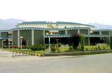
According to the 2011 census, the literacy rate in Jammu and Kashmir was 67.17%, male literacy was 75%, while female literacy was at 56.43%.
Government and politics
The union territory of Jammu and Kashmir is administered under the provisions of Article 239 of the Constitution of India. Article 239A, originally formulated for the union territory of Puduchery, is also applicable to Jammu and Kashmir.[69]
Executive branch
The
A Council of Ministers led by a
Legislative branch
The legislative branch of government is a unicameral
Elections for the Jammu and Kashmir Legislative Assembly are to be held to be expected in 2024 along with general election.[70]
Judicial branch
The union territory is under the jurisdiction of the
Parties
The main political parties active in the region are the Jammu & Kashmir National Conference (President: Farooq Abdullah) the Jammu and Kashmir People's Democratic Party (President: Mehbooba Mufti) the Bharatiya Janata Party (State President: Ravinder Raina), the Indian National Congress (State President: Ghulam Ahmad Mir), and the Jammu and Kashmir People's Conference (President: Sajjad Gani Lone). Other parties with a presence in the region include the Communist Party of India (Marxist), the Jammu and Kashmir National Panthers Party, and the Jammu and Kashmir Apni Party (President: Altaf Bukhari).
Jammu and Kashmir in the Parliament of India
Jammu and Kashmir sends five members (MPs) to the lower house of the
- Lok Sabha constituencies in Jammu and Kashmir
| Constituency No. |
Constituency | Reserved for (SC/ST/None) |
|---|---|---|
| 1 | Baramulla |
None |
| 2 | Srinagar |
None |
| 3 | Anantnag-Rajouri | None |
| 4 | Udhampur |
None |
| 5 | Jammu |
None |
Economy

Jammu and Kashmir's economy is primarily services-based and agriculture-oriented.[72] The gross domestic product of Jammu and Kashmir was estimated at ₹1.76 lakh crore (equivalent to ₹2.1 trillion or US$26 billion in 2023) in 2020–21.[73] In the fiscal year 2023–2024, it is expected that Jammu and Kashmir's Gross Domestic Product (GDP) will exceed Rs 2.30 lakh crore, with a growth rate of 10 per cent.[74] Along with horticulture and agriculture, tourism is an important industry for Jammu and Kashmir, accounting for about 7% to its economy.[75]
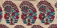
The Kashmir Valley is known for its sericulture and cold-water fisheries.[76] Wood from Kashmir is used to make high-quality cricket bats, popularly known as Kashmir Willow.[77] Major agricultural exports from Jammu and Kashmir include apples, pears, cherries, plums, saffron and walnuts.[78] The traditional Kashmiri handicrafts industry employs a large workforce of around 340 thousand artisans and has potential for producing export goods.[72] Small-scale cottage industries include carpet weaving, silks, shawls, basketry, pottery, copper and silverware, papier-mâché and walnut wood.[72] The horticulture sector is the next biggest source of income in the economy. The temperature of Jammu and Kashmir is also suited to floriculture and can support various species of flora.[72]
Over 500 mineral blocks are present in Jammu and Kashmir, 261 of which are in the Kashmir Division alone.[79] Kishtwar is known as the 'land of sapphire and saffron'.[80] Resources such as timber, herbs and medicinal shrubs, edibles such as mushroom, chilgoza, black zeera, and saffron are available in the forests.[81] The sapphire reserve mines of Machail, Paddar are a source of mineral wealth.[81] Jammu and Kashmir is the only administrative unit in India with a large amount of borax and sapphire resources.[79] It possesses 36 per cent of the graphite, 21 per cent marble and 14 per cent of gypsum present in India.[79] Coal, limestone and magnesite are found scattered among the different districts of the union territory.[79]
Other minerals of significance that occur are bauxite, ball clay and china clay in Udhampur; bentonite in Jammu; diaspore in Rajouri and Udhampur; graphite in Baramulla; lignite and marble in Kupwara; quartz and silica sand in Anantnag, Doda and Udhampur; and quartzite in Anantnag district.[79] In addition, the Department of Geology and Mining has determined the presence of minerals such as magnetite, dolomite, fuel mineral, decorative building stones, slate, and gemstones. All are materials with commercial and industrial uses in many products and factories.[79]
In the fiscal year 2019–20, total exports from Jammu and Kashmir amounted to ₹188.18 million (equivalent to ₹220 million or US$2.8 million in 2023).[72] The Jammu & Kashmir Bank, which is listed as a NIFTY 500 conglomerate, is based in the union territory.[82] Jammu and Kashmir is one of the largest recipients of grants from the central government annually.[83] According to the Sustainable Development Goals Index 2021, 10.35 per cent of the population of Jammu and Kashmir live below the national poverty line, the third-highest among union territories in the country.[84]
Apple cultivation
The apple industry is a significant source of employment in Jammu and Kashmir, generating the highest number of jobs. It provides approximately 400 man-days of work per year per hectare of orchards, supporting a workforce of 3.5 million people. Moreover, it contributes approximately 10 per cent to the Gross State Domestic Product (GSDP). In the year 2020–2021, the apple production in Kashmir was reported to be 1,695,000.00 metric tonnes, while in the Jammu Division, it stood at 24,415.69 metric tonnes. The combined apple production for the entire Union Territory of Jammu and Kashmir amounted to 1,719,415.69 metric tonnes. Notably, the Kashmir Valley is the primary contributor to these numbers, accounting for 75 per cent of India's total apple production and exporting around 1.8 million metric tonnes of apples annually.[85]
Media
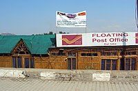
The Telecom Regulatory Authority of India (TRAI) regulates all major aspects pertaining to media and telecommunications in Jammu and Kashmir.[86] In addition, the Jammu and Kashmir administration released their media policy in 2020 which enabled government officers to sanction journalists and media organisations for disseminating "fake news", and is valid for the next five years.[87] The policy attracted criticism for allegedly reducing people to "passive recipients of the information the government intends to disseminate."[88] The Press Council of India (PCI) expressed concern over the provisions of fake news in the policy, as it "interferes with the free functioning of the press."[89]
Major periodicals in Jammu and Kashmir include
Internet shutdowns are frequent in Jammu and Kashmir. As of February 2021, the region had 300 internet shutdowns since 2012. In 2020 alone, this number was 115, the highest of any year.[96]
Sports

Sports tournaments in Jammu and Kashmir are organised by both the Indian army and police, as well as mainstream political parties and the All Parties Hurriyat Conference.[97] Sportspersons who represent India in tournaments face stigmatisation from separatists.[97]
Jammu and Kashmir has 18 stadiums, 23 training centres, three indoor sports complexes and 42 government-maintained playing fields.
Institutions such as the
Tourism

Some major tourist attractions in Jammu and Kashmir are Srinagar, the Mughal Gardens, Gulmarg, Pahalgam, Patnitop, Bhaderwah and Jammu. Every year, thousands of Hindu pilgrims visit holy shrines of Vaishno Devi and Amarnath which has had significant impact on the state's economy.[107]
The Kashmir valley is one of the top tourist destinations in India.[108] Gulmarg, one of the most popular ski resort destinations in India, is also home to the world's highest green golf course.[109] The decrease in violence in the state has boosted the state's economy, specifically tourism.[110] Jammu and Kashmir is also famous for its scenery, flower gardens and apple farms. It attracts tourists for its unique handicrafts and the famous Kashmir shawls.[citation needed]
Notes
- disputed territory between India and Pakistan. Jammu and Kashmir has 42,241 km2 (16,309 sq mi) of area administered by India and 13,297 km2 (5,134 sq mi) of area controlled by Pakistan under Azad Kashmirwhich is claimed by India as part of Jammu and Kashmir.
- ^ Pronounced variably as /ˈdʒæmuː/ or /ˈdʒʌmuː/, /ˈkæʃmɪər/ or /kæʃˈmɪər/.[17]
See also
- Jammu and Kashmir (princely state), for the entity that existed till 1952
- Kashmiriyat
- Tourism in Jammu and Kashmir
- Kashmiri cinema
- Literature of Kashmir
- Music of Jammu and Kashmir
- Kus Bani Koshur Karorpaet
- DD Kashir
- AIR Srinagar
- University of Kashmir
- University of Jammu
- Central University of Kashmir
- Central University of Jammu
- Jammu and Kashmir cricket team
- Real Kashmir F.C.
- Jammu and Kashmir football team
- Jammu and Kashmir Police
- Jammu and Kashmir Light Infantry
- Jammu and Kashmir Rifles
References
- ^ a b Akhtar, Rais; Kirk, William (22 March 2021), "Jammu and Kashmir", Encyclopaedia Britannica, Encyclopædia Britannica, Inc., retrieved 2 April 2022,
The union territory is part of the larger region of Kashmir, which has been the subject of dispute between India, Pakistan, and China since the partition of the subcontinent in 1947. ... The territory that India administered on its side of the line, which contained both Jammu (the seat of the Dogra dynasty) and the Vale of Kashmir, took on the name Jammu and Kashmir. However, both India and Pakistan have continued to claim the entire Kashmir region
- ^ a b Briticannica, Eds Encycl. (1 March 2021), "Ladakh", Encyclopaedia Britannica, Encyclopædia Britannica, Inc., retrieved 2 April 2022,
Ladakh, large area of the northern and eastern Kashmir region, northwestern Indian subcontinent. Administratively, Ladakh is divided between Pakistan (northwest), as part of Gilgit-Baltistan, and India (southeast), as part of Ladakh union territory (until October 31, 2019, part of Jammu and Kashmir state); in addition, China administers portions of northeastern Ladakh.
- ^ due weightin the coverage. Although "controlled" and "held" are also applied neutrally to the names of the disputants or to the regions administered by them, as evidenced in sources (h) through (i) below, "held" is also considered politicised usage, as is the term "occupied," (see (j) below).
(a) Kashmir, region Indian subcontinent, Encyclopaedia Britannica, retrieved 15 August 2019 (subscription required) Quote: "Kashmir, region of the northwestern Indian subcontinent ... has been the subject of dispute between India and Pakistan since the partition of the Indian subcontinent in 1947. The northern and western portions are administered by Pakistan and comprise three areas: Azad Kashmir, Gilgit, and Baltistan, the last two being part of a territory called the Northern Areas. Administered by India are the southern and southeastern portions, which constitute the state of Jammu and Kashmir but are slated to be split into two union territories.";
(b) Pletcher, Kenneth, Aksai Chin, Plateau Region, Asia, Encyclopaedia Britannica, retrieved 16 August 2019 (subscription required) Quote: "Aksai Chin, Chinese (Pinyin) Aksayqin, portion of the Kashmir region, at the northernmost extent of the Indian subcontinent in south-central Asia. It constitutes nearly all the territory of the Chinese-administered sector of Kashmir that is claimed by India to be part of the Ladakh area of Jammu and Kashmir state.";
(c) "Kashmir", Encyclopedia Americana, Scholastic Library Publishing, 2006, p. 328,ISBN 978-1-84904-621-3Quote:"Some politicised terms also are used to describe parts of J&K. These terms include the words 'occupied' and 'held'." - ^ The Hindu Net Desk (8 May 2017). "What is the Darbar Move in J&K all about?". The Hindu. Archived from the original on 10 November 2017. Retrieved 23 February 2019.
- ^ Singh, Jogindar (1975). "Saser Kangri". The American Alpine Journal: 67. Archived from the original on 14 February 2019. Retrieved 14 February 2019. pdf of original pages
- ^ Singh, Vijaita (29 February 2020). "Only J&K will use 2011 Census for delimitation". The Hindu. Retrieved 6 November 2020.
- ^ "The Jammu and Kashmir Official Languages Act, 2020" (PDF). The Gazette of India. 27 September 2020. Archived from the original (PDF) on 19 October 2020. Retrieved 27 September 2020.
- ^ "Parliament passes JK Official Languages Bill, 2020". Rising Kashmir. 23 September 2020. Archived from the original on 24 September 2020. Retrieved 23 September 2020.
- ^ "Pakistan's "Burushaski" Language Finds New Relatives". National Public Radio. Retrieved 6 August 2019.
- ISBN 978-1-137-02958-4. Archivedfrom the original on 23 February 2019. Retrieved 23 February 2019.
- ^ "Bhadrawahi". Ethnologue: Languages of the World. Dallas: SIL International. Retrieved 6 August 2019.
- ^ Bateri.
- ^ Simons, Gary F.; Fennig, Charles D. (2017). Ethnologue: Languages of the World, Twentieth Edition. Dallas: SIL International.
- ^ Crane, Robert I. (1956). Area Handbook on Jammu and Kashmir State. University of Chicago for the Human Relations Area Files. p. 179.
Shina is the most eastern of these languages and in some of its dialects such as the Brokpa of Dah and Hanu and the dialect of Dras, it impinges upon the area of the Sino-Tibetan language family and has been affected by Tibetan with an overlay of words and idioms.
- ISBN 978-81-7022-557-7. Archivedfrom the original on 24 February 2019. Retrieved 23 February 2019.
- ^ [9][10][11][12][13][14][15]
- ISBN 978-3-12-539683-8
- ^ a b Ministry of Home Affairs (9 August 2019), "In exercise of the powers conferred by clause a of section 2 of the Jammu and Kashmir Reorganisation Act." (PDF), The Gazette of India, retrieved 9 August 2019
- ISBN 978-93-5029-898-5.
- ^ "The enigma of terminology". The Hindu. 27 January 2014. Archived from the original on 16 October 2015.
- ^ Zain, Ali (13 September 2015). "Pakistani flag hoisted, pro-freedom slogans chanted in Indian Occupied Kashmir – Daily Pakistan Global". En.dailypakistan.com.pk. Archived from the original on 18 November 2015. Retrieved 17 November 2015.
- ^ "Pakistani flag hoisted once again in Indian Occupied Kashmir". Dunya News. 11 September 2015. Retrieved 17 November 2015.
- ^ South Asia: fourth report of session 2006–07 by Great Britain: Parliament: House of Commons: Foreign Affairs Committee page 37
- ^ K. Venkataramanan (5 August 2019), "How the status of Jammu and Kashmir is being changed", The Hindu
- ^ "Article 370 and 35(A) revoked: How it would change the face of Kashmir". The Economic Times. 5 August 2019.
- ^ a b c Article 370: What happened with Kashmir and why it matters. BBC (6 August 2019). Retrieved 7 August 2019.
- ^ Jeelani, Mushtaq A. (25 June 2001). "Kashmir: A History Littered With Rigged Elections". Media Monitors Network. Archived from the original on 4 March 2016. Retrieved 24 February 2017.
- ^ "Parliament Live | Lok Sabha passes Jammu and Kashmir Reorganisation Bill, Ayes: 370, Noes 70". The Hindu. 6 August 2019. Retrieved 6 August 2019.
- ^ Ghoshal, Devjyot; Pal, Alasdair (12 September 2019). "Thousands detained in Indian Kashmir crackdown, official data reveals". Reuters.
- ^ "Kashmir in lockdown after autonomy scrapped". BBC News. 6 August 2019. Retrieved 6 June 2021.
- ^ "Live Updates: Supreme Court Backs Centre On Scrapping Of Jammu & Kashmir Special Status". NDTV. 11 December 2023. Retrieved 11 December 2023.
- ^ Vij, Shivam (5 May 2017). "Kashmir Is A Prison With Three Walls". HuffPost. Archived from the original on 5 May 2017. Retrieved 9 August 2019. Alt URL
- ^ a b Guruswamy, Mohan (28 September 2016). "Indus: The water flow can't be stopped". The Asian Age. Retrieved 9 August 2019.
- ^ Khan, Asma (26 April 2018). "A Tryst of the Heart and History along the Karakoram Highway". Greater Kashmir. Retrieved 9 August 2019.
- ^ Andrei, Mihai (11 March 2019). "Why India and Pakistan keep fighting over Kashmir – the history of the Kashmir conflict". GME Science. Retrieved 9 August 2019.
- ^ Vrinda; J. Ramanan (21 December 2017). "Doorway of the gods: Himalaya crosses five countries". The Hindu. Retrieved 9 August 2019.
- ^ "Jhelum River". Encyclopædia Britannica. 15 December 2015. Retrieved 9 August 2019.
- ^ Agencies (29 July 2019). "Flooding alert issued as India releases water". The Nation. Retrieved 9 August 2019.
- ^ "Ministry of Home Affairs:: Department of Jammu & Kashmir Affairs". Archived from the original on 8 December 2008. Retrieved 28 August 2008.
- ^ District Census Handbook Kathua (PDF). Census of India 2011, Part A (Report). 18 June 2014. p. 8. Retrieved 21 November 2020.
- ^ District Census Handbook Jammu, Part A (PDF). Census of India 2011 (Report). 18 June 2014. pp. 13, 51, 116. Retrieved 21 November 2020.
District Census Handbook Jammu, Part B (PDF). Census of India 2011 (Report). 16 June 2014. pp. 13, 24. Retrieved 21 November 2020. - ^ District Census Handbook Samba, Part A (PDF). Census of India 2011 (Report). 18 June 2014. pp. 9, 34, 36, 100. Retrieved 21 November 2020.
District Census Handbook Samba, Part B (PDF). Census of India 2011 (Report). 16 June 2014. pp. 10, 12, 22. Retrieved 21 November 2020. - ^ District Census Handbook Udhampur (PDF). Census of India 2011 (Report). 16 June 2014. pp. 12, 22. Retrieved 21 November 2020.
- ^ District Census Handbook Reasi, Part A (PDF). Census of India 2011 (Report). 18 June 2014. pp. 9, 37, 88. Retrieved 21 November 2020.
District Census Handbook Reasi, Part B (PDF). Census of India 2011 (Report). 16 June 2014. pp. 9, 13, 24. Retrieved 21 November 2020. - ^ District Census Handbook Rajouri, Part A (PDF). Census of India 2011 (Report). 18 June 2014. pp. 11, 107. Retrieved 21 November 2020.
District Census Handbook Rajouri, Part B (PDF). Census of India 2011 (Report). 16 June 2014. pp. 9, 10, 12, 22. Retrieved 21 November 2020. - ^ District Census Handbook Punch, Part A (PDF). Census of India 2011 (Report). 18 June 2014. pp. 9, 99. Retrieved 21 November 2020.
District Census Handbook Punch, Part B (PDF). Census of India 2011 (Report). 16 June 2014. pp. 11, 13, 24. Retrieved 21 November 2020. - ^ District Census Handbook Doda, Part B (PDF). Census of India 2011 (Report). 18 June 2014. pp. 9, 12, 99. Retrieved 21 November 2020.
- ^ District Census Handbook Ramban, Part B (PDF). Census of India 2011 (Report). 18 June 2014. pp. 10, 12. Retrieved 21 November 2020.
- ^ District Census Handbook Kishtwar, Part B (PDF). Census of India 2011 (Report). 18 June 2014. pp. 9, 10, 22. Retrieved 21 November 2020.
Part B page 9 says the rural area is 1,643.65 km2 (634.62 sq mi), whilst pages 10 and 22 says 1,643.37 km2 (634.51 sq mi). - ^ District Census Handbook Anantnag, Part A (PDF). Census of India 2011 (Report). July 2016. p. 9. Retrieved 21 November 2020.
District Census Handbook Anantnag, Part B (PDF). Census of India 2011 (Report). July 2016. pp. 12, 22. Retrieved 21 November 2020. - ^ District Census Handbook Kulgam, Part A (PDF). Census of India 2011 (Report). July 2016. p. 10. Retrieved 21 November 2020.
District Census Handbook Kulgam, Part B (PDF). Census of India 2011 (Report). 16 June 2014. pp. 12, 22. Retrieved 21 November 2020.
Part B page 12 says the area of the district is 404 km2 (156 sq mi), but page 22 says 410 km2 (160 sq mi). - ^ District Census Handbook Pulwama, Part B (PDF). Census of India 2011 (Report). 16 June 2014. pp. 12, 22. Retrieved 21 November 2020.
- ^ District Census Handbook Shupiyan, Part A (PDF). Census of India 2011 (Report). 16 June 2014. p. 10. Retrieved 21 November 2020.
District Census Handbook Shupiyan, Part B (PDF). Census of India 2011 (Report). 16 June 2014. pp. 12, 22. Retrieved 21 November 2020.
Part B pages 12 and 22 say the district area is 312.00 km2 (120.46 sq mi), but Part A page 10 says 307.42 km2 (118.70 sq mi). - ^ District Census Handbook Badgam, Part A (PDF). Census of India 2011 (Report). July 2016. pp. 10, 46. Retrieved 21 November 2020.
District Census Handbook Badgam, Part B (PDF). Census of India 2011 (Report). 16 June 2014. pp. 11, 12, 22. Retrieved 21 November 2020.
Part A says the district area is 1,371 km2 (529 sq mi), Part B says 1,371 km2 (529 sq mi) (page 11) and 1,361 km2 (525 sq mi) (page 12s and 22). - ^ District Census Handbook Srinagar, Part A (PDF). Census of India 2011 (Report). July 2016. pp. 11, 48. Retrieved 21 November 2020.
Part A page 48 says the district area was 2,228.0 km2 (860.2 sq mi) in 2001 and 1,978.95 km2 (764.08 sq mi) in 2011. - ^ District Census Handbook Ganderbal, Part B (PDF). Census of India 2011 (Report). July 2016. pp. 11, 12 and 22. Retrieved 21 November 2020.
Part B page 11 says the district area is 393.04 km2 (151.75 sq mi), but pages 12 and 22 say 259.00 km2 (100.00 sq mi). - ^ District Census Handbook Bandipora, Part A (PDF). Census of India 2011 (Report). July 2016. pp. 10, 47. Retrieved 21 November 2020.
District Census Handbook Bandipora, Part B (PDF). Census of India 2011 (Report). 16 June 2014. pp. 11, 20. Retrieved 21 November 2020. - ^ District Census Handbook Baramulla, Part A (PDF). Census of India 2011 (Report). July 2016. p. 11. Retrieved 21 November 2020.
District Census Handbook Baramulla, Part B (PDF). Census of India 2011 (Report). 16 June 2014. p. 22. Retrieved 21 November 2020. - ^ District Census Handbook Kupwara, Part A (PDF). Census of India 2011 (Report). July 2016. p. 7. Retrieved 21 November 2020.
District Census Handbook Kupwara, Part B (PDF). Census of India 2011 (Report). 16 June 2014. pp. 11, 12. Retrieved 21 November 2020. - ^ a b "Table C-16 Population by Religion: Jammu and Kashmir". censusindia.gov.in. Registrar General and Census Commissioner of India.
- The Print. Retrieved 12 August 2023.
- ^ "Are Kashmiri Shias The Next Pandits?". 14 November 2013. Archived from the original on 21 June 2015. Retrieved 21 May 2014.
- ^ Iyer-Mitra, Abhijit (27 September 2019). "After scrapping of Article 370, Shias in Kashmir are in a state of relief and caution". ThePrint. Retrieved 11 September 2021.
- ^ "Population by religion community – 2011". Census of India, 2011. The Registrar General & Census Commissioner, India. Archived from the original on 25 August 2015.
- ^ "Explained: Protests For Jammu's Statehood, The Idea Of Jammu & Kashmir's Trifurcation, And RSS 2002 Resolution".
- ^ Pioneer, The. "Movement launched across Jammu for 'separate State'". The Pioneer.
- ^ "IkkJutt activists detained after protests demanding separate state for Jammu". 18 July 2022.
- ^ a b "Table C-16 Population by Mother Tongue: Jammu and Kashmir". censusindia.gov.in. Registrar General and Census Commissioner of India.
- ^ a b c d e Jammu & Kashmir Reorganisation Bill passed by Rajya Sabha: Key takeaways, The Indian Express, 5 August 2019.
- ^ "Jammu and Kashmir assembly election in 2021 after delimitation: EC sources". Zee News. 29 August 2019.
- ^ Ratan, Devesh; Johri, Iti (7 August 2019). "Salient Features Of Jammu & Kashmir Reorganization Bill [Read Bill]". LiveLaw.in: All about law. Retrieved 7 August 2019.
- ^ a b c d e "Jammu And Kashmir Presentation And Economic Growth Report". India Brand Equity Foundation. 29 July 2021.
- ^ "MOSPI State Domestic Product, Ministry of Statistics and Programme Implementation". Government of India. 15 March 2021. Retrieved 17 April 2021.
- ^ Akmali, Mukeet (24 March 2023). "J&K's economy projected to grow 10% in 2023-24". Greater Kashmir. Retrieved 6 August 2023.
- ^ "Jammu and Kashmir's tourism flourishes, receives highest footfall in 75 years". mint. 7 October 2022.
- ^ "Time for SKUAST-Jammu to start Horti, Dairy Farming, Agri Engineering deptts: LG". The Kashmir Images. 16 March 2021.
- ^ "Jalandhar bats with Pakistani goods". The New Indian Express. 5 November 2017.
- ^ "J&K special report: Ready reckoner of top agri-product manufacturers and industry bodies from Jammu & Kashmir". Gulf News. 27 December 2020.
- ^ a b c d e f "New Mining Policy in J&K: Interests of locals are paramount, not revenue". The Kashmir Images. 11 September 2020.
- ^ Syed Amjad Shah (11 July 2021). "Kishtwar couple globalising local produce; promoting Kashmiri-Dogra arts and crafts". Greater Kashmir.
- ^ a b "Kishtwar Ignored Beauty". Daily Excelsior. 15 March 2020.
- ^ "The Jammu & Kashmir Bank Ltd. - Stock Price". The Financial Express. Retrieved 2 August 2021.
- ^ "Demand for Grants of Union Territory of Jammu and Kashmir 2021-22" (PDF). Finance Department Jammu and Kashmir. Retrieved 2 August 2021.
- ^ "10.35% Population In J&K Living Below Poverty Line: Survey". Kashmir Observer. 11 June 2021. Retrieved 11 June 2021.
- ^ Haneef, Mohammad (31 March 2023). "Kashmir's Apple: An 800-year-old economical backbone of Kashmir". Rising Kashmir. Retrieved 6 August 2023.
- ^ The Telecom Regulatory Authority of India Act, 1997. Georg Thieme Verlag. p. 112. GGKEY:BJ6HEPE0NRE.
- ^ "Why Journalists Are Worried About the New Media Policy in Jammu and Kashmir". The Wire. 17 July 2020.
- ^ "Kashmir Media Policy: Accentuating the Curbs on the Freedom of Press". Economic and Political Weekly: 7–8. 19 August 2020.
- ^ "Press Council of India seeks J&K govt reply on 'fake news' in its media policy". The New Indian Express. 17 June 2020.
- ISBN 978-81-230-2338-0.
- ^ "Kashmir gets its own version of KBC from today". The Tribune. 29 April 2019.
- ^ "Amid Shutdown, a Private News Channel Connects Thousands in J&K". The Wire. 24 September 2019.
- ^ "Rediff on the NeT: AIR, DD to counter Pak propaganda along border areas". Rediff.com. 16 December 1999.
- ^ Mohan, Archis (6 February 2016). "The borderline cases of Jammu & Kashmir". Business Standard India. Archived from the original on 8 November 2017.
- ^ "FM radio stations and their audiences bloom in restive Kashmir". Asia Times. 25 September 2018.
- ^ "India: number of internet shutdowns J&K 2021". Statista. Retrieved 29 July 2021.
- ^ a b Gupta, Amit (16 October 2020). "Sports in Kashmir: How 5 journalists run a magazine that focuses on local sports". Mumbai Mirror.
- ^ "Department of Youth Services & Sports". Department of Youth Services and Sports. Government of Jammu and Kashmir. Archived from the original on 29 November 2019. Retrieved 29 November 2019.
- ^ "Records / Sher-i-Kashmir Stadium, Srinagar / One-Day Internationals". ESPNcricinfo. Archived from the original on 13 August 2014.
- ^ "Molana Azad Stadium, Jammu". CricketArchive. Retrieved 1 August 2021.
- ^ "J&K stadium hosts football match after 25-year gap". The Times of India. 16 July 2012. Archived from the original on 11 May 2013. Retrieved 1 August 2021.
- ^ "UT Govt denies pensionary benefits to retired employees of JIM&WS". Daily Excelsior. 5 July 2021.
- ^ "India". Robert Trent Jones – Golf Architects. Archived from the original on 12 December 2013.
- ISSN 0971-751X.
- ^ Iveson, Ali (15 March 2020). "Hosts win 26 gold medals as first-ever Khelo India Winter Games conclude". Inside the Games. Archived from the original on 19 December 2020.
- ^ "Spectacular Closing Ceremony of 2nd Khelo India National Winter Games organized at Gulmarg". Kashmir News Service. 2 March 2021.
- ^ "Amarnath Board to study yatra impact on Kashmir economy". Online edition of The Hindu. Chennai, India. 13 September 2007. Archived from the original on 9 November 2012. Retrieved 6 June 2009.
- ^ "Foreign tourists flock Kashmir". Online edition of The Hindu. Chennai, India. 18 March 2009. Archived from the original on 9 November 2012. Retrieved 18 March 2009.
- ^ Cris Prystay (26 October 2007). "Fairway to Heaven". The Wall Street Journal.
- ^ "Tourists arrival gives boost to J-K economy". Sify. Archived from the original on 16 July 2011.

