
Edgar County, Illinois
Edgar County | |
|---|---|
UTC−5 (CDT) | |
| Congressional district | 15th |
| Website | www |
Edgar County is a
History
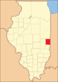
Edgar County was formed out of Clark County in 1823. It was named for John Edgar,[3] an Irish-born officer in the Royal Navy who resigned rather than fight against the Americans in the Revolutionary War. Edgar moved to Kaskaskia, Illinois, in 1784, becoming a miller and merchant in that town.
-
![Edgar County (1823), with unorganized territory attached to it.[4]](//upload.wikimedia.org/wikipedia/commons/thumb/f/f3/Edgar_County_Illinois_1823.png/85px-Edgar_County_Illinois_1823.png) Edgar County (1823), with unorganized territory attached to it.[4]
Edgar County (1823), with unorganized territory attached to it.[4] -
 Edgar County (1825–1826)
 -
 Edgar County (1826–1830)
 -
 Edgar County (1830–present), with the additional territory incorporated into Coles County
![Edgar County (1823), with unorganized territory attached to it.[4]](/File:Edgar_County_Illinois_1823.png)


Geography
According to the US Census Bureau, the county has a total area of 624 square miles (1,620 km2), of which 623 square miles (1,610 km2) is land and 0.6 square miles (1.6 km2) (0.1%) is water.[5]
There is one recreational area in the county, on the north edge of Paris. Twin Lakes Park and Reservoir began in 1895 upon completion of the dam compounding the Twin Lakes Reservoir.[6]
Climate and weather
| Paris, Illinois | ||||||||||||||||||||||||||||||||||||||||||||||||||||||||||||
|---|---|---|---|---|---|---|---|---|---|---|---|---|---|---|---|---|---|---|---|---|---|---|---|---|---|---|---|---|---|---|---|---|---|---|---|---|---|---|---|---|---|---|---|---|---|---|---|---|---|---|---|---|---|---|---|---|---|---|---|---|
| Climate chart (explanation) | ||||||||||||||||||||||||||||||||||||||||||||||||||||||||||||
| ||||||||||||||||||||||||||||||||||||||||||||||||||||||||||||
| ||||||||||||||||||||||||||||||||||||||||||||||||||||||||||||
In recent years, average temperatures in the county seat of Paris have ranged from a low of 16 °F (−9 °C) in January to a high of 86 °F (30 °C) in July, although a record low of −23 °F (−31 °C) was recorded in January 1930 and a record high of 109 °F (43 °C) was recorded in July 1936. Average monthly precipitation ranged from 2.23 inches (57 mm) in January to 4.43 inches (113 mm) in July.[7]
Adjacent counties
- Vermilion County – north
- Vermillion County, Indiana – northeast
- Vigo County, Indiana – southeast
- Clark County – south
- Coles County – southwest
- Douglas County – west
- Champaign County – northwest
Transportation
Major highways
- US Route 36
- US Route 150
 Illinois Route 1
 Illinois Route 16
 Illinois Route 49
 Illinois Route 133
Rail
Three railroad lines run through the county. Two are operated by CSX Transportation and the third by the Eastern Illinois Railroad Company.[8]
Transit
Airport
The county contains one public-use airport: Edgar County Airport (PRG), six miles (10 km) north of Paris.[9]
Demographics
| Census | Pop. | Note | %± |
|---|---|---|---|
| 1830 | 4,071 | — | |
| 1840 | 8,225 | 102.0% | |
| 1850 | 10,692 | 30.0% | |
| 1860 | 16,925 | 58.3% | |
| 1870 | 21,450 | 26.7% | |
| 1880 | 25,499 | 18.9% | |
| 1890 | 26,787 | 5.1% | |
| 1900 | 28,273 | 5.5% | |
| 1910 | 27,336 | −3.3% | |
| 1920 | 25,769 | −5.7% | |
| 1930 | 24,966 | −3.1% | |
| 1940 | 24,430 | −2.1% | |
| 1950 | 23,407 | −4.2% | |
| 1960 | 22,550 | −3.7% | |
| 1970 | 21,591 | −4.3% | |
| 1980 | 21,725 | 0.6% | |
| 1990 | 19,595 | −9.8% | |
| 2000 | 19,704 | 0.6% | |
| 2010 | 18,576 | −5.7% | |
| 2020 | 16,866 | −9.2% | |
| 2023 (est.) | 16,334 | [10] | −3.2% |
| US Decennial Census[11] 1790-1960[12] 1900-1990[13] 1990-2000[14] 2010-2013[1] | |||

As of the
Of the 7,839 households, 28.5% had children under the age of 18 living with them, 50.3% were married couples living together, 10.7% had a female householder with no husband present, 34.3% were non-families, and 29.5% of all households were made up of individuals. The average household size was 2.33 and the average family size was 2.84. The median age was 43.2 years.[15]
The median income for a household in the county was $39,904 and the median income for a family was $51,588. Males had a median income of $38,945 versus $29,951 for females. The per capita income for the county was $22,175. About 9.7% of families and 13.5% of the population were below the
Communities

Cities
Villages
Unincorporated communities
Former communities
- Bell Ridge[18]
- Bloomfield[19]
- Catfish
- Cherry Point[20]
- Clays Prairie[21]
- Conlogue[22]
- Dudley[23]
- Ferrel[24]
- Garland[25]
- Grandview
- Harris[26]
- Hildreth[27]
- Horace[28]
- Huffmanville[29]
- Hughes[30]
- Illiana
- Kentucky[31]
- Kidley[32]
- Logan[33]
- Mabel[34]
- Marley[35]
- Mays[36]
- McCown[37]
- Melwood[38]
- Mortimer[39]
- New Athens
- Palermo[40]
- Quaker
- Scotts[41]
- Warrington[42]
- West Sandford
- Wetzel
Townships
Notable people
- Basil Bennett, Bronze Medalist in the Hammer Throw at the 1920 Olympics
- Offa Neal, professional baseball player with the New York Giants
- Edward Adelbert Doisy, biochemist and Nobel Prize winner
- Frank Fletcher (baseball), professional baseball player with the Philadelphia Phillies
Politics
A swing county in the first eight decades after
| Year | Republican | Democratic | Third party | |||
|---|---|---|---|---|---|---|
| No. | % | No. | % | No. | % | |
| 2020 | 6,193 | 75.41% | 1,887 | 22.98% | 132 | 1.61% |
| 2016 | 5,645 | 71.46% | 1,793 | 22.70% | 461 | 5.84% |
| 2012 | 5,132 | 65.50% | 2,565 | 32.74% | 138 | 1.76% |
| 2008 | 4,398 | 53.09% | 3,743 | 45.18% | 143 | 1.73% |
| 2004 | 5,258 | 62.38% | 3,093 | 36.69% | 78 | 0.93% |
| 2000 | 4,833 | 58.71% | 3,216 | 39.07% | 183 | 2.22% |
| 1996 | 3,746 | 45.12% | 3,552 | 42.78% | 1,004 | 12.09% |
| 1992 | 3,790 | 38.77% | 4,014 | 41.06% | 1,972 | 20.17% |
| 1988 | 5,538 | 58.55% | 3,880 | 41.02% | 41 | 0.43% |
| 1984 | 6,821 | 67.54% | 3,241 | 32.09% | 37 | 0.37% |
| 1980 | 6,639 | 63.14% | 3,394 | 32.28% | 482 | 4.58% |
| 1976 | 5,842 | 53.01% | 5,058 | 45.89% | 121 | 1.10% |
| 1972 | 7,195 | 64.73% | 3,889 | 34.99% | 32 | 0.29% |
| 1968 | 6,281 | 56.33% | 3,565 | 31.97% | 1,305 | 11.70% |
| 1964 | 5,827 | 49.41% | 5,966 | 50.59% | 0 | 0.00% |
| 1960 | 7,348 | 59.37% | 5,024 | 40.59% | 4 | 0.03% |
| 1956 | 7,942 | 64.52% | 4,362 | 35.44% | 5 | 0.04% |
| 1952 | 8,323 | 64.56% | 4,558 | 35.36% | 10 | 0.08% |
| 1948 | 6,282 | 54.77% | 5,121 | 44.65% | 67 | 0.58% |
| 1944 | 6,961 | 57.68% | 5,054 | 41.88% | 54 | 0.45% |
| 1940 | 7,985 | 54.03% | 6,713 | 45.42% | 82 | 0.55% |
| 1936 | 6,929 | 46.51% | 7,822 | 52.50% | 147 | 0.99% |
| 1932 | 5,953 | 43.03% | 7,745 | 55.98% | 138 | 1.00% |
| 1928 | 7,509 | 58.27% | 5,325 | 41.32% | 52 | 0.40% |
| 1924 | 6,297 | 52.31% | 5,222 | 43.38% | 518 | 4.30% |
| 1920 | 6,750 | 53.29% | 5,694 | 44.95% | 223 | 1.76% |
| 1916 | 6,099 | 46.37% | 6,710 | 51.01% | 345 | 2.62% |
| 1912 | 2,430 | 32.84% | 3,479 | 47.02% | 1,490 | 20.14% |
| 1908 | 3,757 | 50.46% | 3,433 | 46.11% | 255 | 3.43% |
| 1904 | 3,753 | 50.33% | 3,443 | 46.17% | 261 | 3.50% |
| 1900 | 3,766 | 48.90% | 3,783 | 49.12% | 153 | 1.99% |
| 1896 | 3,822 | 49.80% | 3,729 | 48.59% | 123 | 1.60% |
| 1892 | 3,197 | 47.64% | 3,164 | 47.15% | 350 | 5.22% |
See also
References
- ^ a b "State & County QuickFacts". US Census Bureau. Archived from the original on June 6, 2011. Retrieved July 4, 2014.
- ^ "Find a County". National Association of Counties. Archived from the original on July 4, 2012. Retrieved June 7, 2011.
- ISBN 0-912226-24-2
- ^ White, Jesse. Origin and Evolution of Illinois Counties. State of Illinois, March 2010. [1]
- ^ a b "Population, Housing Units, Area, and Density: 2010 - County". US Census Bureau. Archived from the original on February 12, 2020. Retrieved July 11, 2015.
- ^ Parks - City of Paris IL (accessed 30 December 2018)
- ^ a b "Monthly Averages for Paris IL". The Weather Channel. Retrieved January 27, 2011.
- ^ Illinois Railroad Map (PDF), archived from the original (PDF) on August 22, 2007, retrieved October 11, 2007
- ^ Public and Private Airports, Edgar County IL
- ^ "Annual Estimates of the Resident Population for Counties: April 1, 2020 to July 1, 2023". United States Census Bureau. Retrieved April 2, 2024.
- ^ "US Decennial Census". US Census Bureau. Retrieved July 4, 2014.
- ^ "Historical Census Browser". University of Virginia Library. Retrieved July 4, 2014.
- ^ "Population of Counties by Decennial Census: 1900 to 1990". US Census Bureau. Retrieved July 4, 2014.
- ^ "Census 2000 PHC-T-4. Ranking Tables for Counties: 1990 and 2000" (PDF). US Census Bureau. Archived (PDF) from the original on March 27, 2010. Retrieved July 4, 2014.
- ^ a b c "Profile of General Population and Housing Characteristics: 2010 Demographic Profile Data". US Census Bureau. Archived from the original on February 13, 2020. Retrieved July 11, 2015.
- ^ "Selected Social Characteristics in the United States – 2006-2010 American Community Survey 5-Year Estimates". US Census Bureau. Archived from the original on February 13, 2020. Retrieved July 11, 2015.
- ^ "Selected Economic Characteristics – 2006-2010 American Community Survey 5-Year Estimates". US Census Bureau. Archived from the original on February 13, 2020. Retrieved July 11, 2015.
- ^ Bell Ridge, Edgar County IL Google Maps (accessed 30 December 2018)
- ^ Bloomfield, Edgar County IL Google Maps (accessed 30 December 2018)
- ^ Cherry Point, Edgar County IL Google Maps (accessed 30 December 2018)
- ^ Clays Prairie, Edgar County IL Google Maps (accessed 30 December 2018)
- ^ Conlogue, Edgar County IL Google Maps (accessed 30 December 2018)
- ^ Dudley, Edgar County IL Google Maps (accessed 30 December 2018)
- ^ Ferrel, Edgar County IL Google Maps (accessed 30 December 2018)
- ^ Garland, Edgar County IL Google Maps (accessed 30 December 2018)
- ^ Harris, Edgar County IL Google Maps (accessed 30 December 2018)
- ^ Hildreth, Edgar County IL Google Maps (accessed 30 December 2018)
- ^ Horace, Edgar County IL Google Maps (accessed 30 December 2018)
- ^ Huffmanville, Edgar County IL Google Maps (accessed 30 December 2018)
- ^ Hughes, Edgar County IL Google Maps (accessed 30 December 2018)
- ^ Kentucky, Edgar County IL Google Maps (accessed 30 December 2018)
- ^ Kidley, Edgar County IL Google Maps (accessed 30 December 2018)
- ^ Logan, Edgar County IL Google Maps (accessed 30 December 2018)
- ^ Mabel, Edgar County IL Google Maps (accessed 30 December 2018)
- ^ Marley, Edgar County IL Google Maps (accessed 30 December 2018)
- ^ Mays, Edgar County IL Google Maps (accessed 30 December 2018)
- ^ McCown, Edgar County IL Google Maps (accessed 30 December 2018)
- ^ Melwood, Edgar County IL Google Maps (accessed 30 December 2018)
- ^ Mortimer, Edgar County IL Google Maps (accessed 30 December 2018)
- ^ Palermo, Edgar County IL Google Maps (accessed 30 December 2018)
- ^ Scotts, Edgar County IL Google Maps (accessed 30 December 2018
- ^ Warrington, Edgar County IL Google Maps (accessed 30 December 2018)
- ^ Leip, David. "Atlas of US Presidential Elections". uselectionatlas.org. Retrieved November 1, 2018.
External links
Places adjacent to Edgar County, Illinois | |
|---|---|
 | ||||
Villages | ||||
| Townships | ||||
| Unincorporated communities | ||||
| Footnotes | ‡This populated place also has portions in an adjacent county or counties | |||
| ||||
| International | |
|---|---|
| National | |
| Other | |