
Gran Roque
Federal dependencies of Venezuela | |
| Demographics | |
|---|---|
| Population | 3.100 |
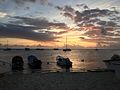
Gran Roque is located by the sea, a few meters from the beach.
History
Gran Roque already appears in Spanish maps as part of the
Geography
Gran Roque has a territorial extension of 170 hectares or 1.70 square kilometers is located in the northeastern part of the archipelago, being its geographic coordinates 11º 47´33´´ of north latitude and 66º 40´37´´ of west longitude in its central part. its highest point is the Cerro Roque with 37 msnm and has 2.361 inhabitants. It is shaped like a right triangle with the sharpest vertex facing northwest, and its maximum dimensions are: 3.15 km in a southeast to northwest direction and 990 m in a northeast to southwest direction.
Government
Gran Roque works as capital of the Venezuelan Federal Dependencies, and also of the Insular Miranda Territory and is the seat of all the inns, the airport, the school and was the headquarters of the Single Area Authority (AUA).
The island does not depend on any municipal or state government but is directly administered by the central government through the figure of the island Territory, created in 2011.
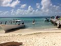
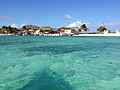
Gallery
-

-
-
 Island of Gran Rouqe
 -
-


See also
- Los Roques Airport, a small airport located on the island
- Geography of Venezuela
References
- ^ "PDVSA" (PDF).
- ISBN 9781556508004.
- ^ Guía ecoturística de Venezuela (in Spanish). Miro Popić Editor C.A. 1998.
External links
This article about a location in Venezuela is a stub. You can help Wikipedia by expanding it. |