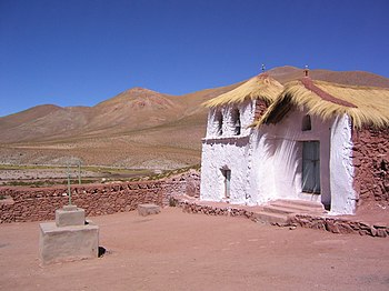
El Loa
El Loa Province
Provincia El Loa | |
|---|---|
 Miscanti Lake | |
| Area code | 56 + 55 |
| Website | www |
El Loa Province (
.Geography and demography
According to the 2012 census by the National Statistics Institute (INE), the province spans an area of 41,999.6 km2 (16,216 sq mi)[1] and had a population of 142,686 inhabitants, giving it a population density of 3.4/km2 (9/sq mi). It is the sixth largest province in the country. Between the 1992 and 2002 censuses, the population grew by 14.9% (18,610 persons).[1]
Communes
- Calama (capital)
- Ollagüe
- San Pedro de Atacama
References
- ^ a b c d e "Territorial division of Chile" (PDF) (in Spanish). National Statistics Institute. 2007. Archived from the original (PDF) on 14 November 2010. Retrieved 18 March 2011.
- ^ "Chile Time". WorldTimeZones.org. Archived from the original on 2007-09-11. Retrieved 2010-07-28.
- ^ "Chile Summer Time". WorldTimeZones.org. Archived from the original on 2007-09-11. Retrieved 2010-07-28.
External links
- Delegation of El Loa (in Spanish)


