
Elista
Elista
Элиста | |
|---|---|
City[1] | |
| Other transcription(s) | |
| • Kalmyk | Элст |
| • Former name | Stepnoy (Степной) |
 Golden Temple, Echo Monument, Monument to Oka Gorodovikov, Stupa of enlightenment, Golden Door | |
.svg) Flag _(2004).png) Coat of arms | |
Location of Elista  | |
| Postal code(s)[7] | 358000–358014 |
| Dialing code(s) | +7 84722 |
| OKTMO ID | 85701000001 |
| Website | www |
Elista (
It was known as Stepnoy (Степно́й) from 1944 to 1957.
History

Elista was founded in 1865 as a small settlement, the name is from
Some western tourists started to visit Elista from the mid-1990s, and more after it received publicity as the host city of the 1998 Chess Olympiad. The city is safe and has little traffic. On the outskirts of Elista, there are vast grasslands.
Geography
The city is located in the area of the Yergeni hills, in the upper part of the Elista valley. The sources of the river are located in the western part of the city. The Elista crosses the urban area from west to east, dividing it into two sections, a larger northern part and a smaller southern one.[10]
Climate
Elista has a hot-summer humid continental climate (Köppen climate classification Dfa), although it has sometimes been described as a temperate semi-arid climate (Köppen classification BSk).[11] Winters are cold with a January average high of −6.1 °C (21.0 °F) while summers are hot with a July average high of 24.5 °C (76.1 °F).[12] The average annual precipitation is 349 millimetres (14 in) with winters being drier than summers.[13] Record temperatures range from −34.0 °C (−29.2 °F) in January 1935 to 43.3 °C (109.9 °F) in July 2011.[14][15]
| Climate data for Elista (1991-2020, extremes 1927-present) | |||||||||||||
|---|---|---|---|---|---|---|---|---|---|---|---|---|---|
| Month | Jan | Feb | Mar | Apr | May | Jun | Jul | Aug | Sep | Oct | Nov | Dec | Year |
| Record high °C (°F) | 14.5 (58.1) |
17.6 (63.7) |
22.6 (72.7) |
32.1 (89.8) |
37.2 (99.0) |
39.8 (103.6) |
43.3 (109.9) |
42.9 (109.2) |
38.7 (101.7) |
32.7 (90.9) |
23.5 (74.3) |
18.1 (64.6) |
43.3 (109.9) |
| Mean daily maximum °C (°F) | −1.1 (30.0) |
0.2 (32.4) |
7.3 (45.1) |
16.1 (61.0) |
23.2 (73.8) |
29.1 (84.4) |
32.2 (90.0) |
31.4 (88.5) |
24.1 (75.4) |
15.5 (59.9) |
5.8 (42.4) |
0.6 (33.1) |
15.4 (59.7) |
| Daily mean °C (°F) | −3.9 (25.0) |
−3.3 (26.1) |
2.4 (36.3) |
10.2 (50.4) |
17.0 (62.6) |
22.5 (72.5) |
25.4 (77.7) |
24.5 (76.1) |
17.6 (63.7) |
10.3 (50.5) |
2.3 (36.1) |
−2.3 (27.9) |
10.2 (50.4) |
| Mean daily minimum °C (°F) | −6.3 (20.7) |
−6.1 (21.0) |
−1.2 (29.8) |
5.3 (41.5) |
11.5 (52.7) |
16.5 (61.7) |
19.1 (66.4) |
18.1 (64.6) |
12.1 (53.8) |
6.2 (43.2) |
0.4 (32.7) |
−4.6 (23.7) |
5.9 (42.7) |
| Record low °C (°F) | −34.0 (−29.2) |
−32.0 (−25.6) |
−27.2 (−17.0) |
−11.2 (11.8) |
−1.3 (29.7) |
3.3 (37.9) |
7.8 (46.0) |
4.6 (40.3) |
−3.2 (26.2) |
−14.7 (5.5) |
−27.7 (−17.9) |
−30.2 (−22.4) |
−34.0 (−29.2) |
| Average precipitation mm (inches) | 25 (1.0) |
22 (0.9) |
32 (1.3) |
31 (1.2) |
48 (1.9) |
41 (1.6) |
37 (1.5) |
24 (0.9) |
34 (1.3) |
35 (1.4) |
30 (1.2) |
31 (1.2) |
390 (15.4) |
| Average precipitation days (≥ 1.0 mm) | 7 | 5 | 7 | 5 | 7 | 6 | 4 | 3 | 5 | 5 | 6 | 7 | 67 |
| Average relative humidity (%)
|
89 | 86 | 78 | 67 | 62 | 54 | 50 | 48 | 61 | 75 | 86 | 91 | 71 |
| Mean monthly sunshine hours | 71 | 88 | 131 | 201 | 277 | 300 | 326 | 299 | 237 | 167 | 71 | 42 | 2,210 |
| Source 1: Pogoda.ru[14] | |||||||||||||
| Source 2: NOAA (sun, 1961–1990)[12] [16] | |||||||||||||
Administrative and municipal status
Elista is the
Features

Since 1991, the town has been characterized by the slow decay of Soviet-built institutions, and the large construction projects instigated by the republic's millionaire president Kirsan Ilyumzhinov.
The town center has a number of renovated public parks focused on the main square, boasting statues to both
During his visit in 1998,
Transportation
Elista has a small regional airport which is open daily during the week, providing flights to Moscow and various cities in the southern part of the Russian Federation. The airport was closed by the federal aviation authorities sometime in the fall of 2006,[why?] but was reopened sometime in 2007. Rail connections are available to Stavropol.
Due to the high cost of air travel, people usually prefer to take the bus between Elista and Moscow. The trip is approximately 18 hours and makes several rest stops along the route. Nowadays there is an airline, Azimuth, that provides air flights to Moscow, Saint Petersburg, Sochi, Crimea and Rostov on Don at affordable cost with direct flights from Elista airport. The price starts at 2500 rubles one way and it saves traveler a lot of time instead of traveling by bus as it was in the past.
Within Elista itself, a network of about a dozen marshrutka (minibus) routes is run by private companies.[why?] Minibuses are available around every five minutes. This is the preferred option of most Kalmykians because of the minimal cost (10 rubles).
Demographics
Population:
103,749 (
Ethnic composition (2021):[19]
Twin towns – sister cities
 Aktau, Kazakhstan
 Khoni, Georgia
 Kyzyl, Russia
- Lhasa, China
 Ulaanbaatar, Mongolia
- Ulan-Ude, Russia
Sport
Typhoon Elista were a motorcycle speedway team who regularly participated in the Soviet Union Championship from 15 April 1967 through to 1991. After the dissolution of the Soviet Union, the team disbanded.[21][22] The team raced at the Elista Motordrome or Avtodrom located at (46°19′14″N 44°15′45″E / 46.32056°N 44.26250°E).
Gallery
-
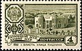 Elista's Pushkin Street on a 1961 stamp
 -
-
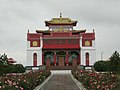
 The Golden Temple
 -
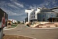 Elista's Chess City
 -
 Playing chess near the Seven Days Pagoda, Elista
.jpg)


See also
Notes
- ^ Most common pronunciation used after 1992 and in Kalmykia itself. The pronunciation Эли́ста [ɪˈlʲistə] was common during the Soviet era.
References
- ^ a b c d e f Appendix to Decree #137
- ^ a b Е. М. Поспелов. "Географические названия мира", Москва, 1998, стр. 480.
- ^ Federal State Statistics Service.
- ^ "26. Численность постоянного населения Российской Федерации по муниципальным образованиям на 1 января 2018 года". Federal State Statistics Service. Retrieved January 23, 2019.
- ^ a b c Law #308-IV-Z
- ^ "Об исчислении времени". Официальный интернет-портал правовой информации (in Russian). June 3, 2011. Retrieved January 19, 2019.
- ^ Почта России. Информационно-вычислительный центр ОАСУ РПО. (Russian Post). Поиск объектов почтовой связи (Postal Objects Search) (in Russian)
- ^ "Большой энциклопедический словарь", под ред. А. М. Прохорова. Москва и Санкт-Петербург, 1997, стр. 1402
- clear scriptis ᡄᠯᡄᠰᡉᡐᡉ or ᠡᠯᠡᠡᠰᠦᠲᠦ, Êlêsütü
- ^ Google Earth
- . Retrieved December 4, 2012.
- ^ a b "Elista Climate Normals 1961–1990". National Oceanic and Atmospheric Administration. Retrieved February 12, 2017.
- ^ "World Weather Information Service – Elista". United Nations. Retrieved December 31, 2010.
- ^ a b "Климатические таблицы. Данные для Элисты". Pogodaikclimat (in Russian). Weather and Climate. Retrieved July 30, 2023.
- ^ "Weather Statistics - Elista" (in Russian). Petrozavodsk State University. Retrieved December 4, 2012.
- ^ "World Meteorological Organization Climate Normals for 1991–2020". World Meteorological Organization. Retrieved August 2, 2023.
- Russian Federal State Statistics Service (May 21, 2004). Численность населения России, субъектов Российской Федерации в составе федеральных округов, районов, городских поселений, сельских населённых пунктов – районных центров и сельских населённых пунктов с населением 3 тысячи и более человек[Population of Russia, Its Federal Districts, Federal Subjects, Districts, Urban Localities, Rural Localities—Administrative Centers, and Rural Localities with Population of Over 3,000] (XLS). Всероссийская перепись населения 2002 года [All-Russia Population Census of 2002] (in Russian).
- ^ Всесоюзная перепись населения 1989 г. Численность наличного населения союзных и автономных республик, автономных областей и округов, краёв, областей, районов, городских поселений и сёл-райцентров [All Union Population Census of 1989: Present Population of Union and Autonomous Republics, Autonomous Oblasts and Okrugs, Krais, Oblasts, Districts, Urban Settlements, and Villages Serving as District Administrative Centers]. Всесоюзная перепись населения 1989 года [All-Union Population Census of 1989] (in Russian). Институт демографии Национального исследовательского университета: Высшая школа экономики [Institute of Demography at the National Research University: Higher School of Economics]. 1989 – via Demoscope Weekly.
- ^ "Таблица 1. Национальный состав населения". Retrieved March 26, 2023.
- ^ "Инвестиционный паспортгорода Элисты" (PDF). gorod-elista.ru (in Russian). Elista. 2015. p. 20. Retrieved November 11, 2020.
- ^ "Soviet Union Team Championship". Speedway History. Retrieved April 13, 2024.
- ^ "Soviet Union & Russian Team Championship". Speedway Fansite. Retrieved April 12, 2024.
Sources
- Justin Corfield, The History of Kalmykia: From Ancient Times to Kirsan Ilyumzhinov and Aleksey Orlov, 2015. ISBN 978-1-876586-29-4.
- Президент Республики Калмыкия. Приложение к Указу №137 от 25 июня 2002 г. «Реестр административно-территориальных единиц Республики Калмыкия», в ред. Указа №103 от 27 июня 2011 г «О внесении изменений в Реестр административно-территориальных единиц Республики Калмыкия, утверждённый Указом Президента Республики Калмыкия от 26 декабря 2001 г. №235 "Об утверждении реестра административно-территориальных единиц Республики Калмыкия"». (President of the Republic of Kalmykia. Appendix to Decree #137 of June 25, 2002 Registry of the Administrative-Territorial Units of the Republic of Kalmykia, as amended by the Decree #103 of June 27, 2011 On Amending the Registry of the Administrative-Territorial Units of the Republic of Kalmykia, Adopted by Decree #235 of the President of the Republic of Kalmykia of December 26, 2001 "On Adopting the Registry of the Administrative-Territorial Units of the Republic of Kalmykia". ).
- Народный Хурал (Парламент) Республики Калмыкия. Закон №308-IV-З от 23 ноября 2011 г. «О некоторых вопросах организации местного самоуправления в Республики Калмыкия», в ред. Закона №105-V-З от 6 марта 2015 г. «О внесении изменений в статью 13.1 Закона Республики Калмыкия "О некоторых вопросах организации местного самоуправления в Республики Калмыкия"». Вступил в силу по истечении 10 дней со дня официального опубликования. Опубликован: "Хальмг Унн", №214, 24 ноября 2011 г. (People's Khural (Parliament) of the Republic of Kalmykia. Law #308-IV-Z of November 23, 2011 On Various Issues of the Organization of the Local Self-Government in the Republic of Kalmykia, as amended by the Law #105-V-Z of March 6, 2015 On Amending Article 13.1 of the Law of the Republic of Kalmykia "On Various Issues of the Organization of the Local Self-Government in the Republic of Kalmykia". Effective as of after 10 days since the day of the official publication.).
External links
 Media related to Elista at Wikimedia Commons
- Official website of Elista (in Russian)
- Elista Business Directory (in Russian)
- Information about Elista Archived March 4, 2012, at the Wayback Machine (in Russian)
| Districts | |||
|---|---|---|---|
| Cities and towns | |||
| Administrative-territorial formation with special status | Chess City (Gorod Shakhmat) | ||