Elk City State Park
| Elk City State Park | |
|---|---|
 A trail bridge in Elk City State Park | |
| Location | Montgomery, Kansas, United States |
| Coordinates | 37°15′20″N 95°46′16″W / 37.25556°N 95.77111°W |
| Area | 857 acres (347 ha) |
| Elevation | 833 ft (254 m)[1] |
| Established | 1967 |
| Visitors | 282,360 (in 2022)[2] |
| Governing body | Kansas Department of Wildlife, Parks and Tourism |
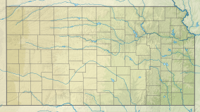
Elk City State Park is a state park in Montgomery County, Kansas, United States, located west of Independence.
The 857-acre (347 ha) park is adjacent to the 4,500-acre (1,800 ha)
.A nationally recognized trails system allows visitors to take in a variety of flora and fauna. The Green Thumb Nature Trail at the Timber Road campground is a one-mile loop with a panoramic vista of the lake. The nearby Table Mound Hiking Trail runs 2.75 miles (4.43 km) north along the east side of the lake to the scenic overlook at the dam. At the overlook is the 2/3-mile Post Oak Nature Trail. There is also a paved and handicapped accessible 3.3-mile (5.3 km) South Squaw Multipurpose trail. Running outside of the park is the Elk River Hiking Trail, a scenic 15-mile (24 km) route that begins at the west edge of the dam and ends near the U.S. Route 160 bridge on the Elk River.
See also
References
- ^ "Elk City State Park". Geographic Names Information System. United States Geological Survey. July 1, 1984. Retrieved November 28, 2012.
- ^ Self, Matthew (August 18, 2023). "Top 5 most popular Kansas state parks revealed". KSNT.
External links
- "Elk City State Park". Kansas Department of Wildlife, Parks and Tourism. Retrieved November 11, 2012.

