
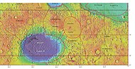
Elysium Planitia
MOLA topographical map of Elysium Planitia (spacecraft landing sites are annotated in Commons) | |
| Coordinates | 3°00′N 154°42′E / 3.0°N 154.7°E |
|---|---|

Elysium Planitia, located in the
The largest craters in Elysium Planitia are
A 2005 photo of a locale in Elysium Planitia at 5°N, 150°E by the Mars Express spacecraft shows what may be ash-covered water ice. The volume of ice is estimated to be 800 km (500 mi) by 900 km (560 mi) in size and 45 m (148 ft) deep, similar in size and depth to the North Sea.[6] The ice is thought to be the remains of water floods from the Cerberus Fossae fissures about 2 to 10 million years ago. The surface of the area is broken into 'plates' like broken ice floating on a lake (see below). Impact crater counts show that the plates are up to 1 million years older than the gap material, showing that the area solidified much too slowly for the material to be basaltic lava.[7]
Overview
-
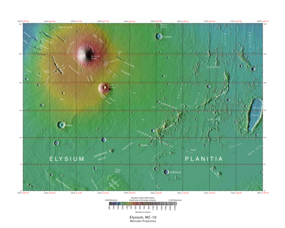 Elysium quadrangle MOLA map, with Elysium Planitia at bottom
 -
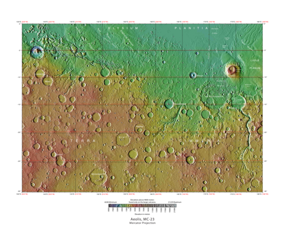 Aeolis quadrangle MOLA map, with Elysium Planitia at top


Exploration
NASA's InSight mission landed in Elysium Planitia on 26 November 2018.[8] It took off from Earth on 5 May 2018. The probe will study the internal structure of Mars and by so doing improve understanding of the planet's evolution. InSight Mars lander was able to take color pictures from the surface Elysium Planitia and sent them by radio signal back to Earth. During the descent sequence two additional items were jettisoned, the backshell with parachute, and heat shield, and they impacted in the vicinity of the lander.


In March 2017, scientists from the Jet Propulsion Laboratory announced that the landing site had been selected. It is located in western Elysium Planitia at 4°30′N 135°54′E / 4.5°N 135.9°E.[9] The landing site is about 600 km (370 mi) north from where the Curiosity rover is operating in Gale Crater.[10]


(13 December 2018)


(26 November 2018)
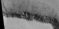
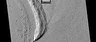
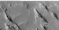
Fractured ground
-
 Wide view of fractured ground, as seen by HiRISE under HiWish program
 -
 Close view of fractured ground, as seen by HiRISE under HiWish program
 -
 Close view of fractured ground, as seen by HiRISE under HiWish program Box shows size of football field. The boulders are the size of houses.
 -
 Close, color view of fractured ground, as seen by HiRISE under HiWish program


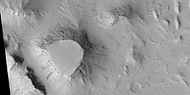
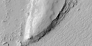
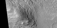
Mesas
-
 Wide view of layered buttes and small mesas, as seen by HiRISE under HiWish program. Somedark slope streaksare visible.
 -
 Layered mesa and mounds with dark slope streaks, as seen by HiRISE under HiWish program
 -
 Close view of layered small mesa with dark slope streak, as seen by HiRISE under HiWish program. Box shows the size of a football field.
 -
 Very close view of individual blocks breaking off layer in a butte, as seen by HiRISE under HiWish program Blocks have angular shapes. Box shows size of football field.


-
 Layered mesas, as seen by HiRISE under HiWish program
 -
 Layered mesas, as seen by HiRISE under HiWish program.Dark slope streaksare also visible.
 -
 Mesas, as seen by HiRISE under HiWish program. Top layer; the cap rock is breaking up into boulders.
 -
 Close view of cap rock breaking up into boulders, as seen by HiRISE under HiWish program


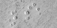
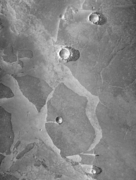
Cubes
-
 Cones, as seen by HiRISE under HiWish program. These cones probably formed when hot lava flowed over ice-rich ground.
 -
 Close view of cones, as seen by HiRISE under HiWish program. These cones probably formed when hot lava flowed over ice-rich ground.


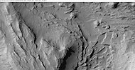
Gallery
-
 MOLA map showing boundaries of Elysium Planitia and other nearby regions
 -
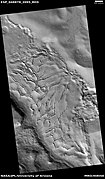
 Layers around streamlined knob, as seen byHiWishprogram
 -
 Layers in old crater rim, in Marte Vallis as seen by HiRISE under HiWish program
 -
 Close view of layers from previous image, as seen by HiRISE under HiWish program. Somedark slope streaksare visible.
 -
 Mounds with layers, as seen by HiRISE under HiWish program. Location is east of Gale Crater in the Aeolis quadrangle.
 -
 These icy plates moved to the left, and obstacles (crater rims) turned them into piles of pieces.


.png)
-
 Mound showing layers at the base, as seen by HiRISE under HiWish program. Location is east of Gale Crater in the Aeolis quadrangle.
 -
 Yardangs showing layers, as seen by HiRISE under HiWish program. Location is east of Gale Crater in the Aeolis quadrangle.
 -
 Mesas and eroded parts of mesas showing layers anddark slope streaks, as seen by HiRISE under HiWish program. Image is located in eastern Avernus Colles.
 -
 Wide view of layered terrain, as seen by HiRISE under HiWish program. Location is northeast of Gale Crater.
 -
 Close view of mound with layers, as seen by HiRISE under HiWish program. Note: this is an enlargement from the previous image.
 -
 Close view of mound with layers, as seen by HiRISE under HiWish program. Note: this is an enlargement from a previous image.


-
 Wide view of layered terrain, as seen by HiRISE under HiWish program. Note: parts of this image are enlarged in the next three images.
 -
 Close view of layers in a mound, from previous image, as seen by HiRISE under HiWish program
 -
 Close view of layers in a mound, from a previous image, as seen by HiRISE under HiWish program
 -
 Close view of layers in a mound, from a previous image, as seen by HiRISE under HiWish program
 -
 Lava field on Elysium Planitia resembling an elephant
 -
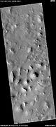
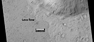 Lava flow anddark slope streaks, as seen by HiRISE under HiWish program


Interactive Mars map

See also
- Fossa (geology)
- Geography of Mars
- Geology of Mars
- List of plains on Mars
- List of quadrangles on Mars
References
- USGS Astrogeology Science Center. Retrieved 7 May 2018.
- S2CID 226299879
- ^ O'Callaghan, Jonathan (20 November 2020). "Signs of Recent Volcanic Eruption on Mars Hint at Habitats for Life - Not thought to be volcanically active, Mars may have experienced an eruption just 53,000 years ago". The New York Times. Retrieved 25 November 2020.
- S2CID 226299879.
- ^ Williams, Dave; Friedlander, Jay. "The Orcus Patera region on Mars". Mars - Mariner 4. NASA. Retrieved 20 December 2015.
- ^ Young, Kelly (25 February 2005). "'Pack ice' suggests frozen sea on Mars". New Scientist. Archived from the original on 9 February 2007. Retrieved 30 January 2007.
- S2CID 4373323.)
{{cite journal}}: CS1 maint: numeric names: authors list (link - ^ "Landing Status | Landing – NASA's InSight Mars Lander". NASA's InSight Mars Lander.
- Bibcode:2017LPI....48.1515G. LPI Contribution No. 1964, id.1515.
- ^ "InSight's Landing Site: Elysium Planitia". NASA. 25 January 2018. Archived from the original on 2 January 2019. Retrieved 1 February 2018.
External links
- Google Mars – zoomable map centered on Elysium Planitia, with three main volcanoes of Elysium visible
- Google Mars – Cerebrus Fossae fissures