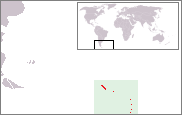
Falkland Islands Dependencies
Falkland Islands Dependencies | |||||||||||||
|---|---|---|---|---|---|---|---|---|---|---|---|---|---|
| 1843–1982 Argentine Occupation: 1982 1982–1985 | |||||||||||||
| Motto: "Desire the right" | |||||||||||||
| Anthem: "God Save the King/Queen" | |||||||||||||
 | |||||||||||||
 | |||||||||||||
| Status | Overseas Territory | ||||||||||||
| Capital | Stanley | ||||||||||||
| Common languages | English | ||||||||||||
| Government | Crown colony | ||||||||||||
| Monarch | |||||||||||||
• 1843–1901 | Victoria (first) | ||||||||||||
• 1952–1985 | Elizabeth II (last) | ||||||||||||
Sir Rex Hunt (last) | |||||||||||||
| Legislature | Legislative Council | ||||||||||||
| History | |||||||||||||
• Established | 1843 | ||||||||||||
| 2 April 1982 | |||||||||||||
| 14 June 1982 | |||||||||||||
• Dissolution | 1985 | ||||||||||||
| Currency | Falkland Islands pound | ||||||||||||
| |||||||||||||
The Falkland Islands Dependencies was the constitutional arrangement from 1843 until 1985 for administering the various British territories in
.The territories
The following are the British territories that made up the Falkland Island Dependencies in the period between 1917 and 1962.
- South Georgia
- South Sandwich Islands
- South Orkney Islands
- South Shetland Islands
- Graham Land
- Antarctic Peninsula
In 1962 the British Antarctic Territory was formed following the Antarctic Treaty System affecting claims south of 60°S latitude, and left only South Georgia and the South Sandwich Islands as Falkland Islands Dependencies between 1962 and 1985.
History
The arrangements were first enacted by the British Letters patent of 1843, and subsequently revised in 1876, 1892, 1908, 1917 and 1962. For reasons of practical convenience the Dependencies were governed by Britain through the Falkland Islands Government. However, they constituted a distinct entity that was not part of the Falkland Islands in political or financial respects.[1]
The territorial extent of the Dependencies varied as particular territories were claimed, annexed, and commercially exploited over an extensive period of time starting with
The territories constituting the Falkland Islands Dependencies in 1908 were listed by the Letters Patent as "the groups of islands known as South Georgia, the South Orkneys, the South Shetlands, and the Sandwich Islands, and the territory known as Graham's Land, situated in the South Atlantic Ocean to the south of the 50th parallel of south latitude, and lying between the 20th and the 80th degrees of west longitude". In 1917, the Letters Patent were modified, applying the "sector principle" used in the Arctic; the new scope of the Dependencies was extended to comprise "all islands and territories whatsoever between the 20th degree of west longitude and the 50th degree of west longitude which are situated south of the 50th parallel of south latitude; and all islands and territories whatsoever between the 50th degree of west longitude and the 80th degree of west longitude which are situated south of the 58th parallel of south latitude", thus reaching the South Pole.[4][1][5]
With the accession of the United Kingdom to the
The new international legal regime introduced in the
Argentine occupation
In November 1976, Argentine armed forces landed and occupied the uninhabited islands of Southern Thule, a collection of the three southernmost islands in the South Sandwich Islands.[7] On 19 March 1982 a group of civilian scrap metal workers from Argentina arrived at Leith Harbour, South Georgia, on board the transport ship ARA Bahía Buen Suceso and raised the Argentine flag. The scrap workers had been infiltrated by Argentine marines posing as civilian scientists.[8][9] Following the Argentine invasion of the Falkland Islands, starting the Falklands War, Argentine naval forces seized control of the east coast of South Georgia after overpowering a small group of Royal Marines at Grytviken on 3 April 1982.
On 22 April 1982, the British task force arrived in Falklands waters and three days later British troops recaptured South Georgia.
Dissolution
In 1985 the Dependencies became the distinct
See also
- History of South Georgia and the South Sandwich Islands
- Sovereignty of South Georgia and the South Sandwich Islands
- History of the Falkland Islands
- British Antarctic Territory
- Special member state territories and their relations with the EU
References
- ^ ISBN 0-521-25274-1
- ^ Odd Gunnar Skagestad. Norsk Polar Politikk: Hovedtrekk og Utvikslingslinier, 1905–1974. Oslo: Dreyers Forlag, 1975
- ^ Thorleif Tobias Thorleifsson. Bi-polar international diplomacy: The Sverdrup Islands question, 1902–1930. Master of Arts Thesis, Simon Fraser University, 2006. Archived 4 March 2009 at the Wayback Machine
- ^ National Interests and Claims in the Antarctic Archived 11 December 2017 at the Wayback Machine, p. 19, Robert E. Wilson
- ^ "The Ross Dependency", The Geographical Journal, Vol. 62, No. 5 (Nov. 1923), pp. 362–365.
- ^ European Commission: Information on the Overseas countries and territories Archived 4 March 2007 at the Wayback Machine
- ^ "Dispute over Argentinian Scientific Base on Southern Thule Island – Further Negotiations over Falkland Islands". Keesing's Record of World Events. July 1978. Retrieved 1 March 2010.
- ^ "infiltrated on board, pretending to be scientists, were members of an Argentine naval special forces unit" Nick van der Bijl, Nine Battles to Stanley, London, Leo Cooper p. 8 as reported in Lawrence Freedman, The Official History of the Falklands Campaign: Vol I The Origins of the Falklands War
- ^ "Bahia Buen Suceso set sail for South Georgia on 11 March carrying Argentine Marines" Rowland White, Vulcan 607, London, Bantam Press, p30.
- ^ "Marines land in South Georgia". BBC News. 25 April 1982. Retrieved 1 March 2010.
- ^ The British Antarctic Territory Order in Council, 1962. Her Majesty's Stationery Office: Statutory Instrument 1962 No. 400.
- ^ "South Georgia and the South Sandwich Islands". CIA World Factbook. 1996. Archived from the original on 22 January 2016. Retrieved 28 October 2007.


