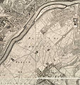
File:1730-1739 Roussel - Paris ses fauxbourgs et ses environs - détail Grenelle.jpg

Page contents not supported in other languages.
This is a file from the Wikimedia Commons
Source: Wikipedia, the free encyclopedia.

Original file(5,416 × 5,744 pixels, file size: 8.58 MB, MIME type: image/jpeg)

Summary

Paris, ses fauxbourgs et ses environs où se trouve le détail des villages, châteaux, grands chemins pavez et autres, des hauteurs, bois, vignes, terres et prez, levez géométriquement, par le Sieur Roussel.   (Wikidata search (Cirrus search) Wikidata query (SPARQL)  Create new Wikidata item based on this file)
Author
Roussel
Title
Paris, ses fauxbourgs et ses environs où se trouve le détail des villages, châteaux, grands chemins pavez et autres, des hauteurs, bois, vignes, terres et prez, levez géométriquement, par le Sieur Roussel.
Description
English: Detail, centered on the plain of Grenelle, from the map of Paris in 1730-1739 by Roussel. Scale approximately 1:9,800.
Français : Détail, centré sur la plaine de Grenelle, du plan de Paris en 1730-1739 par Roussel. Échelle approximative 1:9800.
Date between 1730 and 1739
date QS:P571,+1730-00-00T00:00:00Z/8,P1319,+1730-00-00T00:00:00Z/9,P1326,+1739-00-00T00:00:00Z/9
Dimensions For the whole map of which this file is an extract : 1 map on nine sheets ; 111 x 167 cm, sheets 71 x 48 cm.
institution QS:P195,Q131454
Inscriptions Paris, ses fauxbourgs et ses environs
où se trouve le détail des villages, châteaux, gands chemins pavez, et autres, des hauteurs, bois, vignes, terres, et prez, levez géometriquement. par le Sr. Roussel, Capne. Ingenieur ordre. du Roy, Cher. de St. Louis. ; gravé par les Sieurs Coquart, Delahaye, Cordier Gendre de l'Auteur, Villaret et de Poilly.
References Voir aussi la version sur Gallica. Voir aussi la description de ce plan dans l'article Paris en cartes sur le site de la Mairie de Paris.
Source/Photographer
This map is available from the United States Library of Congress's Geography & Map Division
under the digital ID g5834p.ct003822.
This tag does not indicate the copyright status of the attached work. A normal copyright tag is still required. See Commons:Licensing.

العربية  беларуская (тарашкевіца)  বাংলা  čeština  Deutsch  English  español  فارسی  suomi  français  galego  עברית  magyar  Bahasa Indonesia  italiano  日本語  lietuvių  македонски  മലയാളം  Nederlands  polski  português  português do Brasil  română  русский  sicilianu  slovenčina  slovenščina  Türkçe  українська  中文  中文(简体)  中文(繁體)  +/−

Other versions
English: This file is an extract from:
Français : Ce fichier est extrait de :
 Roussel, Paris, ses fauxbourgs et ses environs, 1731.jpg

Licensing

Public domain

This work is in the public domain in its country of origin and other countries and areas where the copyright term is the author's life plus 100 years or fewer.


You must also include a United States public domain tag to indicate why this work is in the public domain in the United States.

Captions

Add a one-line explanation of what this file represents

Items portrayed in this file

depicts

image/jpeg

cd1855d18f0dde3361e0f09db20a98b023675b7f

8,999,439 byte

5,744 pixel

5,416 pixel

File history

Click on a date/time to view the file as it appeared at that time.

Date/TimeThumbnailDimensionsUserComment
current23:32, 18 August 2014Thumbnail for version as of 23:32, 18 August 20145,416 × 5,744 (8.58 MB)Carfois{{Information |Description ={{en|1=sera rempli après import}} {{fr|1=sera rempli après import}} |Source =sera rempli après import |Author =sera rempli après import |Date =1730-1739 |Permission = |other_versions =Fil...
No pages on the English Wikipedia use this file (pages on other projects are not listed).

Global file usage

The following other wikis use this file:

Metadata