
File:1780 Raynal and Bonne Map of Southeast Asia and the Philippines - Geographicus - Philippines-bonne-1780.jpg
Size of this preview: 800 × 554 pixels. Other resolutions: 320 × 222 pixels | 640 × 443 pixels | 1,024 × 709 pixels | 1,280 × 886 pixels | 2,500 × 1,731 pixels.
Original file (2,500 × 1,731 pixels, file size: 1.35 MB, MIME type: image/jpeg)
| This is a file from the Wikimedia Commons. Information from its description page there is shown below. Commons is a freely licensed media file repository. You can help. |
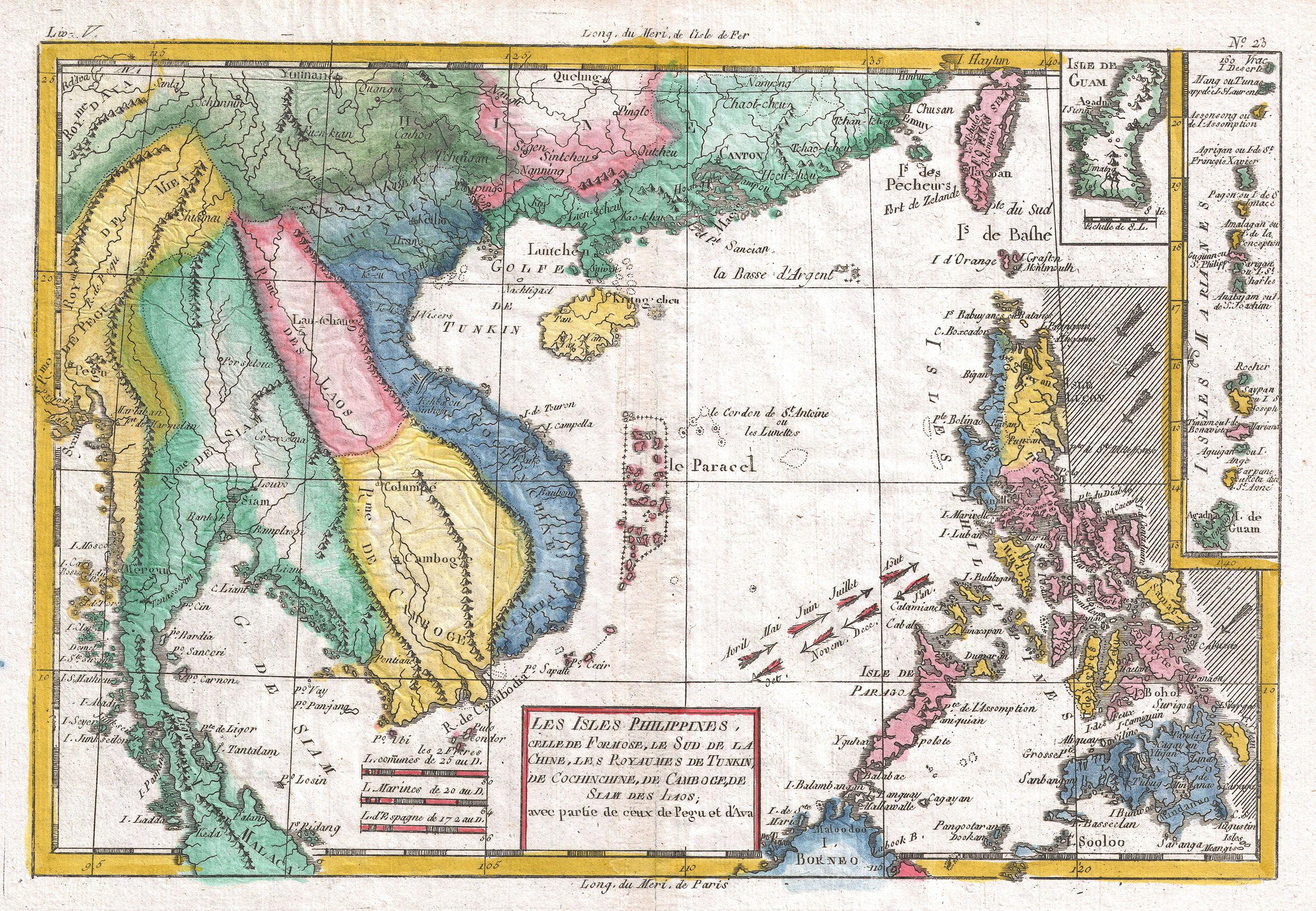
| Rigobert Bonne: Les Isles Philippines
( |
|||||||||||||||||||||||
|---|---|---|---|---|---|---|---|---|---|---|---|---|---|---|---|---|---|---|---|---|---|---|---|
| Artist |
|
||||||||||||||||||||||
| Title |
Les Isles Philippines |
||||||||||||||||||||||
| Description |
English: A fine example of Rigobert Bonne and G. Raynal’s 1780 map of the Southeast Asia and the Philippines. Map corresponds to modern day countries of the Philippines, Vietnam (Tonquin and Chochin), Cambodia (Camboge), Thailand (Siam), Malaysia (Malaca), Taiwan (Formosa) and Laos. Identifies the cities of Tayoun (Taiwan), Manila, Macao, Siam and Bangkok. Furthermore, the Trịnh lords, Nguyễn lords, the Principality of Hà Tiên, Burma, Guam, Northern Mariana Islands, Hainan, Myanmar, Paracel Islands, Yunnan, Guangxi, Guangdong, North Borneo, Yunnan in Qing dynasty, Tonkin and Cochinchina might be identified via the map.
Wind currents and some undersea dangers in the South China Sea. Drawn by R. Bonne for G. Raynal’s Atlas de Toutes les Parties Connues du Globe Terrestre, Dressé pour l'Histoire Philosophique et Politique des Établissemens et du Commerce des Européens dans les Deux Indes . |
||||||||||||||||||||||
| Date | 1780 (undated) | ||||||||||||||||||||||
| Dimensions | height: 9 in (22.8 cm); width: 13 in (33 cm) | ||||||||||||||||||||||
| Accession number |
Geographicus link: Philippines-bonne-1780 |
||||||||||||||||||||||
| Source/Photographer |
Raynal, G., Atlas de Toutes les Parties Connues du Globe Terrestre, Dressé pour l'Histoire Philosophique et Politique des Établissemens et du Commerce des Européens dans les Deux Indes, 1780.
|
||||||||||||||||||||||
| Permission (Reusing this file) |
|
||||||||||||||||||||||
File history
Click on a date/time to view the file as it appeared at that time.
| Date/Time | Thumbnail | Dimensions | User | Comment | |
|---|---|---|---|---|---|
| current | 09:06, 24 March 2011 | | 2,500 × 1,731 (1.35 MB) | BotMultichillT | {{subst:User:Multichill/Geographicus |link=http://www.geographicus.com/P/AntiqueMap/Philippines-bonne-1780 |product_name=1780 Raynal and Bonne Map of Southeast Asia and the Philippines |map_title=Les Isles Philippines |description=A fine example of Rigobe |
File usage
The following pages on the English Wikipedia use this file (pages on other projects are not listed):
Global file usage
The following other wikis use this file:
- Usage on fr.wikipedia.org
- Usage on vi.wikipedia.org
- Usage on zh.wikipedia.org