
File:1850 Mitchell Map of Persia, Arabia and Afghanistan - Geographicus - Arabia-m-50.jpg
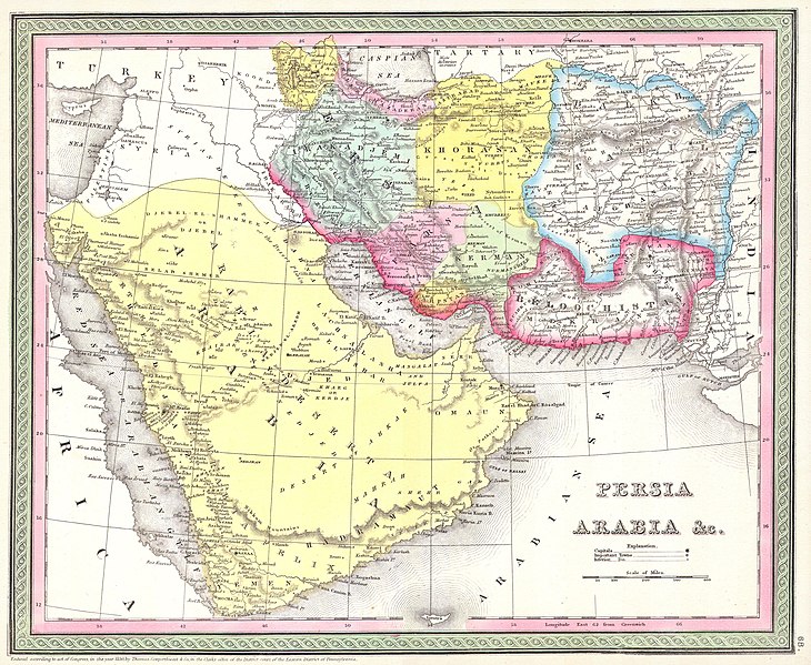
Size of this preview: 730 × 599 pixels. Other resolutions: 292 × 240 pixels | 585 × 480 pixels | 936 × 768 pixels | 1,247 × 1,024 pixels | 2,495 × 2,048 pixels | 4,000 × 3,284 pixels.
Original file (4,000 × 3,284 pixels, file size: 3.01 MB, MIME type: image/jpeg)
| This is a file from the Wikimedia Commons. Information from its description page there is shown below. Commons is a freely licensed media file repository. You can help. |
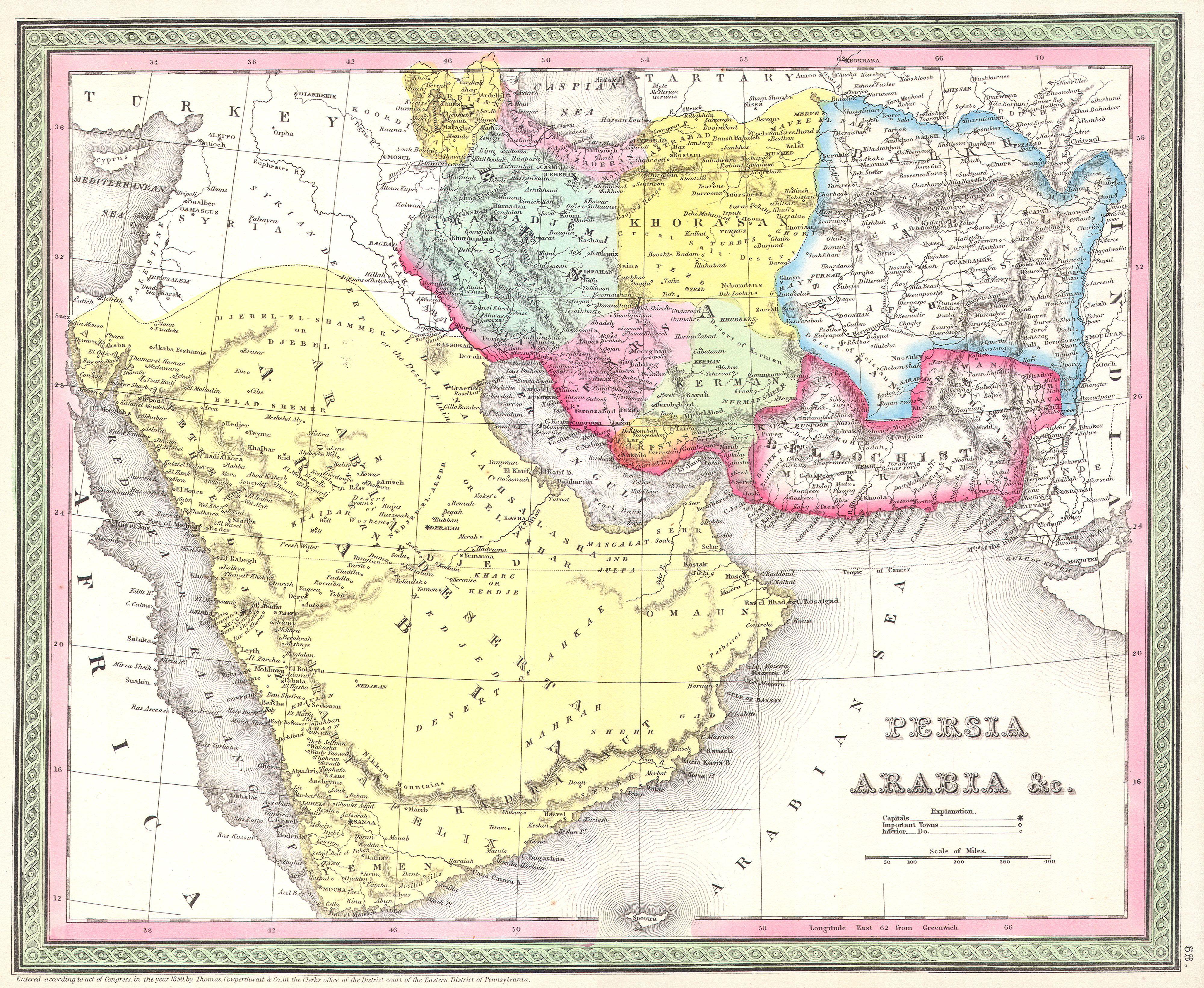
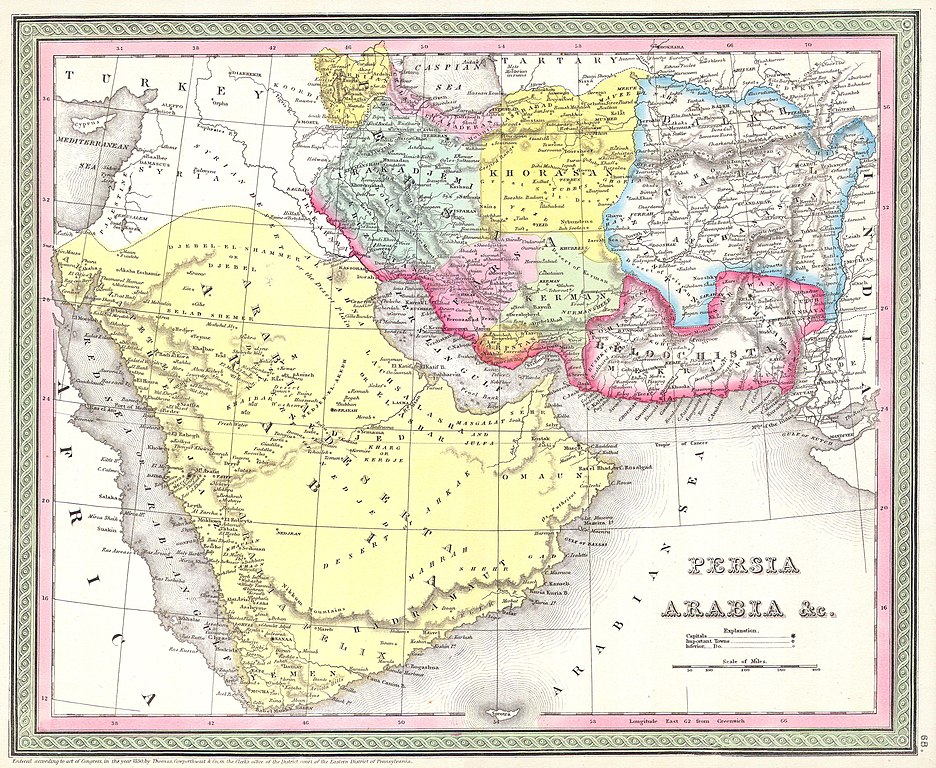
| Samuel Augustus Mitchell: Persia, Arabia, and Afghanistan.
( |
||||||||||||||||||||
|---|---|---|---|---|---|---|---|---|---|---|---|---|---|---|---|---|---|---|---|---|
| Artist |
|
|||||||||||||||||||
| Title |
Persia, Arabia, and Afghanistan. |
|||||||||||||||||||
| Description |
English: This beautiful hand colored map is a lithographic engraving of Persian and Arabia, dating to 1850, by the legendary American map publisher S.A. Mitchell, the elder. Includes what is today Saudi Arabia, Israel, Syria, Jordan, Iran, Iraq and Afghanistan. Many fascinating features including desert oases, caravan routes, and camps, as well as both political and geographical information. Dated and copyrighted: “1850 by Thomas Cowperthwait & co. in the Clerk’s office of the District Court of the Eastern District of Pennsylvania.”. |
|||||||||||||||||||
| Date | 1850 | |||||||||||||||||||
| Dimensions | height: 12.5 in (31.7 cm); width: 15.5 in (39.3 cm) | |||||||||||||||||||
| Accession number |
Geographicus link: Arabia-m-50 |
|||||||||||||||||||
| Source/Photographer |
|
|||||||||||||||||||
| Permission (Reusing this file) |
|
|||||||||||||||||||
File history
Click on a date/time to view the file as it appeared at that time.
| Date/Time | Thumbnail | Dimensions | User | Comment | |
|---|---|---|---|---|---|
| current | 21:22, 15 March 2011 | | 4,000 × 3,284 (3.01 MB) | BotMultichill | {{subst:User:Multichill/Geographicus |link=http://www.geographicus.com/P/AntiqueMap/Arabia-m-50 |product_name=1850 Mitchell Map of Persia, Arabia and Afghanistan |map_title=Persia, Arabia, and Afghanistan. |description=This beautiful hand colored map is a |
File usage
No pages on the English Wikipedia use this file (pages on other projects are not listed).