
File:Abemama Map.jpg

Original file (5,310 × 5,667 pixels, file size: 1.32 MB, MIME type: image/jpeg)
| This is a file from the Wikimedia Commons. Information from its description page there is shown below. Commons is a freely licensed media file repository. You can help. |
Summary
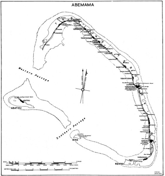
Government map (some maps in the series include the following: "Compiled by Lands and Surveys, Betio, Tarawa") with inscription "H Green 20/4/1970". Original obtained either directly from GEIDA of from a U.S. Government source (USACOE) as a blueline printing sometime in the 1970s. I believe these maps were produced for government use by the Gilbert Islands Colony. I have scanned and slightly altered the original (1/50,000 scale). Maps such as this one showing village locations on Pacific islands are difficult to come by. - Marshman 18:16, 28 November 2005 (UTC)
Licensing
This work is in the public domain in the United States because it is a work prepared by an officer or employee of the United States Government as part of that person’s official duties under the terms of Title 17, Chapter 1, Section 105 of the US Code.
Note: This only applies to original works of the Federal Government and not to the work of any individual U.S. state, territory, commonwealth, county, municipality, or any other subdivision. This template also does not apply to postage stamp designs published by the United States Postal Service since 1978. (See § 313.6(C)(1) of Compendium of U.S. Copyright Office Practices). It also does not apply to certain US coins; see The US Mint Terms of Use.
|
 | |
| This file has been identified as being free of known restrictions under copyright law, including all related and neighboring rights. | ||
File history
Click on a date/time to view the file as it appeared at that time.
| Date/Time | Thumbnail | Dimensions | User | Comment | |
|---|---|---|---|---|---|
| current | 20:07, 28 November 2005 | | 5,310 × 5,667 (1.32 MB) | Marshman~commonswiki | Slightly larger version of same |
| 18:13, 28 November 2005 |  | 3,540 × 3,778 (708 KB) | Marshman~commonswiki | Government map with inscription "H Green 20/4/1970" I obtained the "original" as a blueline printing in the 1970s. I believe these maps were produced for government use by the Gilbert Islands Colony. I have scanned and slightly altered the original (1/50 |
File usage
The following 4 pages use this file:
Global file usage
The following other wikis use this file:
- Usage on ce.wikipedia.org
- Usage on de.wikipedia.org
- Usage on el.wikipedia.org
- Usage on es.wikipedia.org
- Usage on fi.wikipedia.org
- Usage on gl.wikipedia.org
- Usage on he.wikipedia.org
- Usage on hu.wikipedia.org
- Usage on ka.wikipedia.org
- Usage on mk.wikipedia.org
- Usage on pt.wikipedia.org
- Usage on ru.wikipedia.org