
File:AncientEgyptJamesRennell01.jpg

Size of this preview: 541 × 599 pixels. Other resolutions: 217 × 240 pixels | 433 × 480 pixels | 693 × 768 pixels | 924 × 1,024 pixels | 1,548 × 1,715 pixels.
Original file (1,548 × 1,715 pixels, file size: 384 KB, MIME type: image/jpeg)
| This is a file from the Wikimedia Commons. Information from its description page there is shown below. Commons is a freely licensed media file repository. You can help. |
Summary
| Description |
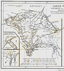
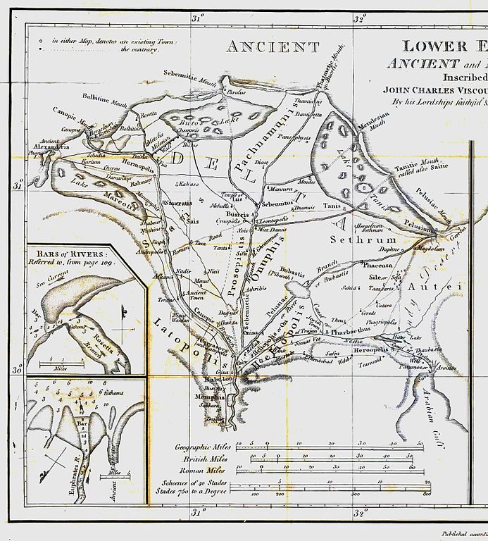
English: Map of ancient Egypt created by James Rennell as an insert for his book "The geographical system of Herodotus examined and explained" (published 1800 and 1830). This map shows Rennell's understanding of the geography of Egypt's Nile delta during the Greek Classical period (510 BC - 323 BC) based on the writings of Herodotus (484 BC - 425 BC). |
| Date | |
| Source | Book "The geographical system of Herodotus examined and explained", by James Rennell (published 1800 and 1830). |
| Author | Carl Drews scanned the map and enhanced the color contrast. |
Licensing
|
This work is in the public domain in its country of origin and other countries and areas where the copyright term is the author's life plus 100 years or fewer. | |
| This file has been identified as being free of known restrictions under copyright law, including all related and neighboring rights. | |
File history
Click on a date/time to view the file as it appeared at that time.
| Date/Time | Thumbnail | Dimensions | User | Comment | |
|---|---|---|---|---|---|
| current | 19:23, 12 August 2010 | | 1,548 × 1,715 (384 KB) | CarlDrews~commonswiki | {{Information |Description={{en|1=Map of ancient Egypt created by James Rennell as an insert for his book "The geographical system of Herodotus examined and explained" (published 1800 and 1830). This map shows Rennell's understanding of the geography of E |
File usage
The following pages on the English Wikipedia use this file (pages on other projects are not listed):
Global file usage
The following other wikis use this file:
- Usage on ar.wikipedia.org
- Usage on bg.wikipedia.org
- Usage on de.wikipedia.org
- Usage on el.wikipedia.org
- Usage on es.wikipedia.org
- Usage on fr.wikipedia.org
- Usage on he.wikipedia.org
- Usage on ja.wikipedia.org
- Usage on ja.wikibooks.org
- Usage on nl.wikipedia.org
- Usage on sl.wikipedia.org
- Usage on uk.wikipedia.org
- Usage on zh.wikipedia.org