
File:Antikes Alexandria Karte.JPG
Size of this preview: 773 × 600 pixels. Other resolutions: 310 × 240 pixels | 619 × 480 pixels | 990 × 768 pixels | 1,280 × 993 pixels | 1,694 × 1,314 pixels.
Original file (1,694 × 1,314 pixels, file size: 611 KB, MIME type: image/jpeg)
| This is a file from the Wikimedia Commons. Information from its description page there is shown below. Commons is a freely licensed media file repository. You can help. |
| Description |
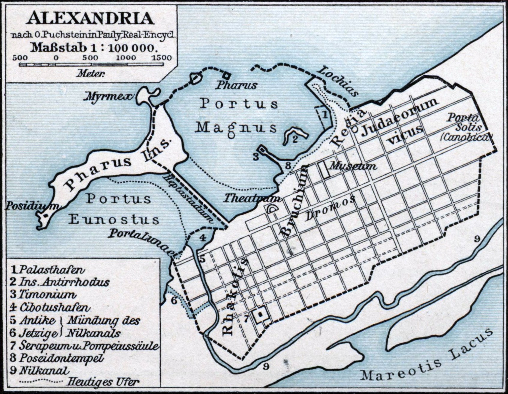
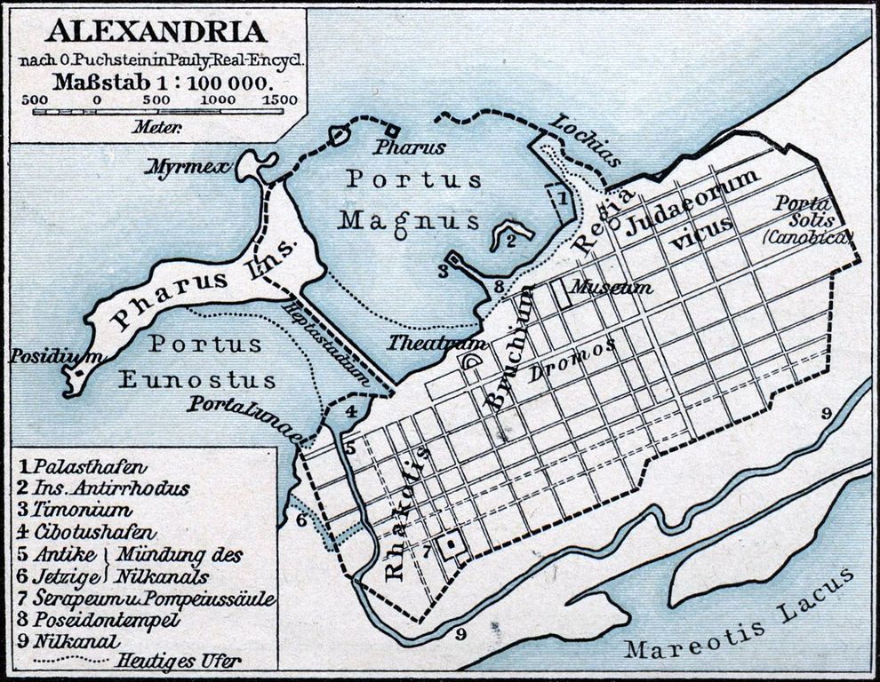
Deutsch: Karte der antiken ägyptischen Stadt Alexandria. |
||||
| Date | |||||
| Source | F. W. Putzgers Historischer Schul-Atlas | ||||
| Author | Friedrich Wilhelm Putzger (1849-1913), nach O. Puchstein in Pauly, Real-Encycl. | ||||
| Permission (Reusing this file) |
|
||||
File history
Click on a date/time to view the file as it appeared at that time.
| Date/Time | Thumbnail | Dimensions | User | Comment | |
|---|---|---|---|---|---|
| current | 00:23, 24 January 2011 | | 1,694 × 1,314 (611 KB) | Oltau | Farbkorrektur |
| 00:21, 24 January 2011 |  | 1,694 × 1,314 (610 KB) | Oltau | {{Information |Description={{de|1=Karte der antiken ägyptischen Stadt Alexandria.}} |Source=F. W. Putzgers Historischer Schul-Atlas |Author=Friedrich Wilhelm Putzger |Date=1901 |Permission={{PD-old}} |other_versions= }} Category:Maps of Alexandria |
File usage
The following pages on the English Wikipedia use this file (pages on other projects are not listed):
Global file usage
The following other wikis use this file:
- Usage on ar.wikipedia.org
- Usage on arz.wikipedia.org
- Usage on ast.wikipedia.org
- Usage on bg.wikipedia.org
- Usage on bs.wikipedia.org
- Usage on ca.wikipedia.org
- Usage on de.wikipedia.org
- Usage on en.wikibooks.org
- Usage on es.wikipedia.org
- Usage on fa.wikipedia.org
- Usage on fr.wikipedia.org
- Usage on fr.wiktionary.org
- Usage on hr.wikipedia.org
- Usage on id.wikipedia.org
- Usage on it.wikipedia.org
- Usage on ja.wikipedia.org
- Usage on ja.wikibooks.org
- Usage on la.wikipedia.org
View more global usage of this file.