
File:Austria relief location map.jpg

Size of this preview: 800 × 446 pixels. Other resolutions: 320 × 178 pixels | 640 × 357 pixels | 1,256 × 700 pixels.
Original file (1,256 × 700 pixels, file size: 677 KB, MIME type: image/jpeg)
| This is a file from the Wikimedia Commons. Information from its description page there is shown below. Commons is a freely licensed media file repository. You can help. |
Summary
| Description |
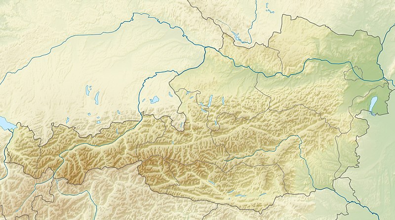
English: Location map of Austria
Equirectangular projection, N/S stretching 150 %. Geographic limits of the map:
|
| Date | |
| Source | Own work |
| Author | Uwe Dedering |
| Other versions |
Derivative works of this file: ÖRF 2011.png
|

Licensing
I, the copyright holder of this work, hereby publish it under the following licenses:
This file is licensed under the Creative Commons Attribution-Share Alike 3.0 Unported license.
- You are free:
- to share – to copy, distribute and transmit the work
- to remix – to adapt the work
- Under the following conditions:
- attribution – You must give appropriate credit, provide a link to the license, and indicate if changes were made. You may do so in any reasonable manner, but not in any way that suggests the licensor endorses you or your use.
- share alike – If you remix, transform, or build upon the material, you must distribute your contributions under the same or compatible license as the original.

|
Permission is granted to copy, distribute and/or modify this document under the terms of the GNU Free Documentation License, Version 1.2 or any later version published by the Free Software Foundation; with no Invariant Sections, no Front-Cover Texts, and no Back-Cover Texts. A copy of the license is included in the section entitled GNU Free Documentation License. |
You may select the license of your choice.

|
This map image could be re-created using vector graphics as an SVG file. This has several advantages; see Commons:Media for cleanup for more information. If an SVG form of this image is available, please upload it and afterwards replace this template with
{{vector version available|new image name}}.
It is recommended to name the SVG file “Austria relief location map.svg”—then the template Vva ) does not need the new image name parameter. |


File history
Click on a date/time to view the file as it appeared at that time.
| Date/Time | Thumbnail | Dimensions | User | Comment | |
|---|---|---|---|---|---|
| current | 09:14, 28 June 2010 | | 1,256 × 700 (677 KB) | Uwe Dedering | very little border change |
| 12:24, 26 April 2010 |  | 1,256 × 700 (677 KB) | Uwe Dedering | rhine | |
| 12:54, 24 April 2010 |  | 1,256 × 700 (676 KB) | Uwe Dedering | {{Information |Description={{en|1=Location map of Austria}} Equirectangular projection, N/S stretching 150 %. Geographic limits of the map: * N: 49.2° N * S: 46.3° N * W: 9.4° E * E: 17.2° E Made with Natural Earth. Free |
File usage
More than 100 pages use this file. The following list shows the first 100 pages that use this file only. A full list is available.
- Achen Lake
- Almsee
- Alpine skiing at the 1976 Winter Olympics
- Ammer Saddle
- Antiesen
- Archbach
- Attersee (lake)
- Austrian Armed Forces
- Austrian Open (golf)
- Baggersee Innsbruck
- Bielerhöhe Pass
- Bregenz
- Dachstein glacier
- Dawinkopf
- Dornbirn
- Drachenhöhle
- Dremelspitze
- Dristner
- FIS Alpine World Ski Championships 1958
- FIS Alpine World Ski Championships 1982
- FIS Alpine World Ski Championships 1991
- FIS Alpine World Ski Championships 2013
- Feldkirch, Vorarlberg
- Feuerspitze
- Fineilspitze
- Four Hills Tournament
- Gaisberg
- Galzig
- Gerlos Pass
- Geschriebenstein
- Gesäuse National Park
- Glockturm
- Golica
- Gosau Group
- Grossglockner
- Großharras
- Gößnitzkopf
- Hahnenkamm, Kitzbühel
- Hallstätter See
- Heiterwanger See
- Hermannskogel
- Hochfeiler
- Hochkar
- Hochkönig
- Hoher Dachstein
- Im Hinteren Eis
- Irrsee
- Kanzelhoehe Solar Observatory
- Karlesspitze
- Kitzsteinhorn
- Kleinzell
- Krems an der Donau
- Kreuzeck group
- Lake Constance
- Lake Faak
- Lake Fuschl
- Lake Klopein
- Lake Neusiedl
- Lake Obernberg
- Lake Ossiach
- Lake Toplitz
- Lake Wolfgang
- Lake Zell
- Langtauferer Spitze
- List of cities and towns in Austria
- Mariapfarr
- Millstätter See
- Mittelberg
- Mondsee (lake)
- NATO Integrated Air Defense System
- NÖ Open (golf)
- Petzen
- Piz Buin
- Plansee
- Pyramidenkogel
- Radstadt Tauern
- Rettenbach glacier
- Riezlern
- Salzkammergut
- Salzofen cave
- Schneeberg (Alps)
- Serles
- Silvrettahorn
- Similaun
- St Anton am Arlberg
- Thurn Pass
- Traunsee
- Urania, Vienna
- Vienna
- Vienna Observatory
- Vienna Woods
- Wechsel Pass
- Weissensee (Carinthia)
- Weißkugel
- Wildspitze
- Windische Höhe Pass
- Wörthersee
- Zellerrain Pass
- Ziller
- Zimba (mountain)
View more links to this file.
Global file usage
The following other wikis use this file:
- Usage on ab.wikipedia.org
- Usage on als.wikipedia.org
- Usage on am.wikipedia.org
- Usage on an.wikipedia.org
- Usage on ar.wikipedia.org
- Usage on arz.wikipedia.org
- Usage on ast.wikipedia.org
- Usage on as.wikipedia.org
- Usage on azb.wikipedia.org
- Usage on az.wikipedia.org
- Usage on ban.wikipedia.org
- Usage on ba.wikipedia.org
- Usage on be-tarask.wikipedia.org
- Usage on be.wikipedia.org
- Usage on bh.wikipedia.org
- Usage on bn.wikipedia.org
View more global usage of this file.