
File:Baltic-Volga-Black-Caspian.png
No higher resolution available.
Baltic-Volga-Black-Caspian.png (340 × 458 pixels, file size: 210 KB, MIME type: image/png)
| This is a file from the Wikimedia Commons. Information from its description page there is shown below. Commons is a freely licensed media file repository. You can help. |
Summary
| Description |
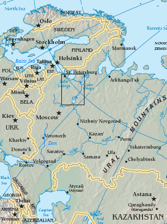
English: Map of the Volga–Baltic Waterway (boxed area).
source map modified with additional labels, box source map modified with additional labels, line drawing, box Original map cropped from https://www.cia.gov/cia/publications/factbook/reference_maps/asia.html |
| Date | 29 August 2006 (original upload date) |
| Source | Transferred from en.wikipedia to Commons. |
| Author | The original uploader was Jauntymcd at English Wikipedia. |
Licensing
This image is in the public domain because it contains materials that originally came from the United States Central Intelligence Agency's World Factbook.
|
 |
This work is based on a work in the public domain. It has been digitally enhanced and/or modified. This derivative work has been (or is hereby) released into the public domain by its author, jauntymcd. This applies worldwide.
In some countries this may not be legally possible; if so: |
Original upload log
The original description page was here. All following user names refer to en.wikipedia.
- 2006-08-29 23:28 Jauntymcd 340×458×8 (214664 bytes) source map modified with additional labels, box source map modified with additional labels, line drawing, box {{PD-retouched-user|jauntymcd}} Original map cropped from https://www.cia.gov/cia/publications/factbook/reference_maps/asia.html {{PD-USGov-CIA-
File history
Click on a date/time to view the file as it appeared at that time.
| Date/Time | Thumbnail | Dimensions | User | Comment | |
|---|---|---|---|---|---|
| current | 01:32, 19 December 2007 | | 340 × 458 (210 KB) | Geanixx | {{Information |Description={{en|source map modified with additional labels, box source map modified with additional labels, line drawing, box Original map cropped from https://www.cia.gov/cia/publications/factbook/reference_maps/asia.html}} |Source=Tran |
File usage
The following pages on the English Wikipedia use this file (pages on other projects are not listed):
Global file usage
The following other wikis use this file:
- Usage on da.wikipedia.org
- Usage on eo.wikipedia.org
- Usage on es.wikipedia.org
- Usage on eu.wikipedia.org
- Usage on fa.wikipedia.org
- Usage on he.wikipedia.org
- Usage on it.wikipedia.org
- Usage on ja.wikipedia.org
- Usage on nn.wikipedia.org
- Usage on no.wikipedia.org
- Usage on pl.wikipedia.org
- Usage on sl.wikipedia.org
- Usage on uz.wikipedia.org
- Usage on zh-yue.wikipedia.org
- Usage on zh.wikipedia.org