
File:Barrahead.jpg
No higher resolution available.
Barrahead.jpg (640 × 427 pixels, file size: 82 KB, MIME type: image/jpeg)
| This is a file from the Wikimedia Commons. Information from its description page there is shown below. Commons is a freely licensed media file repository. You can help. |
| Camera location | | View this and other nearby images on: OpenStreetMap |
|---|
| Object location | | View this and other nearby images on: OpenStreetMap |
|---|
Summary
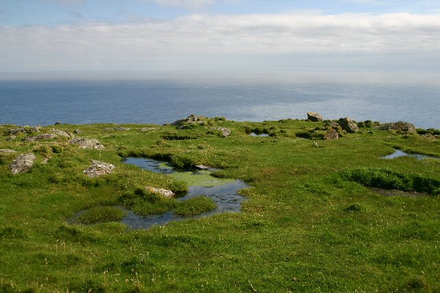
| Description | Mullach a' Lusgan. These rock pools are on top of the cliffs at Barra Head, the southernmost point of the Outer Hebrides. | ||
| Date | |||
| Source |
This file is licensed under the Creative Commons Attribution-Share Alike 2.0 Generic license. Attribution: Bob Jones
|
||
| Author | Bob Jones |

_region:GB-GBN_heading:157.00&language=en)
Licensing
This file is licensed under the Creative Commons Attribution-Share Alike 2.0 Generic license.
- You are free:
- to share – to copy, distribute and transmit the work
- to remix – to adapt the work
- Under the following conditions:
- attribution – You must give appropriate credit, provide a link to the license, and indicate if changes were made. You may do so in any reasonable manner, but not in any way that suggests the licensor endorses you or your use.
- share alike – If you remix, transform, or build upon the material, you must distribute your contributions under the same or compatible license as the original.
File history
Click on a date/time to view the file as it appeared at that time.
| Date/Time | Thumbnail | Dimensions | User | Comment | |
|---|---|---|---|---|---|
| current | 16:55, 6 January 2008 | | 640 × 427 (82 KB) | MacRusgail | == Summary == {{Information |Description=Mullach a' Laggan. These rock pools are on top of the cliffs at Barra Head, the southernmost point of the Outer Hebrides. |Source= {{geograph|228852|Bob Jones}} |Date= 22 August, 2006 |Author= Bob Jones |Permission |
File usage
The following pages on the English Wikipedia use this file (pages on other projects are not listed):
Global file usage
The following other wikis use this file:
- Usage on arz.wikipedia.org
- Usage on ca.wikipedia.org
- Usage on ceb.wikipedia.org
- Usage on cs.wikipedia.org
- Usage on da.wikipedia.org
- Usage on de.wikipedia.org
- Usage on ga.wikipedia.org
- Usage on nn.wikipedia.org
- Usage on no.wikipedia.org
- Usage on pl.wikipedia.org
- Usage on www.wikidata.org