
File:Burlington.nj.jpg

Size of this preview: 800 × 578 pixels. Other resolutions: 320 × 231 pixels | 640 × 463 pixels | 1,024 × 740 pixels | 1,280 × 926 pixels | 2,560 × 1,851 pixels | 3,543 × 2,562 pixels.
Original file (3,543 × 2,562 pixels, file size: 388 KB, MIME type: image/jpeg)
| This is a file from the Wikimedia Commons. Information from its description page there is shown below. Commons is a freely licensed media file repository. You can help. |
Summary
| Description |
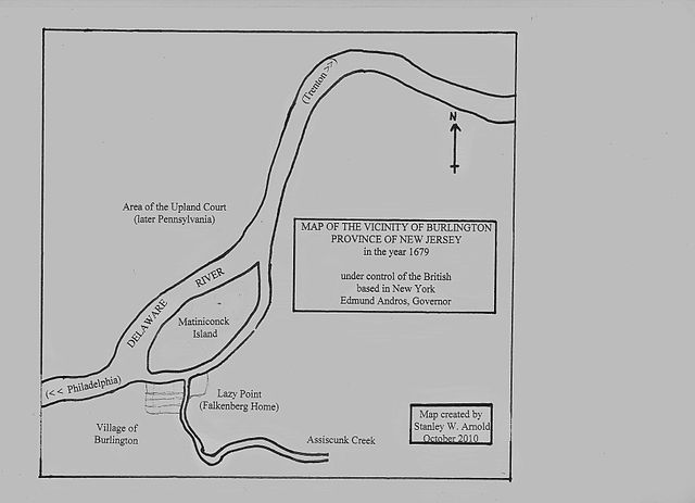
English: Map of the area of Burlington, Province of New Jersey in 1679 |
| Date | |
| Source | Template:I created it |
| Author | Sarnold17 |
The map shows the relative locations of Burlington, NJ, the Delaware River, Matiniconck Island, and the property of Hendrick Jacobs Falkenberg (Lazy Point) in 1679.
Licensing
| I, the copyright holder of this work, release this work into the public domain. This applies worldwide. In some countries this may not be legally possible; if so: I grant anyone the right to use this work for any purpose, without any conditions, unless such conditions are required by law. |
File history
Click on a date/time to view the file as it appeared at that time.
| Date/Time | Thumbnail | Dimensions | User | Comment | |
|---|---|---|---|---|---|
| current | 18:53, 17 October 2010 | | 3,543 × 2,562 (388 KB) | Sarnold17 | {{Information |Description={{en|1=Map of the area of Burlington, Province of New Jersey in 1679}} |Source={{I created it}} |Author=Sarnold17 |Date=20101017 |Permission= |other_versions= }} The map shows the relative locations of Burling |
File usage
The following pages on the English Wikipedia use this file (pages on other projects are not listed):