
Search results
The page "File:CIA map Central America" does not exist. You can ask for it to be uploaded, but consider checking the search results below to see whether the topic is already covered.
 Summary == Map of [[Central America]], see https://www.cia.gov/library/publications/the-world-factbook/docs/refmaps.html. == License == {{PD-USGov-CIA-WF}}...(1,390 × 1,044 (1.6 MB)) - 06:33, 17 February 2024
 0/PDMCreative Commons Public Domain Mark 1.0falsefalse English German Karte von Mittelamerika aus dem CIA World Factbook determination method: SHA-1...(1,272 × 1,014 (1.7 MB)) - 05:50, 18 January 2024
 File:Jamaica Passage.png (category PD CIA WF)1392x1066 (1720810 Bytes) {{Information |Description=Map of [[:en:Central America]], see https://www.cia.gov/library/publications/the-world-factbook/docs/refmaps...(706 × 345 (320 KB)) - 06:33, 17 February 2024
 File:Sanandrescolombia.png (category PD CIA WF)(284580 bytes) modified by [[user:f3rn4nd0]] from https://www.cia.gov/cia/publications/factbook/reference_maps/pdf/central_america.pdf {{PD-USGov-CIA-WF}}...(454 × 288 (278 KB)) - 03:17, 5 January 2024
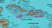 File:GreaterAntillesIslands.png (category PD CIA WF)1300×700×8 (323345 bytes) Self modified from https://www.cia.gov/cia/publications/factbook/reference_maps/pdf/central_america.pdf {{PD-USGov-CIA-WF}}...(1,300 × 700 (119 KB)) - 23:05, 25 April 2022
 File:CaribbeanIslands.png (category PD CIA WF)Self modified from https://www.cia.gov/cia/publications/factbook/reference_maps/pdf/central_america.pdf {{PD-USGov-CIA-WF}} English determination method:...(1,500 × 900 (577 KB)) - 04:45, 3 February 2024
 File:Location of Pokhara.JPG (category CIA World Factbook maps of Nepal)público ya que su contenido proviene de CIA World Factbook, un trabajo de la Agencia Central de Inteligencia de los Estados Unidos de América. English...(634 × 324 (28 KB)) - 21:44, 4 February 2023
 English: World map depicting America Esperanto: Mondmapo bildiganta Amerikon Español: Ubicación de América map adapted from PDF world map at CIA World Fact...(2,759 × 1,404 (99 KB)) - 10:10, 26 October 2022
 File:CaribbeanIslands PT.png (category PD CIA WF)modified from https://www.cia.gov/cia/publications/factbook/reference_maps/pdf/central_america.pdf}} |Source=Transfered from [http://en.wikipedia.org en.wikipedia]...(1,500 × 900 (530 KB)) - 04:45, 3 February 2024
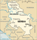 Map of Serbia from The World Factbook archive copy at the Wayback Machine (published by CIA in 2008). This map is updated with current events; independence...(328 × 352 (13 KB)) - 08:12, 2 September 2023
 File:Sino-Indian Geography.png (category PD CIA WF)from a larger map showing Asia - which may be found on the Library of Congress website (the source image) or alternatively on the CIA World Factbook...(918 × 648 (1.36 MB)) - 20:33, 2 March 2022
 File:Range of Poecilia obscura.png (category CIA World Factbook maps of Trinidad and Tobago)utexas.edu/maps/americas.html |Date=1969 |Author=CIA |Permission={{PD-USGov-CIA}} |other_versions= }} [[Category:CIA World Factbook maps of Trinidad...(718 × 602 (160 KB)) - 23:29, 31 July 2018
 File:Wikinews Ameryka Środkowa mapa.png (category PD CIA WF)|Description=World map depicting Central America |Source=own work, adapted from LocationAmericas.png, itself adapted from PDF world map at CIA World Fact Book...(2,759 × 1,404 (233 KB)) - 08:13, 12 December 2020
 2006-01-23T20:24:15Z Sanao 504x670 (1237579 Bytes) South America Origin : CIA World Factbook converted in SVG [[Category:SVG maps]] Uploaded with derivativeFX English...(505 × 670 (560 KB)) - 08:29, 21 February 2022
 map of Panama, converted directly from CIA World Factbook GIF Source en:Image:Pm-map.png English Spanish (formal address) برزخ بنما Latin American Spanish...(633 × 323 (16 KB)) - 02:44, 8 October 2023
 United States. Central Intelligence Agency. [Washington, D.C. : Central Intelligence Agency, 2002] Relief shown by shading. "Base 802899AI (C00429) 11-02...(2,000 × 1,340 (1.43 MB)) - 19:12, 2 October 2020
 English CIA map showing oil infrastructure in regions near Caspian Sea (Eurasia)...(13,270 × 10,343 (12.08 MB)) - 08:51, 13 June 2022
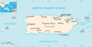 File:Rico (1).png (category CIA World Factbook maps of Puerto Rico)04:50 Hoshie 634×321× (15787 bytes) Updated version using the latest CIA Factbook map with the inset readded 2005-06-20 01:11 Ikescs 557×263× (9414 bytes)...(631 × 321 (13 KB)) - 04:24, 13 November 2020
 English The political map of the world with all countries labeled and their boundaries marked. determination method: SHA-1...(6,300 × 3,600 (22.53 MB)) - 05:49, 18 January 2024
 File:Voyage of Blonde 1824 sm.png (category PD CIA WF)image is a derivative work of the following images: File:WorldMap.svg licensed with PD-USGov-CIA-WF 2009-01-01T14:51:09Z CodeOne 2760x1398 (520387 Bytes) ==...(790 × 800 (164 KB)) - 05:54, 8 December 2020


.png)


- Moscow 18 hville To Port Republic and Cross Keys Staunton a cia Waynesboro in sera Jackson’s home at Lexington and Jackson’s