
File:Cape Town Foreshore original coastline.svg

Size of this PNG preview of this SVG file: 800 × 523 pixels. Other resolutions: 320 × 209 pixels | 640 × 418 pixels | 1,024 × 669 pixels | 1,280 × 837 pixels | 2,560 × 1,674 pixels | 1,190 × 778 pixels.
Original file (SVG file, nominally 1,190 × 778 pixels, file size: 1.65 MB)
| This is a file from the Wikimedia Commons. Information from its description page there is shown below. Commons is a freely licensed media file repository. You can help. |
| Description |
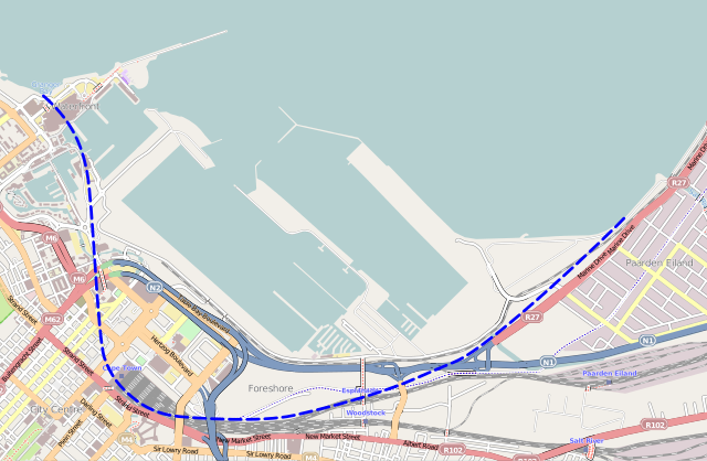
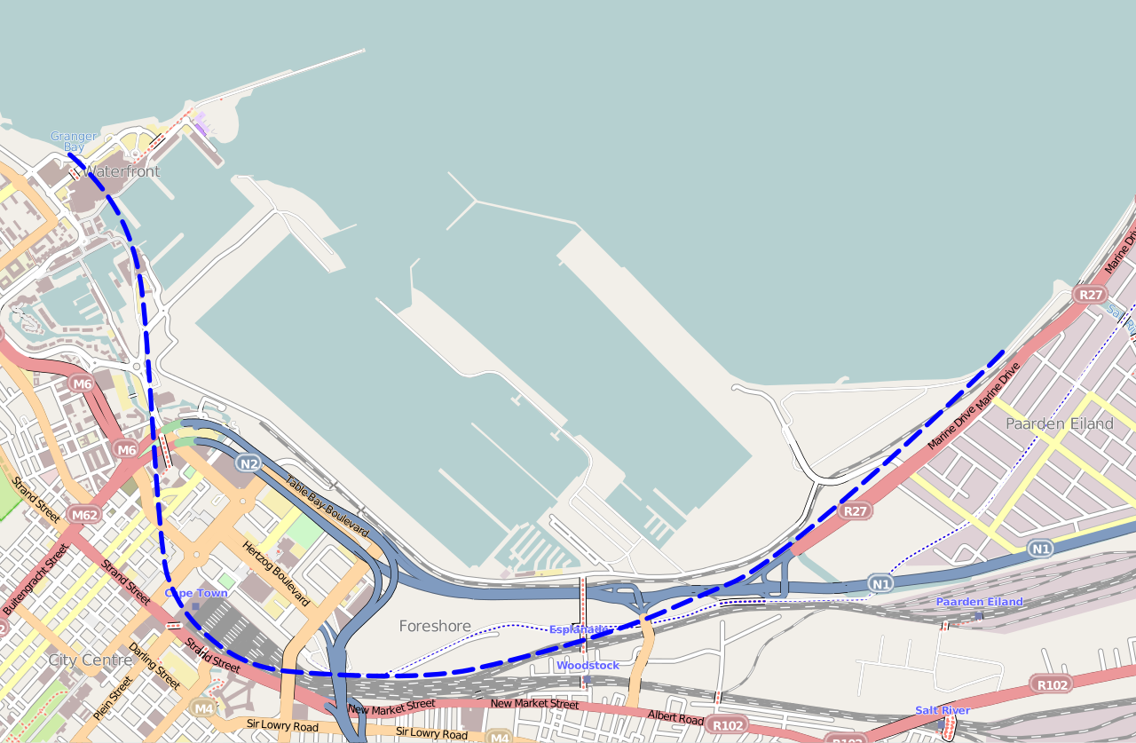
English: Map of the Foreshore area of central Cape Town, showing the approximate line of the original Table Bay coastline before land reclamation took place. |
|||
| Date | ||||
| Source | Base map from OpenStreetMap; coastline principally from 1891 "Map of Cape Town" drawn by the City Engineer | |||
| Author | Htonl | |||
| Permission (Reusing this file) |
This file is licensed under the Creative Commons Attribution-Share Alike 2.0 Generic license.
|
File history
Click on a date/time to view the file as it appeared at that time.
| Date/Time | Thumbnail | Dimensions | User | Comment | |
|---|---|---|---|---|---|
| current | 09:51, 6 March 2013 | | 1,190 × 778 (1.65 MB) | Htonl | {{Information |Description ={{en|1=Map of the Foreshore area of central Cape Town, showing the approximate line of the original Table Bay coastline before land reclamation took place.}} |Source =Base map from OpenStreetMap; coastline princip... |
File usage
The following pages on the English Wikipedia use this file (pages on other projects are not listed):
Global file usage
The following other wikis use this file:
- Usage on af.wikipedia.org
- Usage on fr.wikipedia.org
- Usage on lv.wikipedia.org