
File:Carrickstone water tower - geograph.org.uk - 6049.jpg
No higher resolution available.
Carrickstone_water_tower_-_geograph.org.uk_-_6049.jpg (640 × 480 pixels, file size: 99 KB, MIME type: image/jpeg)
| This is a file from the Wikimedia Commons. Information from its description page there is shown below. Commons is a freely licensed media file repository. You can help. |
Summary
| Description |
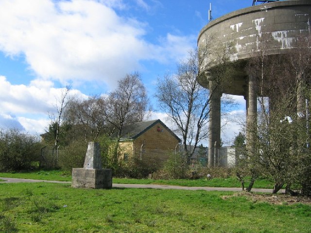
English: Carrickstone water tower. Until recently Carrickstone was a hilltop farm, the trigpoint in a hedge at the side of a lane. Now it has been swallowed up by new housing in Cumbernauld. The water tower is a hilltop landmark. |
| Date | |
| Source | From geograph.org.uk |
| Author | Richard Webb |
| Attribution (required by the license) | Richard Webb / Carrickstone water tower / |
| Camera location | | View this and other nearby images on: OpenStreetMap |
|---|
_heading:292.00&language=en)
| Object location | | View this and other nearby images on: OpenStreetMap |
|---|
_heading:292.00&language=en)
Licensing

|
This image was taken from the
Creative Commons Attribution-ShareAlike 2.0 license. |
This file is licensed under the Creative Commons Attribution-Share Alike 2.0 Generic license.
Attribution: Richard Webb
- You are free:
- to share – to copy, distribute and transmit the work
- to remix – to adapt the work
- Under the following conditions:
- attribution – You must give appropriate credit, provide a link to the license, and indicate if changes were made. You may do so in any reasonable manner, but not in any way that suggests the licensor endorses you or your use.
- share alike – If you remix, transform, or build upon the material, you must distribute your contributions under the same or compatible license as the original.
File history
Click on a date/time to view the file as it appeared at that time.
| Date/Time | Thumbnail | Dimensions | User | Comment | |
|---|---|---|---|---|---|
| current | 01:01, 30 January 2010 | | 640 × 480 (99 KB) | GeographBot | == {{int:filedesc}} == {{Information |description={{en|1=Carrickstone water tower. Until recently Carrickstone was a hilltop farm, the trigpoint in a hedge at the side of a lane. Now it has been swallowed up by new housing in Cumbernauld. The water tower |
File usage
The following pages on the English Wikipedia use this file (pages on other projects are not listed):