
Search results
There is a page named "File:Europe satellite image location map.jpg" on Wikipedia
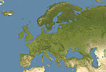 DescriptionEurope satellite image location map.jpg Deutsch: Positionskarte von Europa, Satellitenbild Quadratische Plattkarte, N-S-Streckung 150 %. Geographische...(5,668 × 3,800 (1.83 MB)) - 14:15, 14 September 2022
 the following license: This image is a derivative work of the following images: File:Europe_satellite_image_location_map.jpg licensed with PD-self 2008-09-28T12:40:05Z...(3,807 × 2,954 (1.8 MB)) - 13:38, 21 October 2020
 Source public domain, File:Europe_satellite_image_location_map.jpg English Wikimedia username: Fakirbakir URL: https://commons.wikimedia.org/wiki/user:Fakirbakir...(1,029 × 814 (766 KB)) - 21:14, 11 April 2024
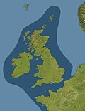 Edited by Francis J Reynolds, Allen C Churchill, File:Europe_satellite_image_location_map.jpg licensed with PD-self 2008-09-28T12:40:05Z NordNordWest...(1,273 × 1,651 (286 KB)) - 22:02, 19 September 2020
 Source is a public domain (map) http://commons.wikimedia.org/wiki/File:Europe_satellite_image_location_map.jpg Items derive from http://www.tankonyvtar...(1,068 × 848 (960 KB)) - 23:41, 13 October 2020
 Attribution-Share Alike 3.0 truetrue This image is a derivative work of the following images: File:Europe_satellite_image_location_map.jpg licensed with PD-self 2008-09-28T12:40:05Z...(5,668 × 3,800 (8.57 MB)) - 00:20, 5 October 2020
 Attribution-Share Alike 3.0 truetrue This image is a derivative work of the following images: File:Europe_satellite_image_location_map.jpg licensed with PD-self 2008-09-28T12:40:05Z...(3,627 × 2,565 (2.78 MB)) - 00:20, 5 October 2020
 |Description={{en|Location map of oceans around the [[United Kingdom]] and [[Ireland]] Equirectangular projection, N/S stretching 150 %. Geographic limits of the map:...(1,654 × 1,998 (242 KB)) - 21:54, 14 September 2020
 Geba (Guinea–Bissau) between 1979 and 2015. European Journal of Remote Sensing, 51 (1), 314-325. European Space Agency (2014, October 1). Guinea–Bissau...(5,130 × 4,203 (6.15 MB)) - 22:08, 4 February 2024
 and Linz were marked a few kilometers from their actual locations in the original satellite image; this has been corrected here. Deutsch: Die Karte beruht...(2,550 × 1,381 (1.22 MB)) - 05:12, 4 October 2023
 File:CK12 Earth Science.pdf (matches file content)(Source: http://earthobservatory.nasa.gov/Newsroom/NewImages/Images/arizona_volcanoes.AST20031021.jpg, Courtesy: NASA, License: Public Domain) Landforms...(1,275 × 1,650 (130.11 MB)) - 14:19, 18 January 2024
 central Europe. determination method: SHA-1 described at URL: https://www.copernicus.eu/en/media/image-day-gallery/record-setting-heatwave-europe...(2,744 × 2,883 (3.43 MB)) - 18:06, 4 December 2023
 computations from the Global Tropospheric Experiment (GTE), soundings and satellite imagery. The GTE data provide monthly occurrences and seasonality of atmospheric...(1,275 × 1,650 (2.48 MB)) - 23:36, 22 July 2022
 File:East Francia 843.svg (category SVG locator maps of former countries of Europe (gray and green scheme))org/licenses/by-sa/4.0CC BY-SA 4.0 Creative Commons Attribution-Share Alike 4.0 truetrue English Location map of East Francia within Europe circa 843 CE...(500 × 380 (933 KB)) - 22:10, 23 May 2023
 File:WikiReader Decade Volcanoes.pdf (matches file content)TerraServer-USA • Satellite image from Google Maps • • • RELATED IMAGES A graph depicting CO2 data from Mauna Loa. CO2 levels. Image of Hawai‘i (big...(1,239 × 1,754 (1.6 MB)) - 10:09, 6 January 2021
 collected by NASAâ s ICESat program using a laser altimeter mounted on a satellite of the same name. The NPS model indicates an accelerated thinning trend...(1,275 × 1,650 (1.89 MB)) - 22:38, 17 July 2022
 central Europe. determination method: SHA-1 described at URL: https://www.copernicus.eu/en/media/image-day-gallery/record-setting-heatwave-europe-february-2021...(5,548 × 2,913 (16.8 MB)) - 18:05, 4 December 2023
 waves; Buoys Language English Publication date September 2010 Current location IA Collections: navalpostgraduateschoollibrary; fedlink Accession number...(1,275 × 1,650 (1.66 MB)) - 04:33, 22 August 2020
 Congressional Research Service; CRS; Congress Language English Current location IA Collections: congressional-research-service; nationalsecurityarchive;...(1,239 × 1,752 (979 KB)) - 06:36, 18 September 2020
 Attribution English This image shows the tiered satellite observation of a methane leak in Algeria on 4 January 2020. determination method: SHA-1 described...(1,920 × 1,080 (1.62 MB)) - 18:01, 28 March 2024


