
File:Footpath above Achnashellach - geograph.org.uk - 203418.jpg
No higher resolution available.
Footpath_above_Achnashellach_-_geograph.org.uk_-_203418.jpg (640 × 480 pixels, file size: 162 KB, MIME type: image/jpeg)
| This is a file from the Wikimedia Commons. Information from its description page there is shown below. Commons is a freely licensed media file repository. You can help. |
Summary
| Description |
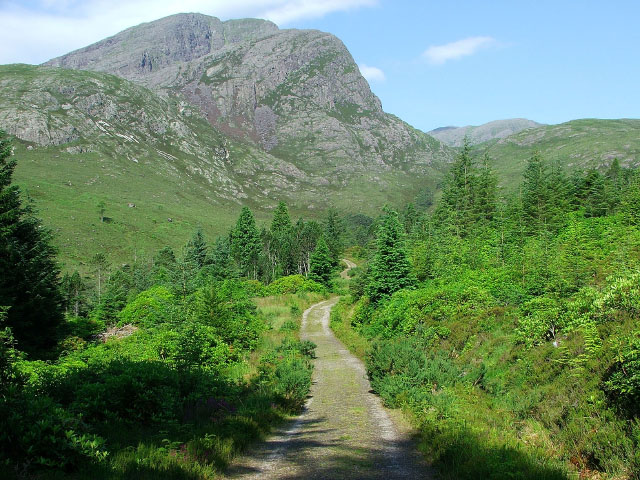
English: Footpath above Achnashellach. This path runs from Achnashellach to Torridon via Coire Lair. The mountain in the near distance is Fuar Tholl, and the mountain in the far distance, with just the top being visible is Beinn Liath Mhor. |
| Date | |
| Source | From geograph.org.uk |
| Author | David Maclennan |
| Attribution (required by the license) | David Maclennan / Footpath above Achnashellach / |
| Camera location | | View this and other nearby images on: OpenStreetMap |
|---|
_heading:270.00&language=en)
| Object location | | View this and other nearby images on: OpenStreetMap |
|---|
_heading:270.00&language=en)
Licensing

|
This image was taken from the
Creative Commons Attribution-ShareAlike 2.0 license. |
This file is licensed under the Creative Commons Attribution-Share Alike 2.0 Generic license.
Attribution: David Maclennan
- You are free:
- to share – to copy, distribute and transmit the work
- to remix – to adapt the work
- Under the following conditions:
- attribution – You must give appropriate credit, provide a link to the license, and indicate if changes were made. You may do so in any reasonable manner, but not in any way that suggests the licensor endorses you or your use.
- share alike – If you remix, transform, or build upon the material, you must distribute your contributions under the same or compatible license as the original.
File history
Click on a date/time to view the file as it appeared at that time.
| Date/Time | Thumbnail | Dimensions | User | Comment | |
|---|---|---|---|---|---|
| current | 18:58, 31 January 2010 | | 640 × 480 (162 KB) | GeographBot | == {{int:filedesc}} == {{Information |description={{en|1=Footpath above Achnashellach. This path runs from Achnashellach to Torridon via Coire Lair. The mountain in the near distance is Fuar Tholl, and the mountain in the far distance, with just the top b |
File usage
The following pages on the English Wikipedia use this file (pages on other projects are not listed):
Global file usage
The following other wikis use this file:
- Usage on www.wikidata.org