
File:Front View of Humayun's tomb 01.jpg

Original file (5,824 × 3,129 pixels, file size: 10.67 MB, MIME type: image/jpeg)
| This is a file from the Wikimedia Commons. Information from its description page there is shown below. Commons is a freely licensed media file repository. You can help. |
Summary
| Description |
|
||
| Date | |||
| Source | Own work | ||
| Author | DeepsDeepakIndia |
| Camera location | | View this and other nearby images on: OpenStreetMap |
|---|
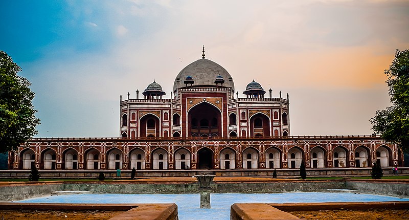
Humayun's tomb-is the tomb of the Mughal Emperor Humayun in Delhi, India. The tomb was commissioned by Humayun's son Akbar[1][2][3][4][5][6] in 1569-70, and designed by Mirak Mirza Ghiyas, a Persian architect chosen by Bega Begum.[7][8] It was the first garden-tomb on the Indian subcontinent,[9] and is located in Nizamuddin East, Delhi, India, close to the Dina-panah citadel also known as Purana Qila (Old Fort)that Humayun founded in 1533. It was also the first structure to use red sandstone at such a scale.[10][11] The tomb was declared a UNESCO World Heritage Site in 1993,[9] and since then has undergone extensive restoration work, which is complete.[12] Besides the main tomb enclosure of Humayun, several smaller monuments dot the pathway leading up to it, from the main entrance in the West, including one that even pre-dates the main tomb itself, by twenty years; it is the tomb complex of Isa Khan Niyazi, an Afghan noble in Sher Shah Suri's court of the Suri dynasty, who fought against the Mughals, constructed in 1547 CE.
Licensing
- You are free:
- to share – to copy, distribute and transmit the work
- to remix – to adapt the work
- Under the following conditions:
- attribution – You must give appropriate credit, provide a link to the license, and indicate if changes were made. You may do so in any reasonable manner, but not in any way that suggests the licensor endorses you or your use.
- share alike – If you remix, transform, or build upon the material, you must distribute your contributions under the same or compatible license as the original.

|
This image was uploaded as part of Wiki Loves Monuments 2016.
|
 |
File history
Click on a date/time to view the file as it appeared at that time.
| Date/Time | Thumbnail | Dimensions | User | Comment | |
|---|---|---|---|---|---|
| current | 11:13, 26 September 2016 | | 5,824 × 3,129 (10.67 MB) | DeepsDeepakIndia | User created page with UploadWizard |