
File:Gare original do Cais do Sodre - O Caminho de Ferro Revisitado.jpg
No higher resolution available.
Gare_original_do_Cais_do_Sodre_-_O_Caminho_de_Ferro_Revisitado.jpg (796 × 458 pixels, file size: 138 KB, MIME type: image/jpeg)
| This is a file from the Wikimedia Commons. Information from its description page there is shown below. Commons is a freely licensed media file repository. You can help. |
Summary
| Description |
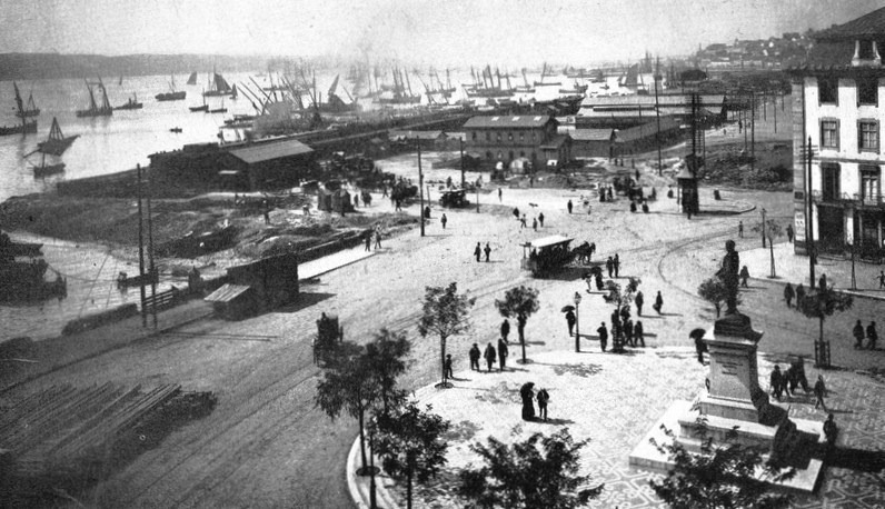
Português: A zona do Cais do Sodré, em Lisboa, nos finais do Século XIX. A estação primitiva do Cais do Sodré aparece no lado esquerdo da fotografia. English: The Cais do Sodré area, in Lisbon, at the end of the 19th Century.. The original Cais do Sodré Railway Station appears at the left of the picture. |
| Date | 1890s |
| Source |
MARTINS, João Paulo; BRION, Madalena, SOUSA, Miguel de; LEVY, Maurício; AMORIM, Óscar. O Caminho de Ferro Revisitado: O Caminho de Ferro em Portugal de 1856 a 1996. [S.l.]: Caminhos de Ferro Portugueses, 1996. 446 p |
| Author | Unknown author |
| Camera location | | View this and other nearby images on: OpenStreetMap |
|---|
Licensing
This image (or other media file) is in the public domain because its copyright has expired and its author is anonymous.
This applies to the European Union and those countries with a copyright term of 70 years after the work was made available to the public and the author never disclosed their identity. Important: Always mention where the image comes from, as far as possible, and make sure the author never claimed authorship. |
 | |
 |
Note: In Germany and possibly other countries, certain anonymous works published before July 1, 1995 are copyrighted until 70 years after the death of the author. See Übergangsrecht. Please use this template only if the author never claimed authorship or their authorship never became public in any other way. If the work is anonymous or pseudonymous (e.g., published only under a corporate or organization's name), use this template for images published more than 70 years ago.
For a work made available to the public in the United Kingdom, please use Template:PD-UK-unknown instead.
|
File history
Click on a date/time to view the file as it appeared at that time.
| Date/Time | Thumbnail | Dimensions | User | Comment | |
|---|---|---|---|---|---|
| current | 06:53, 6 August 2020 | | 796 × 458 (138 KB) | Tuvalkin | menos píxeis, mais detalhe |
| 15:38, 18 January 2013 |  | 3,900 × 2,712 (8.59 MB) | Ajpvalente | User created page with UploadWizard |
File usage
The following pages on the English Wikipedia use this file (pages on other projects are not listed):
Global file usage
The following other wikis use this file:
- Usage on it.wikipedia.org
- Usage on pt.wikipedia.org