Search results
Appearance
There is a page named "File:Georgia location map.svg" on Wikipedia
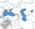
- DescriptionGeorgia location map.svg Deutsch: Positionskarte von Georgien Quadratische Plattkarte, N-S-Streckung 135 %. Geographische Begrenzung der Karte:...(1,715 × 913 (141 KB)) - 16:36, 29 October 2022
- Fitzgerald|captureDate=25 May 2007|location=Georgia (country)|source=[[Image:Georgia regions map.svg]]|caption=Ma (Import from wikitravel.org/shared)...(800 × 543 (105 KB)) - 04:39, 17 July 2023
- This image is a derivative work of the following images: File:Bahamas location map.svg licensed with Cc-by-sa-3.0, GFDL 2008-10-23T19:17:05Z NordNordWest...(13,310 × 6,935 (10.66 MB)) - 09:41, 11 January 2024
- truetrue This image is a derivative work of the following images: Bahamas location map.svg licensed with Cc-by-sa-3.0, GFDL 2008-10-23T19:17:05Z NordNordWest...(13,310 × 6,935 (9.24 MB)) - 09:40, 11 January 2024
- }} [[Category:SVG locator maps of Abkhazia (location map scheme)]] [[Category:SVG locator maps of South Ossetia (location map scheme)]] Uploaded...(774 × 413 (609 KB)) - 07:13, 23 June 2021
- English Map relief of Georgia & vicinity....(1,182 × 629 (1.08 MB)) - 01:50, 23 June 2024
- File:RBC footprint 2011-07.png (category Maps by Magog the Ogre)[[:en:Florida|Florida]], [[:en:United States|USA]], for geo-location purpose, with count File:USA Georgia location map.svg licensed with Cc-by-3.0, GFDL 2009-06-20T11:26:27Z...(2,126 × 2,464 (1.01 MB)) - 14:26, 19 May 2023
- [[:File:Georgia location map2.svg]] | თარიღი = * 18.11. This image is a derivative work of the following images: File:Georgia_location_map2.svg licensed...(1,715 × 913 (149 KB)) - 01:38, 10 October 2023
- der Karte:}} {{en|Location map [[w:en:Hesse|Hesse]], Germany. Geographic limits of the map:}} * N: 51 Lower Saxony location map.svg licensed with Cc-by-sa-3...(928 × 1,116 (1.22 MB)) - 09:08, 23 March 2022
- 15:54 (UTC) |Author=*[[:File:Asia_location_GEO2008.png|]]: [[User:Spapla|Spapla] File:Georgia_(orthographic_projection).svg licensed with Cc-by-sa-3.0 2010-01-11T21:11:06Z...(631 × 526 (83 KB)) - 21:25, 26 September 2023
- This SVG map is part of a locator map series applying the widespread location map scheme. Please see root category to browse for more. FDFBEA → Marked...(512 × 386 (1.4 MB)) - 23:54, 1 January 2024
- 15:54 (UTC) |Author=*[[:File:Asia_location_GEO2008.png|]]: [[User:Spapla|Spapla] File:Georgia_(orthographic_projection).svg licensed with Cc-by-sa-3.0 2010-01-11T21:11:06Z...(631 × 526 (83 KB)) - 21:25, 26 September 2023
- File:TDBank footprint.png (category Maps by Magog the Ogre)This image is a derivative work of the following images: File:Bahamas location map.svg licensed with Cc-by-sa-3.0, GFDL 2011-04-15T17:31:56Z NordNordWest...(1,114 × 1,758 (321 KB)) - 17:14, 20 February 2024
- This SVG map is part of a locator map series applying the widespread location map scheme. Please see root category to browse for more. FDFBEA → Marked...(512 × 386 (556 KB)) - 23:56, 1 January 2024
- This SVG map is part of a locator map series applying the widespread location map scheme. Please see root category to browse for more. FDFBEA → Marked...(512 × 448 (1.8 MB)) - 02:45, 22 May 2024
- This SVG map is part of a locator map series applying the widespread location map scheme. Please see root category to browse for more. FDFBEA → Marked...(512 × 684 (2.88 MB)) - 16:51, 8 June 2024
- This SVG map is part of a locator map series applying the widespread location map scheme. Please see root category to browse for more. FDFBEA → Marked...(512 × 209 (1.77 MB)) - 22:47, 7 March 2024
- File:PNC footprint 2015.png (category Maps by Magog the Ogre)This image is a derivative work of the following images: File:Bahamas location map.svg licensed with Cc-by-sa-3.0, GFDL 2011-04-15T17:31:56Z NordNordWest...(3,289 × 4,039 (1.68 MB)) - 15:23, 9 November 2023
- This SVG map is part of a locator map series applying the widespread location map scheme. Please see root category to browse for more. FDFBEA → Marked...(512 × 448 (1.8 MB)) - 00:00, 2 January 2024
- This SVG map is part of a locator map series applying the widespread location map scheme. Please see root category to browse for more. FDFBEA → Marked...(512 × 343 (4.36 MB)) - 23:55, 1 January 2024


