
File:Ground Plan of Belfast (1685).png
Size of this preview: 800 × 550 pixels. Other resolutions: 320 × 220 pixels | 640 × 440 pixels | 1,024 × 705 pixels | 1,280 × 881 pixels | 2,560 × 1,761 pixels | 3,735 × 2,570 pixels.
Original file (3,735 × 2,570 pixels, file size: 10.07 MB, MIME type: image/png)
| This is a file from the Wikimedia Commons. Information from its description page there is shown below. Commons is a freely licensed media file repository. You can help. |
Summary
| Description |
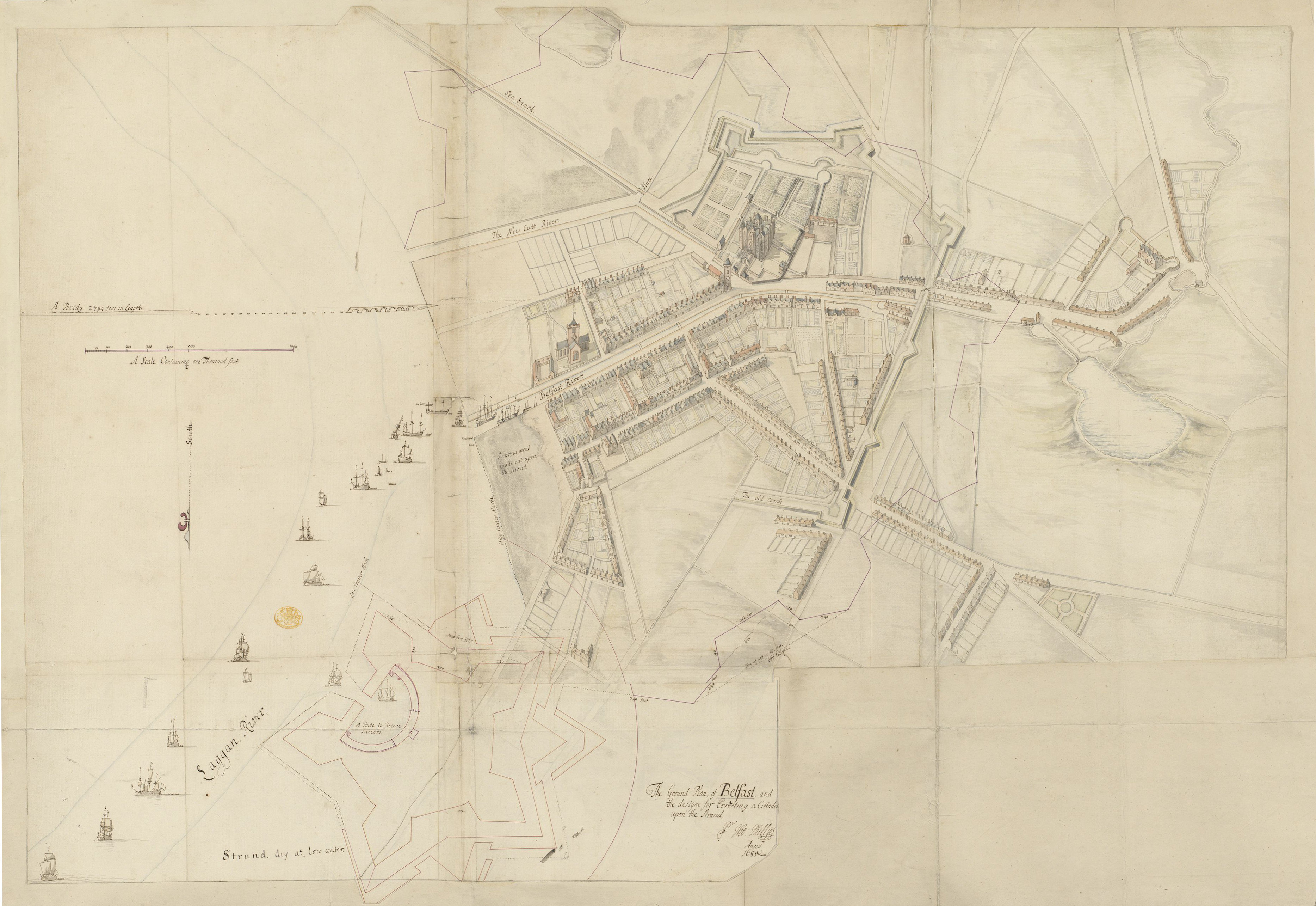
English: A pen and ink sketch of Belfast, prepared as part of Thomas Phillips' survey of Irish towns and fortifications. The town's existing ramparts are overlaid by a much grander scheme of Phillips' own devisal, with a plan for a citadel to the north. Landmarks include Belfast Castle and the Corporation Church, and the unfinished Long Bridge. The River Farset runs through the High Street and the Blackstaff flows over the slobland to the south, meeting the Lagan via the "new cutt". |
| Date | |
| Source | The British Library King's Topographical Collection |
| Author | Thomas Phillips (d. 1693) |
| Other versions |
|
.png)
.png)
| Annotations | This image is annotated: View the annotations at Commons |
Licensing
|
This work is in the public domain in its country of origin and other countries and areas where the copyright term is the author's life plus 70 years or fewer. This work is in the public domain in the United States because it was published (or registered with the U.S. Copyright Office) before January 1, 1929. | |
| This file has been identified as being free of known restrictions under copyright law, including all related and neighboring rights. | |
File history
Click on a date/time to view the file as it appeared at that time.
| Date/Time | Thumbnail | Dimensions | User | Comment | |
|---|---|---|---|---|---|
| current | 17:33, 16 January 2021 | | 3,735 × 2,570 (10.07 MB) | Zacwill | Uploaded a work by {{w|Thomas Phillips (engineer)|Thomas Phillips}} (d. 1693) from https://flickr.com/photos/britishlibrary/50263987671 with UploadWizard |
File usage
The following pages on the English Wikipedia use this file (pages on other projects are not listed):
.png)