
Search results
There is a page named "File:Hackney London UK 2014 blank ward map.svg" on Wikipedia
 DescriptionHackney London UK 2014 blank ward map.svg Blank map of the London Borough of Hackney, showing electoral wards in 2014. Equirectangular map projection...(1,218 × 1,266 (343 KB)) - 23:30, 9 October 2020
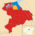 Striped wards have mixed representation. Date 20 March 2015 Source This file was derived from: Hackney London UK 2014 blank ward map.svg: Author Hackney...(1,218 × 1,266 (345 KB)) - 22:58, 6 March 2024
 elements that have been taken or adapted from this file: Hackney London UK 2014 blank ward map.svg (by Nilfanion). This vector image includes elements...(1,425 × 1,140 (2.47 MB)) - 22:58, 6 March 2024
 Conservative Labour Striped wards have mixed representation. Derived from File:Hackney_London_UK_2014_blank_ward_map.svg Date 4 March 2019 Source Own...(1,218 × 1,266 (344 KB)) - 09:28, 20 February 2024
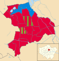 election Date 6 May 2022 Source This file was derived from: Hackney London UK 2014 blank ward map.svg: Author Nilfanion, created using Ordnance Survey data;...(1,218 × 1,266 (346 KB)) - 10:20, 10 August 2024
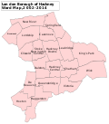 DescriptionHackney London UK labelled ward map 2002-2014.svg English: A labelled map of the wards of the London Borough of Hackney which were used from...(1,112 × 1,266 (66 KB)) - 13:44, 1 October 2020


