
File:Hamburg Hafen S-2 Tracker HMCS Bonaventure 0004-PSD.jpg
Size of this preview: 800 × 523 pixels. Other resolutions: 320 × 209 pixels | 640 × 419 pixels | 1,024 × 670 pixels | 1,280 × 837 pixels | 2,560 × 1,674 pixels | 4,809 × 3,145 pixels.
Original file (4,809 × 3,145 pixels, file size: 7.35 MB, MIME type: image/jpeg)
| This is a file from the Wikimedia Commons. Information from its description page there is shown below. Commons is a freely licensed media file repository. You can help. |
Summary
| Description |
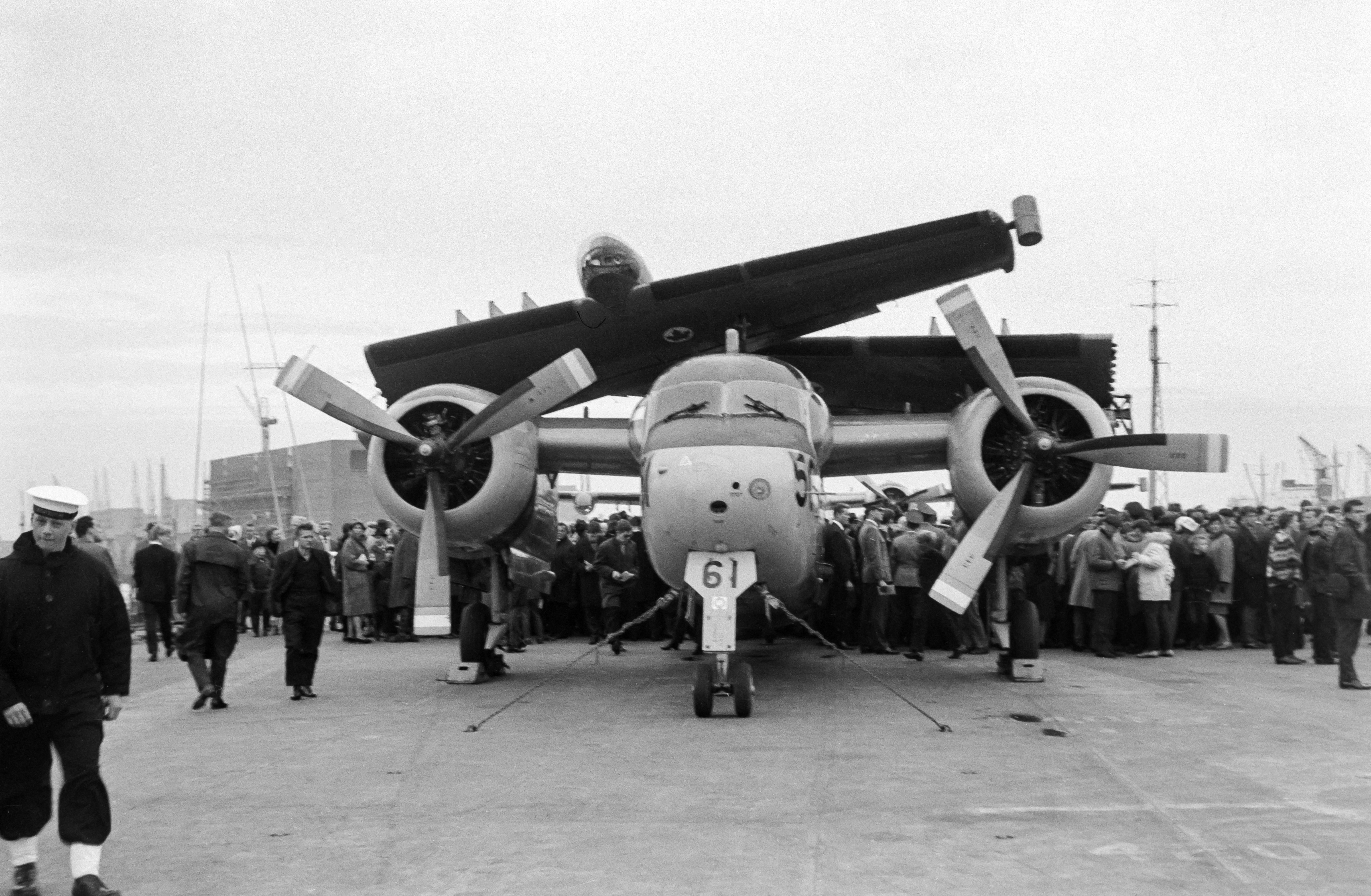
English: Hamburg landing bridges 1966. An S-2 tracker on the HMCS Bonaventure during a fleet visit. On the left in the background you can see the Kaispeicher A which is under construction and on which the Elphilharmonie was later built.
Deutsch: Hamburg Landungsbrücken 1966. Ein S-2 Tracker auf der HMCS Bonaventure bei einem Flottenbesuch. Links im Hintergrund ist der im Bau befindliche Kaispeicher A zu erkennen auf dem dann später die Elphilharmonie gebaut wurde. |
||||||
| Date | |||||||
| Source | Own work | ||||||
| Author | Ermell | ||||||
| Permission (Reusing this file) |
|


| Camera location | | View this and other nearby images on: OpenStreetMap |
|---|
Licensing
Reinhold Möller, the copyright holder of this work, hereby publishes it under the following license:
This file is licensed under the Creative Commons Attribution-Share Alike 4.0 International license.
Attribution: Reinhold Möller
- You are free:
- to share – to copy, distribute and transmit the work
- to remix – to adapt the work
- Under the following conditions:
- attribution – You must give appropriate credit, provide a link to the license, and indicate if changes were made. You may do so in any reasonable manner, but not in any way that suggests the licensor endorses you or your use.
- share alike – If you remix, transform, or build upon the material, you must distribute your contributions under the same or compatible license as the original.
File history
Click on a date/time to view the file as it appeared at that time.
| Date/Time | Thumbnail | Dimensions | User | Comment | |
|---|---|---|---|---|---|
| current | 11:35, 8 December 2018 | 4,809 × 3,145 (7.35 MB) | Ermell | Uploaded with LrMediaWiki 0.5.0, LR 8.0 Win |
File usage
The following pages on the English Wikipedia use this file (pages on other projects are not listed):
Global file usage
The following other wikis use this file:
- Usage on cs.wikipedia.org
- Usage on de.wikipedia.org