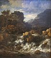
File:Herzog Anton Ulrich-Museum, Jacob Isaacksz. van Ruisdael, Wasserfall.jpg
Appearance

Size of this preview: 528 × 600 pixels. Other resolutions: 211 × 240 pixels | 423 × 480 pixels | 676 × 768 pixels | 901 × 1,024 pixels | 1,803 × 2,048 pixels | 2,982 × 3,387 pixels.
Original file (2,982 × 3,387 pixels, file size: 3.06 MB, MIME type: image/jpeg)
File history
Click on a date/time to view the file as it appeared at that time.
| Date/Time | Thumbnail | Dimensions | User | Comment | |
|---|---|---|---|---|---|
| current | 13:01, 7 April 2022 |  | 2,982 × 3,387 (3.06 MB) | Dguendel | Uploaded own work with UploadWizard |
File usage
The following pages on the English Wikipedia use this file (pages on other projects are not listed):
Global file usage
The following other wikis use this file:
- Usage on ca.wikipedia.org
- Usage on cy.wikipedia.org
- Usage on da.wikipedia.org
- Usage on de.wikipedia.org
- Usage on es.wikipedia.org
- Usage on fi.wikipedia.org
- Usage on hy.wikipedia.org
- Usage on nl.wikipedia.org
- Usage on pt.wikipedia.org
- Usage on ru.wikipedia.org
- Usage on www.wikidata.org
- Wikidata:WikiProject sum of all paintings/Creator/Jacob van Ruisdael
- Wikidata:WikiProject sum of all paintings/Catalog/Jacob van Ruisdael catalog raisonné, 1911
- Wikidata:WikiProject sum of all paintings/Catalog/Jacob van Ruisdael, A Complete Catalogue of His Paintings, Drawings, and Etchings
- Wikidata:WikiProject sum of all paintings/Catalog/Jacob van Ruisdael (1928)
- Wikidata:WikiProject sum of all paintings/Collection/Herzog Anton Ulrich Museum
- Q124609678


