
File:Hong Kong Map made by Edward Belcher in 1841.jpg
Size of this preview: 800 × 595 pixels. Other resolutions: 320 × 238 pixels | 640 × 476 pixels | 1,024 × 762 pixels | 1,280 × 952 pixels | 2,000 × 1,488 pixels.
Original file (2,000 × 1,488 pixels, file size: 623 KB, MIME type: image/jpeg)
| This is a file from the Wikimedia Commons. Information from its description page there is shown below. Commons is a freely licensed media file repository. You can help. |
| Description | ||||||
| Date |
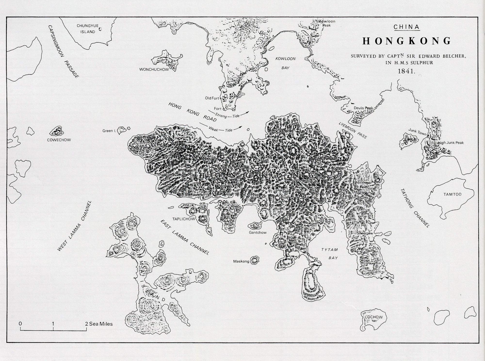
中文:1841年。 English: 1841. |
|||||
| Source |
中文:來自互聯網。 English: From internet. |
|||||
| Author |
中文:由愛德華·卑路乍繪製。 |
|||||
| Permission (Reusing this file) |
|
.svg)

File history
Click on a date/time to view the file as it appeared at that time.
| Date/Time | Thumbnail | Dimensions | User | Comment | |
|---|---|---|---|---|---|
| current | 14:04, 13 November 2008 | | 2,000 × 1,488 (623 KB) | Stewart | {{Information |Description={{zh|zh:1841年的zh:香港全圖,當時的香港只包括zh:香港島部份,地圖由zh:愛德華·卑路乍於zh:英國皇家海軍炮艦zh:硫磺號上繪製。}} {{en|Map of [[:en:Hong |
File usage
The following pages on the English Wikipedia use this file (pages on other projects are not listed):
Global file usage
The following other wikis use this file:
- Usage on cs.wikipedia.org
- Usage on de.wikipedia.org
- Usage on fr.wikipedia.org
- Usage on it.wikipedia.org
- Usage on zh.wikipedia.org