
File:Jasper Danckaerts - Map based on - New York from Brooklyn Heights - 1679.jpg
Size of this preview: 799 × 266 pixels. Other resolutions: 320 × 107 pixels | 640 × 213 pixels | 1,024 × 341 pixels | 3,000 × 999 pixels.
Original file (3,000 × 999 pixels, file size: 406 KB, MIME type: image/jpeg)
| This is a file from the Wikimedia Commons. Information from its description page there is shown below. Commons is a freely licensed media file repository. You can help. |
Summary
| Description |
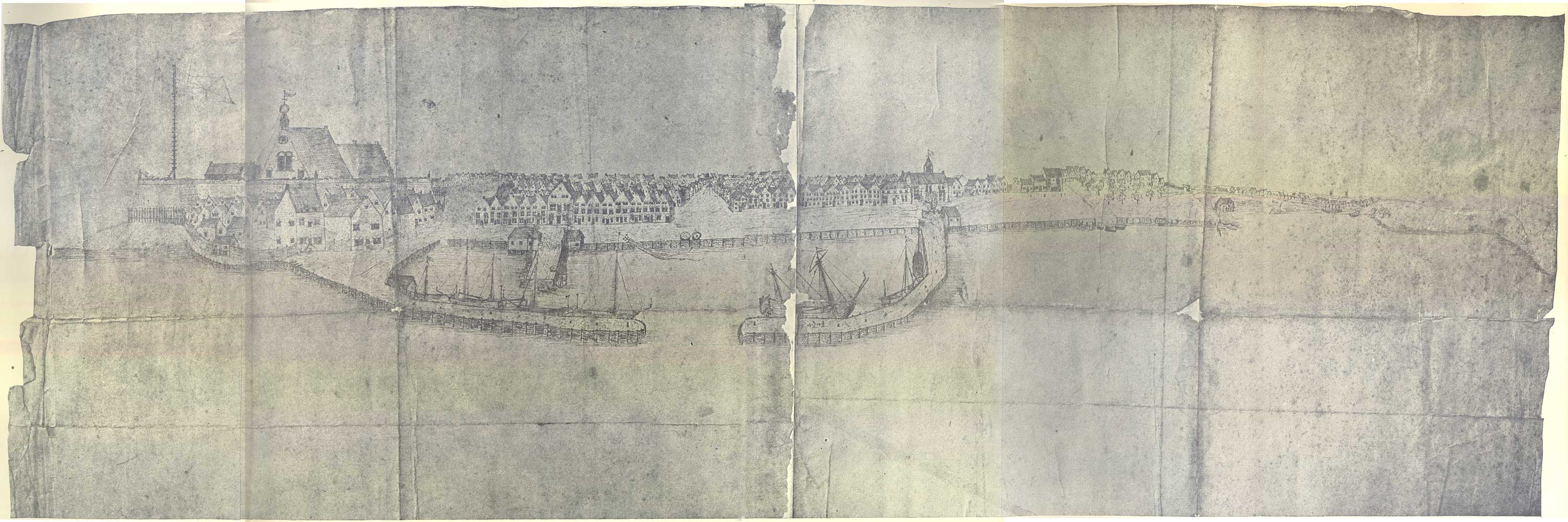
English: Jasper Danckaerts - Map based on - New York from Brooklyn Heights - 1679 |
| Date | |
| Source | The Project Gutenberg eBook, Journal of Jasper Danckaerts, 1679-1680, by Jasper Danckaerts, Edited by Bartlett Burleigh James and J. Franklin Jameson, Translated by Henry C. Murphy - http://www.gutenberg.org/files/23258/23258-h/23258-h.htm |
| Author | Copied from a work by Jasper Danckaerts |
Licensing
This media file is in the public domain in the United States. This applies to U.S. works where the copyright has expired, often because its first publication occurred prior to January 1, 1929, and if not then due to lack of notice or renewal. See this page for further explanation.
|
 | |
 |
This image might not be in the public domain outside of the United States; this especially applies in the countries and areas that do not apply the rule of the shorter term for US works, such as Canada, Mainland China (not Hong Kong or Macao), Germany, Mexico, and Switzerland. The creator and year of publication are essential information and must be provided. See Wikipedia:Public domain and Wikipedia:Copyrights for more details.
|
File history
Click on a date/time to view the file as it appeared at that time.
| Date/Time | Thumbnail | Dimensions | User | Comment | |
|---|---|---|---|---|---|
| current | 19:09, 21 March 2012 | 3,000 × 999 (406 KB) | Tagishsimon |
File usage
The following pages on the English Wikipedia use this file (pages on other projects are not listed):
Global file usage
The following other wikis use this file:
- Usage on www.wikidata.org