
Search results
There is a page named "File:Kamarupa map (cropped).png" on Wikipedia
 The map is created with QGIS, using Natural Earth data. The boundary of Kamarupa is geo-referenced from the map created in Acharya, N N (1968) and published...(842 × 665 (168 KB)) - 08:39, 25 March 2024
 The map is created with QGIS, using Natural Earth data. The boundary of Kamarupa is geo-referenced from the map created in Acharya, N N (1968) and published...(2,550 × 2,539 (777 KB)) - 08:39, 25 March 2024
 DescriptionKamarupa map (cropped)-ar.png العربية: مملكة كاماروبا في ذورة مجدها English: The traditional boundary of Kamarupa kingdom. Date 7 May 2024...(842 × 665 (151 KB)) - 17:57, 7 May 2024
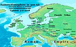 available. (Dvaka, Guptas, Kamarupa, Licchavis, Nagas, Pundravardhana, Samatata, Vakatakas, Western Satraps). 2. WorldHistoryMaps.com's map, "Countries of the...(968 × 602 (107 KB)) - 18:54, 13 May 2024
 File:East-Hem 300ad.jpg (category Historical map images that should use vector graphics)available. (Dvaka, Guptas, Kamarupa, Licchavis, Nagas, Pundravardhana, Samatata, Vakatakas, Western Satraps). 2. WorldHistoryMaps.com's map, "Countries of the...(3,240 × 1,903 (739 KB)) - 13:49, 22 January 2024
.png)

-ar.png)
.jpg)
