
File:Kiev on 1804 map.jpg
No higher resolution available.
Kiev_on_1804_map.jpg (272 × 208 pixels, file size: 21 KB, MIME type: image/jpeg)
| Description |
|
|---|---|
| Source |
|
| Date |
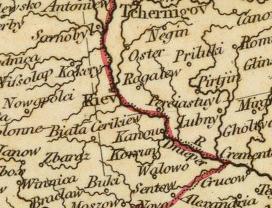
c. 1804 |
| Author |
Cary, John, ca. 1754-1835 |
| Permission (Reusing this file) |
See below.
|
| This file is in the public domain because its copyright has expired in the United States and those countries with a copyright term of no more than the life of the author plus 100 years.
|
| The uploader or another editor requests that a local copy of this file be kept. This image or media file may be available on the deletion, notify the tagging editor. |
File history
Click on a date/time to view the file as it appeared at that time.
| Date/Time | Thumbnail | Dimensions | User | Comment | |
|---|---|---|---|---|---|
| current | 04:59, 27 May 2007 | | 272 × 208 (21 KB) | Irpen (talk | contribs) | |
| 06:43, 26 May 2007 |  | 1,189 × 852 (1.01 MB) | Irpen (talk | contribs) | *A fragment of the old map. *Original full title of the map: A new map of Europe, from the latest authorities. By John Cary, engraver, 1804. London: Published by J. Cary, Engraver & Map-seller, No. 181, Strand, Novr. 28, 1804. *Author: [[John Cary|Cary, |
You cannot overwrite this file.
File usage
The following file is a duplicate of this file (more details):
- File:1804ம் ஆண்டு நில வரைபடத்தில் கீவ்.jpg from Commons
The following pages on the English Wikipedia use this file (pages on other projects are not listed):