
File:LocationUSVirginIslands.png

No higher resolution available.
LocationUSVirginIslands.png (250 × 115 pixels, file size: 8 KB, MIME type: image/png)
| This is a file from the Wikimedia Commons. Information from its description page there is shown below. Commons is a freely licensed media file repository. You can help. |
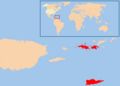
English: Location map for the en:U.S. Virgin Islands.
Originally created for English Wikipedia by Vardion.
| |
This work has been released into the public domain by its author, Vardion, at the English Wikipedia project. This applies worldwide. In case this is not legally possible: |
-
 Map of USA highlight Virgin Islands

File history
Click on a date/time to view the file as it appeared at that time.
| Date/Time | Thumbnail | Dimensions | User | Comment | |
|---|---|---|---|---|---|
| current | US Virgin Islands.<br/>Originally created for English Wikipedia by Vardion.<br/>{{GFDL}}<br/>Category:Country locator maps |
File usage
The following pages on the English Wikipedia use this file (pages on other projects are not listed):
Global file usage
The following other wikis use this file:
- Usage on ar.wikipedia.org
- Usage on azb.wikipedia.org
- Usage on ba.wikipedia.org
- Usage on be-tarask.wikipedia.org
- Usage on be.wikipedia.org
- Usage on bg.wikipedia.org
- Usage on bpy.wikipedia.org
- Usage on ceb.wikipedia.org
- Usage on da.wikipedia.org
- Usage on dsb.wikipedia.org
- Usage on el.wikipedia.org
- Usage on es.wikipedia.org
- Usage on fa.wikipedia.org
- Usage on fo.wikipedia.org
- Usage on frp.wikipedia.org
- Usage on fr.wiktionary.org
- Usage on he.wikipedia.org
- Usage on he.wikivoyage.org
- Usage on hr.wikipedia.org
- Usage on hu.wikipedia.org
- Usage on hu.wikinews.org
- Usage on incubator.wikimedia.org
- Usage on is.wikipedia.org
- Usage on it.wikivoyage.org
- Usage on ja.wikipedia.org
- Usage on jv.wikipedia.org
- Usage on ka.wikipedia.org
- Usage on kk.wikipedia.org
- Usage on ko.wikipedia.org
- Usage on ko.wiktionary.org
- Usage on kw.wikipedia.org
- Usage on ky.wikipedia.org
- Usage on lij.wikipedia.org
- Usage on li.wikipedia.org
- Usage on lt.wiktionary.org
- Usage on mr.wikipedia.org
- Usage on nl.wikipedia.org
- Usage on nn.wikipedia.org
View more global usage of this file.