
Search results
There is a page named "File:Machynlleth, Montgomeryshire.jpeg" on Wikipedia
 Watkins: Machynlleth, Montgomeryshire Artist Gastineau, Henry G., 1791-1876 Watkins, H. G., fl. ca. 1830, engraver. Title Machynlleth, Montgomeryshire Part...(900 × 649 (398 KB)) - 21:52, 7 October 2024
 Scourfield R. and Haslam R. (2013), ‘’The Buildings of Wales: Powys; Montgomeryshire, Radnorshire and Breconshire’’, Yale University Press. https://creativecommons...(787 × 769 (376 KB)) - 23:36, 4 January 2022
 Title Ordnance Survey Drawings: Machynlleth (OSD 337) DescriptionOrdnance Survey Drawings - Machynlleth (OSD 337).jpg Centre of map shown on a map of...(3,116 × 4,000 (3.36 MB)) - 14:21, 15 August 2024
 DescriptionA Plaid Cymru rally in Machynlleth in 1949 where the "Parliament for Wales in 5 years" campaign was started (14050400654).jpg Teitl Cymraeg/Welsh...(586 × 404 (73 KB)) - 13:10, 22 June 2023
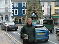 File:Mick Bates.jpg (category 2007 in Machynlleth)DescriptionMick Bates.jpg English: Mick Bates, AM for Montgomeryshire 1999-2011 Date 21 February 2007 Source Own work Author Littlemonday Other versions...(1,280 × 960 (483 KB)) - 08:06, 1 June 2023
 File:Mick Bates (cropped).jpg (category Machynlleth)DescriptionMick Bates (cropped).jpg English: Mick Bates, AM for Montgomeryshire 1999-2011 Date 21 February 2007 Source Own work Author Littlemonday Other...(212 × 263 (29 KB)) - 08:06, 1 June 2023
 File:002osd000000004u00305000.jpg (category 19th-century maps of Montgomeryshire)Title Ordnance Surveyor Drawing of Machynlleth (OSD 337) Description002osd000000004u00305000.jpg A triangulation diagram appears on the reverse of this...(3,116 × 4,000 (2.9 MB)) - 16:32, 19 August 2024
 File:Ordnance Survey One-Inch Sheet 127 Aberystwyth, Published 1966.jpg (category Machynlleth)OS map of Aberystwyth and the surrounding region in Merionethshire Montgomeryshire RadnorshireBrecknockshire and Cardiganshire, at a scale of 1:63,360...(8,282 × 9,889 (11.32 MB)) - 13:27, 2 July 2022
 ill-treatedindividual ! CHAPTER LXXIX Machynlleth—Remarkable Events—Ode to Glendower—DafyddGam—Lawddens Hatchet. Machynlleth, pronounced Machuncleth, is one...(2,304 × 1,626 (666 KB)) - 15:13, 5 July 2024


.jpg)
.jpg)

.jpg)


_(14595240678).jpg)