
File:Malta location map.svg

Size of this PNG preview of this SVG file: 645 × 600 pixels. Other resolutions: 258 × 240 pixels | 516 × 480 pixels | 826 × 768 pixels | 1,101 × 1,024 pixels | 2,202 × 2,048 pixels | 773 × 719 pixels.
Original file (SVG file, nominally 773 × 719 pixels, file size: 141 KB)
| This is a file from the Wikimedia Commons. Information from its description page there is shown below. Commons is a freely licensed media file repository. You can help. |
Summary
| Description |
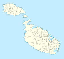
Deutsch: Positionskarte von Malta
Quadratische Plattkarte. Geographische Begrenzung der Karte:
English: Location map of Malta
Equirectangular projection. Geographic limits of the map:
|
||
| Date | 5 September 2008 (upload date) | ||
| Source | own work, using Fgura-map.svg by William Shewring | ||
| Author | Maximilian Dörrbecker (Chumwa) | ||
| Permission (Reusing this file) |
I, the copyright holder of this work, hereby publish it under the following licenses:
This file is licensed under the Creative Commons Attribution-Share Alike 3.0 Unported license.
You may select the license of your choice. |


|
This map has been made or improved in the German Kartenwerkstatt (Map Lab). You can propose maps to improve as well.
|
File history
Click on a date/time to view the file as it appeared at that time.
| Date/Time | Thumbnail | Dimensions | User | Comment | |
|---|---|---|---|---|---|
| current | 04:57, 5 September 2008 | | 773 × 719 (141 KB) | Chumwa | Karte etwas in N/S-Richtung gestreckt |
| 04:44, 5 September 2008 |  | 773 × 565 (141 KB) | Chumwa | == Beschreibung == {{Information |Description= {{de|Positionskarte von Malta}} Quadratische Plattkarte. Geographische Begrenzung der Karte: * N: 36.06° N * S: 35.47° N * W: 14.10° O * O: 14.36° O {{en|Location map of Malta} |
File usage
More than 100 pages use this file. The following list shows the first 100 pages that use this file only. A full list is available.
- 1909–10 Maltese Premier League
- 1911–12 Maltese Premier League
- 1912–13 Maltese Premier League
- 1919–20 Maltese Premier League
- 2000–01 Maltese Premier League
- 2001–02 Maltese Premier League
- 2002–03 Maltese Premier League
- 2003–04 Maltese Premier League
- 2008–09 Maltese Second Division
- 2009–10 Maltese Premier League
- 2010 Viva World Cup
- 2010–11 Maltese Premier League
- 2011–12 Maltese Premier League
- 2012–13 Maltese Premier League
- 2013–14 Maltese Premier League
- 2014 UEFA European Under-17 Championship
- 2014–15 Maltese Premier League
- 2015–16 Maltese Premier League
- 2016–17 Maltese Premier League
- Baħar iċ-Ċagħaq
- Baħrija
- Bidnija
- Blata l-Bajda
- Blue Grotto (Malta)
- Burmarrad
- Buġibba
- Casa Cosmana Navarra
- Chapel of St Nicholas, Żejtun
- Chapel of the Annunciation, Żurrieq
- Christ the Redeemer Church (Valletta, Malta)
- Church of Our Lady of Damascus, Valletta
- Church of Our Lady of Liesse
- Church of St Augustine, Victoria Gozo
- Church of St Francis, Victoria
- Church of St George, Valletta
- Church of St Lucy, Valletta
- Church of St Matthew, Qrendi
- Church of the Flight into Egypt
- Church of the Holy Trinity, Sliema
- Church of the Jesuits, Valletta
- Church of the Nativity of Our Lady (Savina)
- Cittadella (Gozo)
- Collegiate Church of the Immaculate Conception, Bormla
- Comino
- Cominotto
- De Redin towers
- Filfla
- Fleur-de-Lys, Malta
- Floriana Lines
- Fortifications of Birgu
- Fortifications of Mdina
- Fortifications of Senglea
- Fortifications of Valletta
- Franciscan Church of St Mary of Jesus
- Għar Dalam
- Hay Wharf
- Hompesch Hunting Lodge
- Is-Salina
- Junior Eurovision Song Contest 2014
- Lascaris towers
- List of World Heritage Sites in Malta
- List of football clubs in Malta
- List of football stadiums in Malta
- List of lighthouses in Malta
- List of top-division football clubs in UEFA countries
- Malta (island)
- Malta national cricket team
- Maltese Premier League
- Maltese Women's League
- Manikata
- Mariam Al-Batool Mosque
- Mġarr ix-Xini
- Ninu's Cave
- Our Lady of Pompei Church, Victoria, Gozo
- Paceville
- Palazzo Dorell
- Palazzo Nasciaro
- Parliament House (Malta)
- Qawra
- RAF Hal Far
- RAF Kalafrana
- RAF Luqa
- Ras ir-Raħeb
- Robert Samut Hall
- Santa Marija Chapel
- Sarria Church
- Selmun Palace
- Sopu Tower
- St. Andrew's Scots Church, Malta
- St Francis of Assisi Church, Valletta
- St Lucy's Church, Gozo
- St Mary's Chapel, Bir Miftuħ
- St Matthew's Chapel (Iż-Żgħir)
- The Westin Dragonara
- Verdala Palace
- Villa Bighi
- Wignacourt towers
- Xemxija
- Xerri's Grotto
- Xlendi
View more links to this file.
Global file usage
The following other wikis use this file:
- Usage on af.wikipedia.org
- Usage on als.wikipedia.org
- Usage on an.wikipedia.org
- Usage on ar.wikipedia.org
- Usage on ast.wikipedia.org
- Usage on az.wikipedia.org
- Usage on ba.wikipedia.org
- Usage on be-tarask.wikipedia.org
View more global usage of this file.