
File:Map Willoughby Northbridge.jpg
No higher resolution available.
Map_Willoughby_Northbridge.jpg (568 × 434 pixels, file size: 121 KB, MIME type: image/jpeg)
| This is a file from the Wikimedia Commons. Information from its description page there is shown below. Commons is a freely licensed media file repository. You can help. |
| Description |
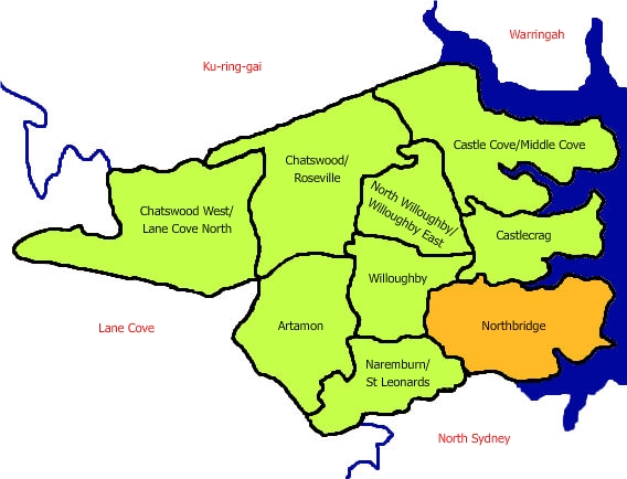
English: Map of Northbridge in relation to other suburbs controlled by the Willoughby Council, NSW, Australia. |
| Date | 16 August 2006 (original upload date) |
| Source | Own work |
| Author | Ladida at en.wikipedia |
| Permission (Reusing this file) |
Released under the GNU Free Documentation License . |
Licensing
Ladida at the English-language Wikipedia, the copyright holder of this work, hereby publishes it under the following license:
| This file is licensed under the Creative Commons Attribution-Share Alike 3.0 Unported license. Subject to disclaimers. | ||
| Attribution: Ladida at the English-language Wikipedia | ||
| ||
| This licensing tag was added to this file as part of the GFDL licensing update. |

|
Permission is granted to copy, distribute and/or modify this document under the terms of the GNU Free Documentation License, Version 1.2 or any later version published by the Free Software Foundation; with no Invariant Sections, no Front-Cover Texts, and no Back-Cover Texts. A copy of the license is included in the section entitled GNU Free Documentation License. Subject to disclaimers. |
Original upload log
The original description page was here. All following user names refer to en.wikipedia.
- 2006-08-16 15:32 Ladida 568×434× (123894 bytes) Map of Northbridge in relation to other suburbs controlled by the Willoughby council, NSW, Australia. Image created by uploader.
File history
Click on a date/time to view the file as it appeared at that time.
| Date/Time | Thumbnail | Dimensions | User | Comment | |
|---|---|---|---|---|---|
| current | 10:48, 30 April 2009 | | 568 × 434 (121 KB) | File Upload Bot (Magnus Manske) | {{BotMoveToCommons|en.wikipedia|year={{subst:CURRENTYEAR}}|month={{subst:CURRENTMONTHNAME}}|day={{subst:CURRENTDAY}}}} {{Information |Description={{en|Map of Northbridge in relation to other suburbs controlled by the Willoughby council, NSW, Australia. I |
File usage
The following pages on the English Wikipedia use this file (pages on other projects are not listed):