
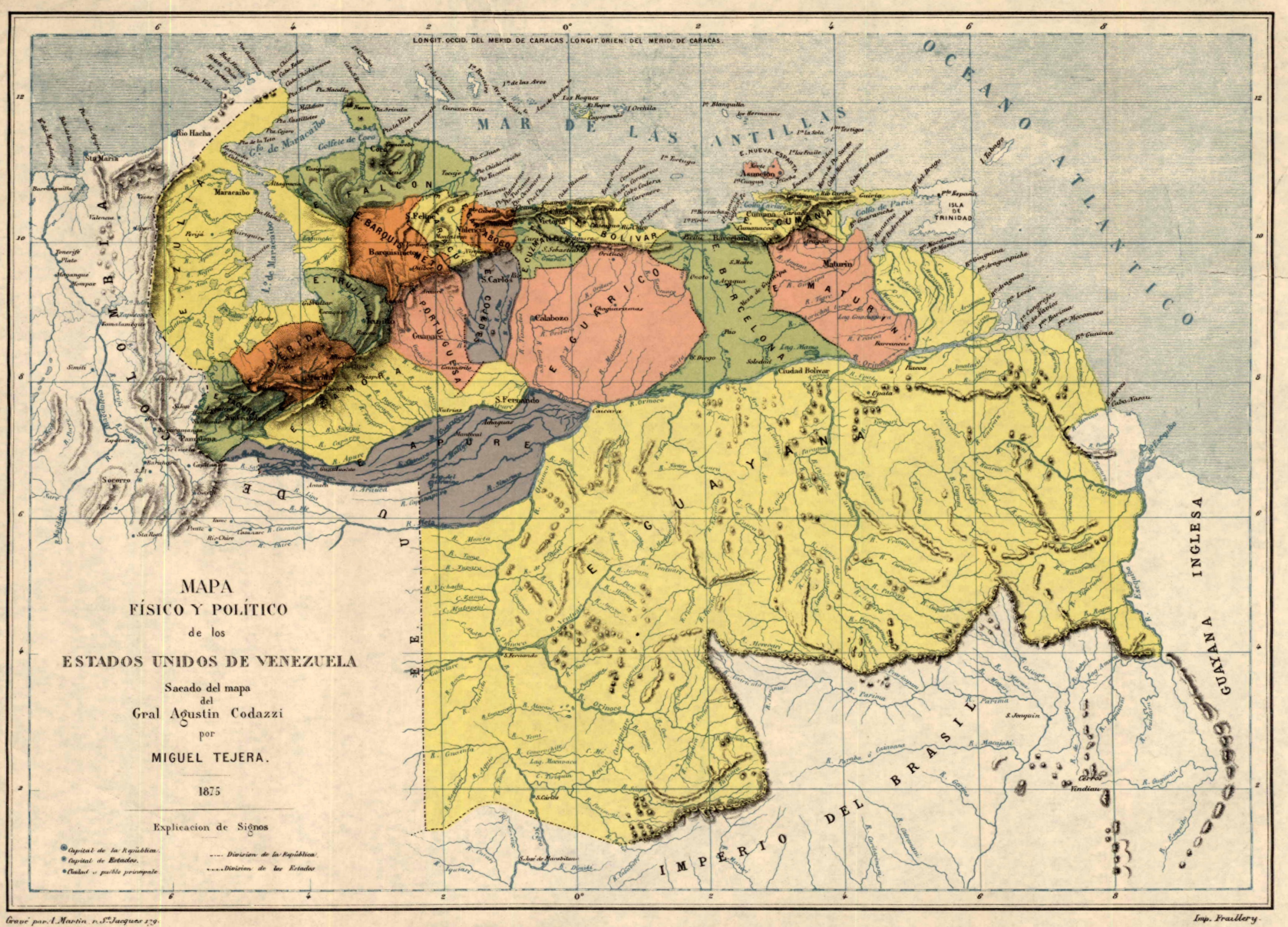
File:Mapa de Venezuela (1875).jpg
Size of this preview: 800 × 576 pixels. Other resolutions: 320 × 230 pixels | 640 × 461 pixels | 1,024 × 737 pixels | 1,280 × 921 pixels | 2,560 × 1,842 pixels | 3,474 × 2,500 pixels.
Original file (3,474 × 2,500 pixels, file size: 2.48 MB, MIME type: image/jpeg)
| This is a file from the Wikimedia Commons. Information from its description page there is shown below. Commons is a freely licensed media file repository. You can help. |
.jpg)
Summary
| Description |
Español: Mapa físico y político de los Estados Unidos de Venezuela |
| Date | |
| Source | Walter Ortiz: EEUU y Gran Bretaña buscan promover una guerra tras el diferendo con Guyana |
| Author | Miguel Tejera |
Licensing
This work was first published in Venezuela and is now in the public domain because its copyright protection has expired in Venezuela by virtue of the “Venezuelan Law on Copyright of August 14th, 1993, Art. 25, 26 and 38” (details) because the work meets one of the following criteria:
Note to the uploader: Please provide the authorship and publication details.
|

|
File history
Click on a date/time to view the file as it appeared at that time.
| Date/Time | Thumbnail | Dimensions | User | Comment | |
|---|---|---|---|---|---|
| current | 17:40, 17 February 2015 | | 3,474 × 2,500 (2.48 MB) | Milenioscuro | User created page with UploadWizard |
File usage
The following pages on the English Wikipedia use this file (pages on other projects are not listed):
Global file usage
The following other wikis use this file:
- Usage on ar.wikipedia.org
- Usage on es.wikipedia.org
- Usage on ru.wikipedia.org
- Usage on uz.wikipedia.org
.jpg)