
File:Municipios de Quintana Roo.svg

Size of this PNG preview of this SVG file: 600 × 600 pixels. Other resolutions: 240 × 240 pixels | 480 × 480 pixels | 768 × 768 pixels | 1,024 × 1,024 pixels | 2,048 × 2,048 pixels | 1,300 × 1,300 pixels.
Original file (SVG file, nominally 1,300 × 1,300 pixels, file size: 69 KB)
| This is a file from the Wikimedia Commons. Information from its description page there is shown below. Commons is a freely licensed media file repository. You can help. |
| Description |
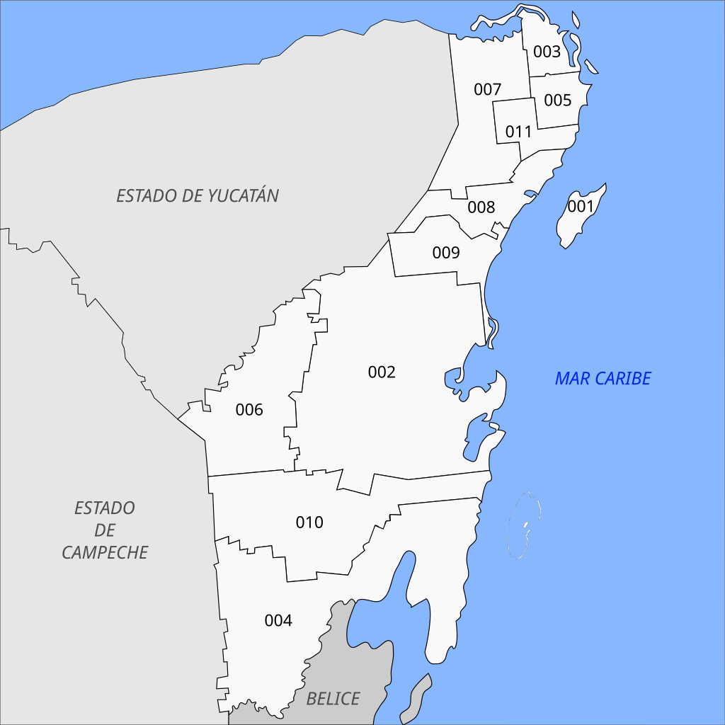
Español: Mapa de los municipios del estado mexicano de Quintana Roo.
|
||
| Date | Updated through 2020 | ||
| Source |
self-made This W3C-unspecified vector image was created with Inkscape . |
||
| Author | Battroid | ||
| Permission (Reusing this file) |
|
||
| Other versions |
|

File history
Click on a date/time to view the file as it appeared at that time.
| Date/Time | Thumbnail | Dimensions | User | Comment | |
|---|---|---|---|---|---|
| current | 12:20, 23 August 2022 | | 1,300 × 1,300 (69 KB) | MikSed | update 2020 |
| 18:38, 5 June 2021 |  | 1,184 × 1,030 (116 KB) | Capmo | removed leading zeros | |
| 00:26, 21 December 2015 |  | 1,184 × 1,030 (140 KB) | Jaontiveros | Actualizando undécimo municipio Puerto Morelos | |
| 07:02, 16 February 2013 |  | 1,184 × 1,030 (139 KB) | MikSed | + Bacalar | |
| 06:45, 16 February 2013 |  | 1,184 × 1,062 (174 KB) | MikSed | + Municipio Bacalar | |
| 06:40, 1 February 2009 |  | 1,184 × 1,062 (175 KB) | Battroid | {{Information |Description=Mapa de los municipios del estado mexicano de Quintana Roo. |Source=self-made {{Inkscape}} |Date=May 4, 2008 |Author= Battroid |Permission={{PD-self}} |other_versions=<gallery>Image:Municipios-de-Quintana-Roo.j | |
| 06:23, 20 May 2008 |  | 1,184 × 1,062 (98 KB) | Battroid | {{Information |Description=Mapa de los municipios del estado mexicano de Quintana Roo. |Source=self-made {{Inkscape}} |Date=May 20, 2008 |Author= Battroid |Permission={{PD-self}} |other_versions=<gallery>Image:Municipios-de-Quintana-Roo. | |
| 21:10, 4 May 2008 |  | 1,184 × 1,062 (97 KB) | Battroid | {{Information |Description=Mapa de los municipios del estado mexicano de Quintana Roo. |Source=self-made {{Inkscape}} |Date=May 4, 2008 |Author= Battroid |Permission={{PD-self}} |other_versions=<gallery>Image:Municipios-de-Quintana-Roo.j |
File usage
The following pages on the English Wikipedia use this file (pages on other projects are not listed):
Global file usage
The following other wikis use this file:
- Usage on an.wikipedia.org
- Usage on ca.wikipedia.org
- Usage on de.wikipedia.org
- Usage on eo.wikipedia.org
- Usage on es.wikipedia.org
- Usage on fr.wikipedia.org
- Usage on it.wikipedia.org
- Usage on nl.wikipedia.org
- Usage on no.wikipedia.org
- Usage on pl.wikipedia.org
- Usage on qu.wikipedia.org
- Usage on ru.wikipedia.org
- Usage on sco.wikipedia.org
- Usage on zh.wikipedia.org