Search results
Appearance
There is a page named "File:New Brunswick, Canada location map.svg" on Wikipedia
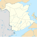
- DescriptionNew Brunswick, Canada location map.svg Deutsch: Positionskarte von New Brunswick, Kanada Quadratische Plattkarte, N-S-Streckung 145 %. Geographische...(1,411 × 1,388 (309 KB)) - 00:08, 31 October 2020
- image is a derivative work of the following images: File:Canada_New_Brunswick_location_map.svg licensed with Cc-by-sa-3.0 2009-09-28T14:04:56Z NordNordWest...(1,068 × 1,030 (115 KB)) - 21:45, 6 July 2024
- image is a derivative work of the following images: File:Canada_New_Brunswick_location_map.svg licensed with Cc-by-sa-3.0 2009-09-28T14:04:56Z NordNordWest...(1,000 × 984 (240 KB)) - 17:15, 26 December 2021
- image is a derivative work of the following images: File:Canada_New_Brunswick_location_map.svg licensed with Cc-by-sa-3.0 2009-09-28T14:04:56Z NordNordWest...(1,000 × 984 (44 KB)) - 17:27, 10 December 2021
- image is a derivative work of the following images: File:Canada_New_Brunswick_location_map.svg licensed with Cc-by-sa-3.0 2009-09-28T14:04:56Z NordNordWest...(1,000 × 984 (241 KB)) - 17:27, 10 December 2021
- image is a derivative work of the following images: File:Canada_New_Brunswick_location_map.svg licensed with Cc-by-sa-3.0 2009-09-28T14:04:56Z NordNordWest...(1,000 × 984 (241 KB)) - 17:27, 10 December 2021
- image is a derivative work of the following images: File:Canada_New_Brunswick_location_map.svg licensed with Cc-by-sa-3.0 2009-09-28T14:04:56Z NordNordWest...(1,000 × 984 (241 KB)) - 17:27, 10 December 2021
- image is a derivative work of the following images: File:Canada_New_Brunswick_location_map.svg licensed with Cc-by-sa-3.0 2009-09-28T14:04:56Z NordNordWest...(1,000 × 984 (241 KB)) - 17:27, 10 December 2021
- image is a derivative work of the following images: File:Canada_New_Brunswick_location_map.svg licensed with Cc-by-sa-3.0 2009-09-28T14:04:56Z NordNordWest...(1,000 × 984 (240 KB)) - 17:27, 10 December 2021
- image is a derivative work of the following images: File:Canada_New_Brunswick_location_map.svg licensed with Cc-by-sa-3.0 2009-09-28T14:04:56Z NordNordWest...(1,000 × 984 (240 KB)) - 17:27, 10 December 2021
- image is a derivative work of the following images: File:Canada_New_Brunswick_location_map.svg licensed with Cc-by-sa-3.0 2009-09-28T14:04:56Z NordNordWest...(1,000 × 984 (241 KB)) - 17:27, 10 December 2021
- English Location of the province of New Brunswick within Canada author name string: MapGrid URL: https://commons.wikimedia.org/wiki/user:MapGrid Wikimedia...(1,114 × 942 (279 KB)) - 01:42, 16 October 2023
- 5° N * S: 20.7° N * W: 80.7° W * O: 70.8° W {{en|Loca File:Canada Quebec location map.svg licensed with Cc-by-sa-3.0 2009-08-31T19:03:59Z NordNordWest...(13,310 × 6,935 (10.66 MB)) - 09:41, 11 January 2024
- N: 27.5° N * S: 20.7° N * W: 80.7° W * O: 70.8° W {{en|Loca Canada Quebec location map.svg licensed with Cc-by-sa-3.0 2009-08-31T19:03:59Z NordNordWest...(13,310 × 6,935 (9.24 MB)) - 09:40, 11 January 2024
- File:TDBank footprint.png (category Maps by Magog the Ogre)N * S: 20.7° N * W: 80.7° W * O: 70.8° W {{en|Loca File:Canada New Brunswick location map.svg licensed with Cc-by-sa-3.0 2009-09-28T14:04:56Z NordNordWest...(1,114 × 1,758 (321 KB)) - 17:14, 20 February 2024


