
File:Phoenix Urban Villages.svg

Size of this PNG preview of this SVG file: 299 × 599 pixels. Other resolutions: 120 × 240 pixels | 240 × 480 pixels | 383 × 768 pixels | 511 × 1,024 pixels | 1,023 × 2,048 pixels | 502 × 1,005 pixels.
Original file (SVG file, nominally 502 × 1,005 pixels, file size: 34 KB)
| This is a file from the Wikimedia Commons. Information from its description page there is shown below. Commons is a freely licensed media file repository. You can help. |
Summary
| Description |
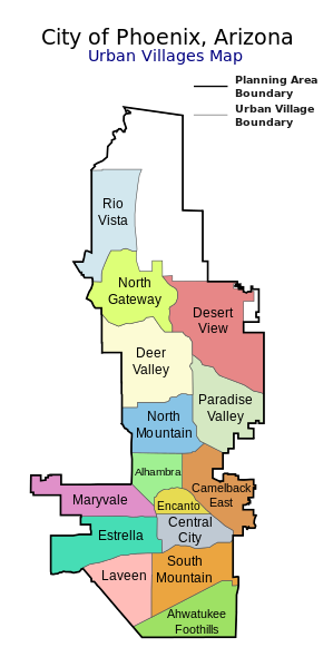
Map of the 15 Urban Villages of Phoenix — within the City of Phoenix, in Maricopa County, Arizona.
|
| Date | |
| Source | My own work, based on government information. Though I strove to be as accurate in the detail as possible, the information isn't one hundred percent accurate. |
| Author | Ixnayonthetimmay |
| Permission (Reusing this file) |
Public Domain |
| Other versions | See Category:Maps of the Urban Villages of Phoenix, Arizona for other versions of this image. |
Licensing
| I, the copyright holder of this work, release this work into the public domain. This applies worldwide. In some countries this may not be legally possible; if so: I grant anyone the right to use this work for any purpose, without any conditions, unless such conditions are required by law. |
File history
Click on a date/time to view the file as it appeared at that time.
| Date/Time | Thumbnail | Dimensions | User | Comment | |
|---|---|---|---|---|---|
| current | 03:51, 8 October 2014 | | 502 × 1,005 (34 KB) | Wereldburger758 | Fix error. |
| 03:46, 8 October 2014 |  | 502 × 1,005 (35 KB) | Wereldburger758 | Fix viewport. | |
| 03:40, 8 October 2014 |  | 500 × 1,000 (34 KB) | Wereldburger758 | Unlocking layer reveals hidden, empty element. Removal element. Valid SVG now. | |
| 08:33, 17 April 2008 |  | 500 × 1,000 (116 KB) | Ixnayonthetimmay | ||
| 05:25, 16 April 2008 |  | 500 × 1,000 (109 KB) | Ixnayonthetimmay | == Summary == {{Information |Description=This map shows the Urban Villages in Phoenix, Arizona. I created it in Inkscape using data from the [http://phoenix.gov/PLANNING/vplan |
File usage
The following pages on the English Wikipedia use this file (pages on other projects are not listed):
Global file usage
The following other wikis use this file:
- Usage on frr.wikipedia.org
- Usage on fr.wikipedia.org
- Usage on hy.wikipedia.org
- Usage on kn.wikipedia.org
- Usage on pl.wikipedia.org
- Usage on ru.wikipedia.org
- Usage on simple.wikipedia.org
- Usage on so.wikipedia.org
- Usage on vep.wikipedia.org