
File:Porthloo beach, St Mary's, Scilly - geograph.org.uk - 1607577.jpg
No higher resolution available.
Porthloo_beach,_St_Mary's,_Scilly_-_geograph.org.uk_-_1607577.jpg (640 × 383 pixels, file size: 83 KB, MIME type: image/jpeg)
| This is a file from the Wikimedia Commons. Information from its description page there is shown below. Commons is a freely licensed media file repository. You can help. |
Summary
| Description |
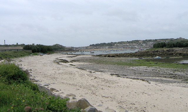
English: Porthloo beach, St Mary's, Scilly Porthloo has a nice sandy upper beach, but the middle shore is mainly occupied by shingle, rocks and weed. Not good for swimming, but from the seats nearby, you can watch shorebirds foraging amongst the rocks and weed. In the middle distance is the launching ramp for the St Mary's lifeboat at Carn Thomas. Beyond and to the right is St Mary's Pool, with many boats moored. The island to the middle right is Newford Island. The land to the upper right is the Garrison. |
| Date | |
| Source | From geograph.org.uk |
| Author | John Rostron |
| Attribution (required by the license) | John Rostron / Porthloo beach, St Mary's, Scilly / |
| Camera location | | View this and other nearby images on: OpenStreetMap |
|---|
_heading:202.00&language=en)
| Object location | | View this and other nearby images on: OpenStreetMap |
|---|
_heading:202.00&language=en)
Licensing

|
This image was taken from the
Creative Commons Attribution-ShareAlike 2.0 license. |
This file is licensed under the Creative Commons Attribution-Share Alike 2.0 Generic license.
Attribution: John Rostron
- You are free:
- to share – to copy, distribute and transmit the work
- to remix – to adapt the work
- Under the following conditions:
- attribution – You must give appropriate credit, provide a link to the license, and indicate if changes were made. You may do so in any reasonable manner, but not in any way that suggests the licensor endorses you or your use.
- share alike – If you remix, transform, or build upon the material, you must distribute your contributions under the same or compatible license as the original.
File history
Click on a date/time to view the file as it appeared at that time.
| Date/Time | Thumbnail | Dimensions | User | Comment | |
|---|---|---|---|---|---|
| current | 07:08, 4 March 2011 | | 640 × 383 (83 KB) | GeographBot | == {{int:filedesc}} == {{Information |description={{en|1=Porthloo beach, St Mary's, Scilly Porthloo has a nice sandy upper beach, but the middle shore is mainly occupied by shingle, rocks and weed. Not good for swimming, but from the seats nearby, you can |
File usage
The following pages on the English Wikipedia use this file (pages on other projects are not listed):
Global file usage
The following other wikis use this file:
- Usage on eu.wikipedia.org
- Usage on gd.wikipedia.org
- Usage on hy.wikipedia.org
- Usage on pl.wikipedia.org
- Usage on www.wikidata.org