
File:Portland Trimet Map.png
Size of this preview: 800 × 458 pixels. Other resolutions: 320 × 183 pixels | 640 × 366 pixels | 1,024 × 586 pixels | 1,280 × 732 pixels | 2,083 × 1,192 pixels.
Original file (2,083 × 1,192 pixels, file size: 398 KB, MIME type: image/png)
| This is a file from the Wikimedia Commons. Information from its description page there is shown below. Commons is a freely licensed media file repository. You can help. |
Summary
| Description |
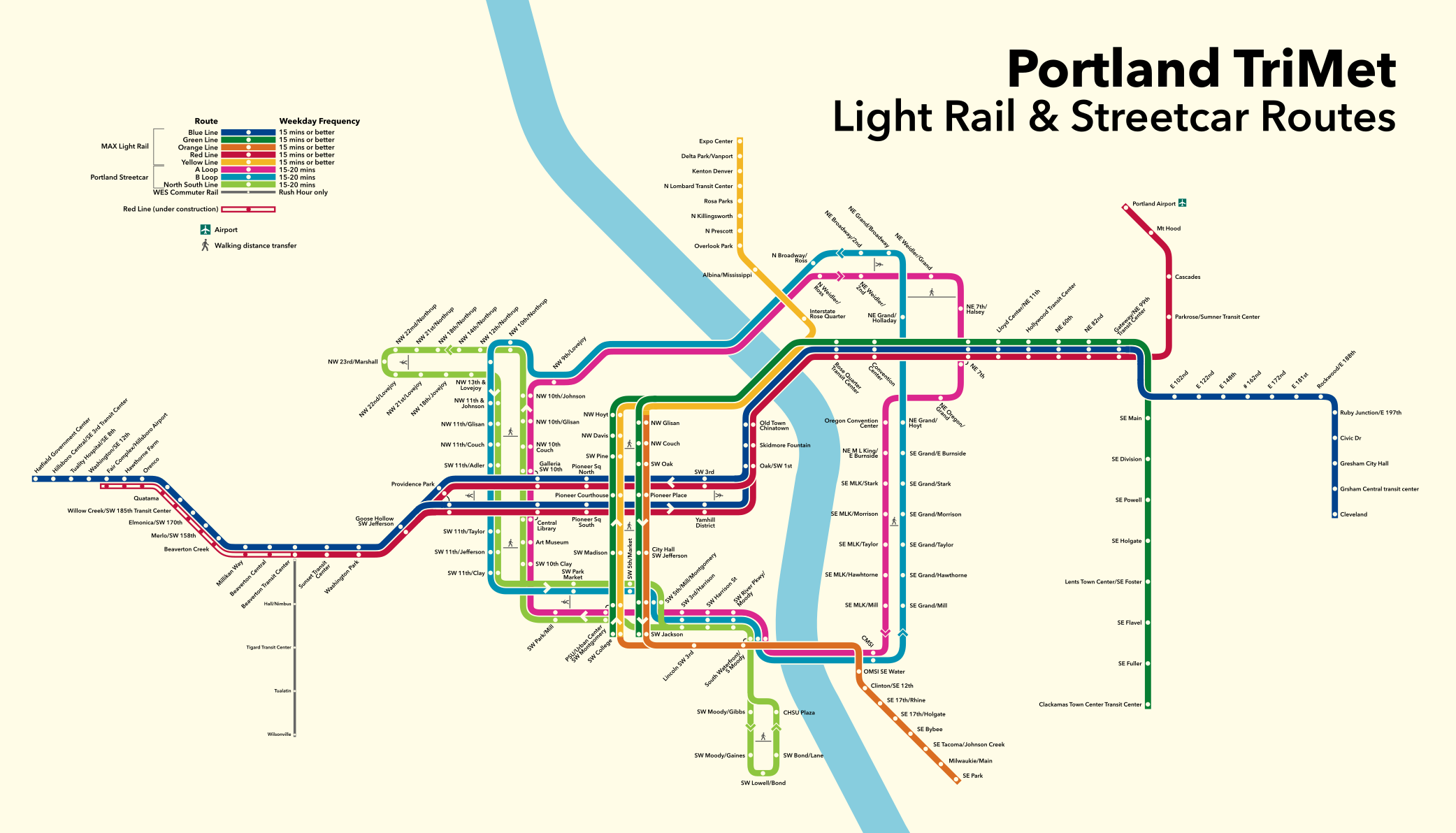
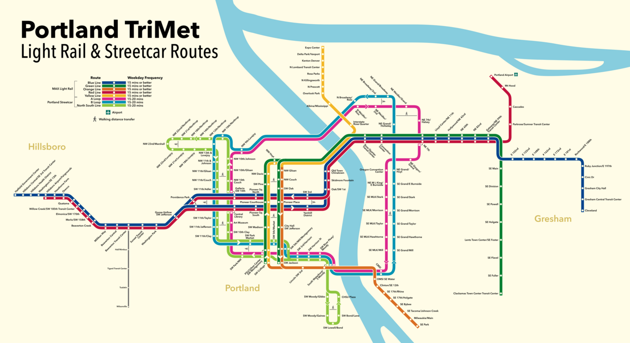
English: Route map of Portland's passenger rail systems, Trimet's MAX Light Rail and the Portland Streetcar |
| Date | |
| Source | Own work |
| Author | Haha169 |
Licensing
I, the copyright holder of this work, hereby publish it under the following license:
This file is licensed under the Creative Commons Attribution-Share Alike 4.0 International license.
- You are free:
- to share – to copy, distribute and transmit the work
- to remix – to adapt the work
- Under the following conditions:
- attribution – You must give appropriate credit, provide a link to the license, and indicate if changes were made. You may do so in any reasonable manner, but not in any way that suggests the licensor endorses you or your use.
- share alike – If you remix, transform, or build upon the material, you must distribute your contributions under the same or compatible license as the original.
File history
Click on a date/time to view the file as it appeared at that time.
| Date/Time | Thumbnail | Dimensions | User | Comment | |
|---|---|---|---|---|---|
| current | 18:57, 15 May 2021 | | 2,083 × 1,192 (398 KB) | Haha169 | fix NW 9th/Lovejoy |
| 21:43, 20 March 2021 |  | 2,083 × 1,192 (394 KB) | Haha169 | add Better Red to legend | |
| 21:27, 20 March 2021 |  | 2,083 × 1,192 (391 KB) | Haha169 | Uploaded own work with UploadWizard |
File usage
The following pages on the English Wikipedia use this file (pages on other projects are not listed):
Global file usage
The following other wikis use this file:
- Usage on hu.wikipedia.org
- Usage on ru.wikipedia.org
- Usage on uk.wikipedia.org
- Usage on www.wikidata.org