
File:Portuguese Malacca map.png
Size of this preview: 395 × 599 pixels. Other resolutions: 158 × 240 pixels | 316 × 480 pixels | 833 × 1,264 pixels.
Original file (833 × 1,264 pixels, file size: 371 KB, MIME type: image/png)
| This is a file from the Wikimedia Commons. Information from its description page there is shown below. Commons is a freely licensed media file repository. You can help. |
Summary
| Description |
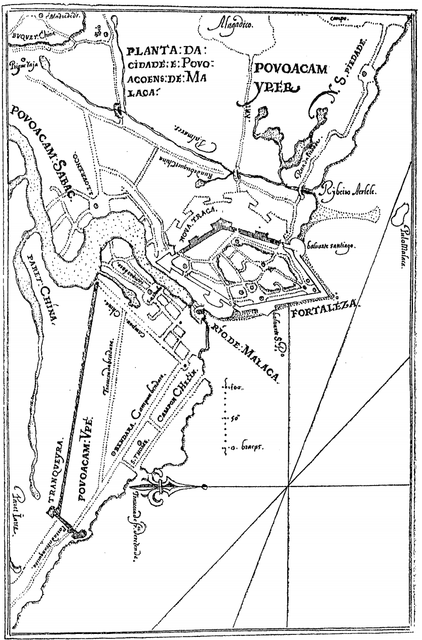
English: An early 17th century map of the city of Malacca and it's sorrounding area by the Portuguese-Malayan cartographer Manuel Godinho de Herédia |
| Date | |
| Source | Declaraçam de Malaca e da India Meridional com Cathay, 1604 |
| Author | Manuel Godinho de Herédia |
Licensing
| This file is made available under the Creative Commons CC0 1.0 Universal Public Domain Dedication. | |
| The person who associated a work with this deed has dedicated the work to the public domain by waiving all of their rights to the work worldwide under copyright law, including all related and neighboring rights, to the extent allowed by law. You can copy, modify, distribute and perform the work, even for commercial purposes, all without asking permission.
|
File history
Click on a date/time to view the file as it appeared at that time.
| Date/Time | Thumbnail | Dimensions | User | Comment | |
|---|---|---|---|---|---|
| current | 03:23, 17 March 2017 | | 833 × 1,264 (371 KB) | Wareno | User created page with UploadWizard |
File usage
The following pages on the English Wikipedia use this file (pages on other projects are not listed):
Global file usage
The following other wikis use this file:
- Usage on fr.wikipedia.org
- Usage on id.wikipedia.org
- Usage on it.wikipedia.org
- Usage on ms.wikipedia.org
- Usage on pt.wikipedia.org
- Usage on uk.wikipedia.org