
File:Roads-Canada-frame.png

Size of this preview: 746 × 599 pixels. Other resolutions: 299 × 240 pixels | 598 × 480 pixels | 860 × 691 pixels.
Original file (860 × 691 pixels, file size: 185 KB, MIME type: image/png)
| This is a file from the Wikimedia Commons. Information from its description page there is shown below. Commons is a freely licensed media file repository. You can help. |

|
This map image could be re-created using vector graphics as an SVG file. This has several advantages; see Commons:Media for cleanup for more information. If an SVG form of this image is available, please upload it and afterwards replace this template with
{{vector version available|new image name}}.
It is recommended to name the SVG file “Roads-Canada-frame.svg”—then the template Vva ) does not need the new image name parameter. |
Summary
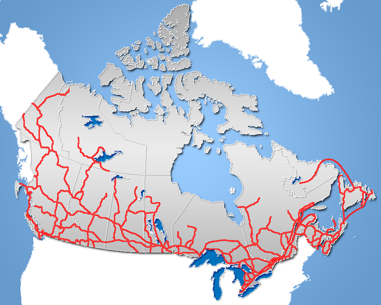
| Description | Major Road Network of Canada (includes Ferry Routes) |
| Date | |
| Source | GIS data |
| Author | Qyd (talk · contribs) |
| Permission (Reusing this file) |
All |
| Other versions | Image:TransCanadaHWY.png (Trans-Canada Highway), Image:Yellowhead route.png (Yellowhead Highway] |
Licensing
| I, the copyright holder of this work, release this work into the public domain. This applies worldwide. In some countries this may not be legally possible; if so: I grant anyone the right to use this work for any purpose, without any conditions, unless such conditions are required by law. |
File history
Click on a date/time to view the file as it appeared at that time.
| Date/Time | Thumbnail | Dimensions | User | Comment | |
|---|---|---|---|---|---|
| current | 19:58, 21 November 2006 | | 860 × 691 (185 KB) | Qyd | {{Information |Description=Major Road Network of Canada (includes Ferry Routes) |Source=GIS data |Date=Nov 2006 |Author={{User|Qyd}} |Permission=All |other_versions= }} Category:Maps of Canada |
File usage
More than 100 pages use this file. The following list shows the first 100 pages that use this file only. A full list is available.
- Numbered highways in Canada
- Talk:400-series highways
- Talk:Alaska Highway
- Talk:Alberta Highway 1
- Talk:Alberta Highway 2
- Talk:Alberta Highway 22
- Talk:Allen Road
- Talk:Auto trail
- Talk:British Columbia Highway 1
- Talk:British Columbia Highway 10
- Talk:British Columbia Highway 13
- Talk:British Columbia Highway 14
- Talk:British Columbia Highway 15
- Talk:British Columbia Highway 17
- Talk:British Columbia Highway 1A
- Talk:British Columbia Highway 7
- Talk:British Columbia Highway 7A
- Talk:British Columbia Highway 7B
- Talk:British Columbia Highway 91
- Talk:British Columbia Highway 91A
- Talk:British Columbia Highway 95
- Talk:British Columbia Highway 99
- Talk:British Columbia Highway 99A
- Talk:Cabot Trail
- Talk:Canol Road
- Talk:Cariboo Road
- Talk:Concession road
- Talk:Conestoga Parkway
- Talk:Continental 1
- Talk:County highway
- Talk:Douglas Road
- Talk:Gardiner Expressway
- Talk:Great River Road
- Talk:Haines Highway
- Talk:James Bay Road
- Talk:List of Alberta provincial highways
- Talk:List of Manitoba provincial highways
- Talk:List of Ontario expressways
- Talk:List of Quebec provincial highways
- Talk:Manitoba Highway 29
- Talk:Manitoba Highway 59
- Talk:Manitoba Highway 75
- Talk:Mid-Peninsula Highway
- Talk:New Brunswick Route 95
- Talk:Nova Scotia Highway 101
- Talk:Nova Scotia Highway 102
- Talk:Nova Scotia Highway 103
- Talk:Nova Scotia Highway 104
- Talk:Nova Scotia Highway 105
- Talk:Nova Scotia Highway 106
- Talk:Nova Scotia Highway 107
- Talk:Nova Scotia Highway 111
- Talk:Nova Scotia Highway 113
- Talk:Nova Scotia Highway 118
- Talk:Nova Scotia Highway 125
- Talk:Nova Scotia Highway 142
- Talk:Nova Scotia Highway 162
- Talk:Nova Scotia Route 322
- Talk:Nova Scotia Trunk 1
- Talk:Nova Scotia Trunk 14
- Talk:Nova Scotia Trunk 2
- Talk:Nova Scotia Trunk 3
- Talk:Nova Scotia Trunk 7
- Talk:Nova Scotia Trunk 8
- Talk:Ontario Highway 10
- Talk:Ontario Highway 11
- Talk:Ontario Highway 115
- Talk:Ontario Highway 140
- Talk:Ontario Highway 17
- Talk:Ontario Highway 2
- Talk:Ontario Highway 27
- Talk:Ontario Highway 2A
- Talk:Ontario Highway 400
- Talk:Ontario Highway 401
- Talk:Ontario Highway 402
- Talk:Ontario Highway 403
- Talk:Ontario Highway 404
- Talk:Ontario Highway 406
- Talk:Ontario Highway 407
- Talk:Ontario Highway 409
- Talk:Ontario Highway 410
- Talk:Ontario Highway 522
- Talk:Ontario Highway 6
- Talk:Ontario Provincial Highway Network
- Talk:Pan-American Highway
- Talk:Pan-American Highway (North America)
- Talk:Quebec Autoroute 13
- Talk:Quebec Autoroute 40
- Talk:Quebec Route 132
- Talk:Quebec Route 138
- Talk:Quebec Route 185
- Talk:Quebec Route 389
- Talk:Queen Elizabeth Way
- Talk:Queensway
- Talk:Red Hill Valley Parkway
- Talk:Spadina Expressway
- Talk:Trans-Canada Highway
- Talk:Trans-Labrador Highway
- Talk:Yellowhead Highway
- Talk:Yonge Street
View more links to this file.
Global file usage
The following other wikis use this file:
- Usage on de.wikipedia.org
- Dempster Highway
- Tibbitt to Contwoyto Winter Road
- Ingraham Trail
- Vorlage:Navigationsleiste Straßen in den Nordwest-Territorien
- Canol Road
- Liard Highway
- Liste der Highways in den Nordwest-Territorien
- Wikipedia:WikiProjekt Straßen/ToDo/Kanada
- Hay River Highway
- Mackenzie Highway
- Yellowknife Highway
- Fort Smith Highway
- Fort Resolution Highway
- Nahanni Range Road
- Inuvik–Tuktoyaktuk Highway
- Usage on fi.wikipedia.org
- Usage on hu.wikipedia.org