
File:SE Mesoamerican Formative Period sites.svg

Size of this PNG preview of this SVG file: 800 × 600 pixels. Other resolutions: 320 × 240 pixels | 640 × 480 pixels | 1,024 × 768 pixels | 1,280 × 959 pixels | 2,560 × 1,919 pixels | 1,226 × 919 pixels.
Original file (SVG file, nominally 1,226 × 919 pixels, file size: 269 KB)
| This is a file from the Wikimedia Commons. Information from its description page there is shown below. Commons is a freely licensed media file repository. You can help. |
Summary
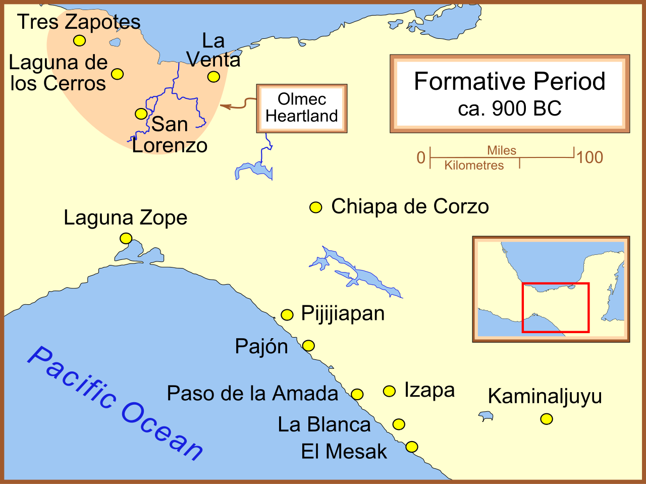
A map of Formative Period sites in southeast Mesoamerica.
Part of a series:
-
 }Formative Period sites in Central Mexico
 -
 Formative Period sites in Southeastern Mesoamerica
 -
 Map of the Olmec Heartland
 -
 Classic era sites in Central Mexico
 -
 Site with early evidence for ballplaying


Licensing
I, the copyright holder of this work, hereby publish it under the following licenses:

|
Permission is granted to copy, distribute and/or modify this document under the terms of the GNU Free Documentation License, Version 1.2 or any later version published by the Free Software Foundation; with no Invariant Sections, no Front-Cover Texts, and no Back-Cover Texts. A copy of the license is included in the section entitled GNU Free Documentation License. |
| This file is licensed under the Creative Commons Attribution-Share Alike 3.0 Unported license. | ||
| ||
| This licensing tag was added to this file as part of the GFDL licensing update. |
This file is licensed under the Creative Commons Attribution 2.5 Generic license.
- You are free:
- to share – to copy, distribute and transmit the work
- to remix – to adapt the work
- Under the following conditions:
- attribution – You must give appropriate credit, provide a link to the license, and indicate if changes were made. You may do so in any reasonable manner, but not in any way that suggests the licensor endorses you or your use.
You may select the license of your choice.
File history
Click on a date/time to view the file as it appeared at that time.
| Date/Time | Thumbnail | Dimensions | User | Comment | |
|---|---|---|---|---|---|
| current | 05:28, 8 January 2012 | | 1,226 × 919 (269 KB) | Madman2001 | Changed some objects to paths to fix rendering issues. |
| 03:51, 29 September 2007 |  | 1,226 × 919 (129 KB) | Madman2001 | fixed another error | |
| 04:24, 16 March 2007 |  | 1,226 × 919 (128 KB) | Madman2001 | Fixed another error. | |
| 04:16, 16 March 2007 |  | 1,226 × 919 (128 KB) | Madman2001 | one letter did not translate - "pathed" it | |
| 04:12, 16 March 2007 |  | 613 × 459 (123 KB) | Madman2001 | A map of Formative Period sites in southeast Mesoamerica. |
File usage
The following pages on the English Wikipedia use this file (pages on other projects are not listed):
Global file usage
The following other wikis use this file:
- Usage on de.wikipedia.org
- Usage on fi.wikipedia.org
- Usage on fr.wikipedia.org
- Usage on it.wikipedia.org
- Usage on ja.wikipedia.org
- Usage on lt.wikipedia.org
- Usage on pt.wikipedia.org
- Usage on ru.wikipedia.org