
File:Sandfields Pumping Station Lichfield.jpg
Sandfields_Pumping_Station_Lichfield.jpg (700 × 511 pixels, file size: 173 KB, MIME type: image/jpeg)
| This is a file from the Wikimedia Commons. Information from its description page there is shown below. Commons is a freely licensed media file repository. You can help. |
Summary
| Description |
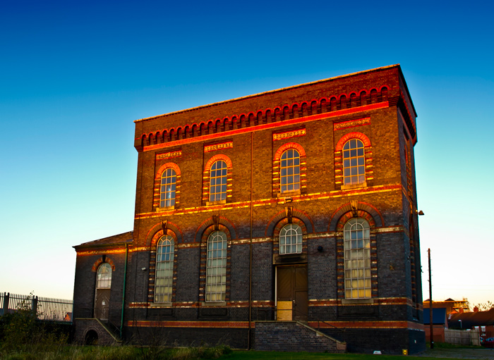
English: Engine House At Sandfields Pumping Station
|
|
| Date | ||
| Source | Own work | |
| Author | David Moore |
| Camera location | | View this and other nearby images on: OpenStreetMap |
|---|
Sandfields Pumping Station, Lichfield is a Grade II* redundant Victorian Waterworks and the original home of the South Staffs Water Works company. Built in response to the deadly cholera epidemics of the mid nineteenth century in the black County, when John Snow the physician proved the link between cholera and contaminated water.
Snow had demonstrated the need for an organised water supply. Sandfields Pumping Station provided clean water to the beleaguered communities of the Black Country, supporting the industrial growth on the industrial midlands.
Licensing
- You are free:
- to share – to copy, distribute and transmit the work
- to remix – to adapt the work
- Under the following conditions:
- attribution – You must give appropriate credit, provide a link to the license, and indicate if changes were made. You may do so in any reasonable manner, but not in any way that suggests the licensor endorses you or your use.
- share alike – If you remix, transform, or build upon the material, you must distribute your contributions under the same or compatible license as the original.

|
This image was uploaded as part of Wiki Loves Monuments 2017.
|
File history
Click on a date/time to view the file as it appeared at that time.
| Date/Time | Thumbnail | Dimensions | User | Comment | |
|---|---|---|---|---|---|
| current | 18:53, 4 September 2017 | | 700 × 511 (173 KB) | Morturn | User created page with UploadWizard |
File usage
Global file usage
The following other wikis use this file:
- Usage on www.wikidata.org